Estimated Value: $428,938 - $486,000
4
Beds
3
Baths
2,872
Sq Ft
$160/Sq Ft
Est. Value
About This Home
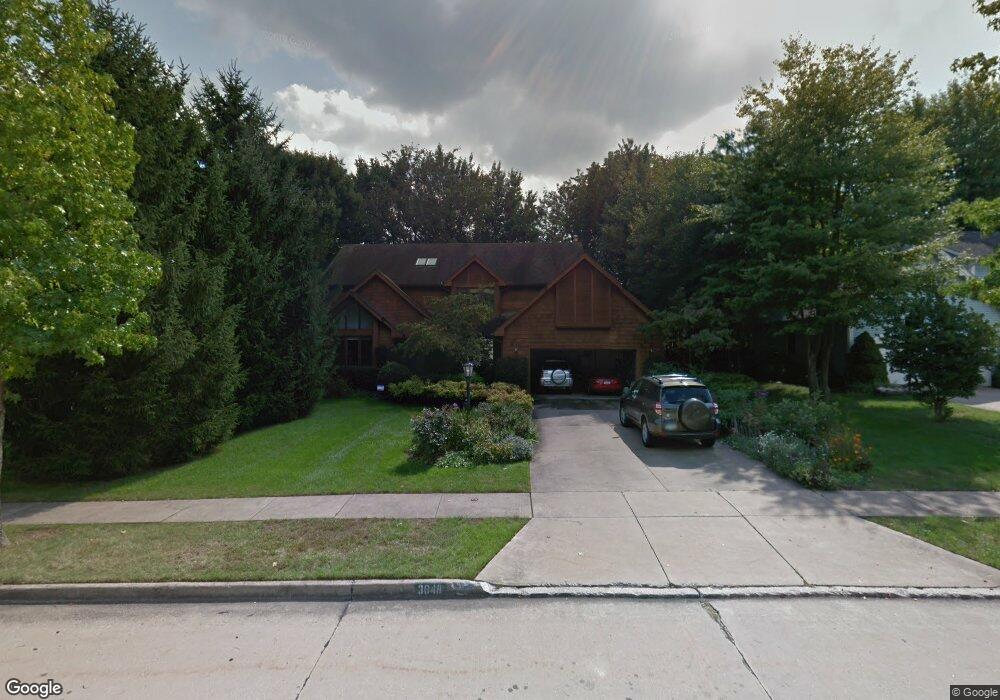
This home is located at 3048 Deercrest Path, Stow, OH 44224 and is currently estimated at $459,235, approximately $159 per square foot. 3048 Deercrest Path is a home located in Summit County with nearby schools including Stow-Munroe Falls High School, Holy Family Elementary School, and St Patrick Elementary School.
Ownership History
Date
Name
Owned For
Owner Type
Purchase Details
Closed on
May 14, 1997
Sold by
Vacco Howard K
Bought by
Hirschman Richard and Hirschman Judith
Current Estimated Value
Home Financials for this Owner
Home Financials are based on the most recent Mortgage that was taken out on this home.
Original Mortgage
$180,000
Outstanding Balance
$25,231
Interest Rate
8.27%
Mortgage Type
New Conventional
Estimated Equity
$434,004
Create a Home Valuation Report for This Property
The Home Valuation Report is an in-depth analysis detailing your home's value as well as a comparison with similar homes in the area
Home Values in the Area
Average Home Value in this Area
Purchase History
| Date | Buyer | Sale Price | Title Company |
|---|---|---|---|
| Hirschman Richard | $230,000 | -- |
Source: Public Records
Mortgage History
| Date | Status | Borrower | Loan Amount |
|---|---|---|---|
| Open | Hirschman Richard | $180,000 |
Source: Public Records
Tax History
| Year | Tax Paid | Tax Assessment Tax Assessment Total Assessment is a certain percentage of the fair market value that is determined by local assessors to be the total taxable value of land and additions on the property. | Land | Improvement |
|---|---|---|---|---|
| 2024 | $6,624 | $127,026 | $20,633 | $106,393 |
| 2023 | $6,624 | $127,026 | $20,633 | $106,393 |
| 2022 | $5,770 | $99,341 | $16,121 | $83,220 |
| 2021 | $5,164 | $99,341 | $16,121 | $83,220 |
| 2020 | $5,075 | $99,340 | $16,120 | $83,220 |
| 2019 | $5,154 | $94,790 | $16,120 | $78,670 |
| 2018 | $5,069 | $94,790 | $16,120 | $78,670 |
| 2017 | $4,325 | $94,790 | $16,120 | $78,670 |
| 2016 | $4,451 | $79,960 | $16,120 | $63,840 |
| 2015 | $4,325 | $79,960 | $16,120 | $63,840 |
| 2014 | $4,329 | $79,960 | $16,120 | $63,840 |
| 2013 | $4,170 | $77,760 | $16,120 | $61,640 |
Source: Public Records
Map
Nearby Homes
- 458 Irma St
- 1330 Chelton Dr
- 1245 Chelton Dr
- 3209 Pimlico Blvd
- 1285 Gale Dr
- 350 Silver Meadows Blvd
- 2721 Santa Anita Dr
- 1138 Lower Dr
- 3313 Crown Pointe Dr
- 1189 Garth Dr
- 3767 Lake Run Blvd
- 0 Middlebury Rd
- 726 Hughey Dr
- 3905 Kent Rd
- 537 Park Ridge Dr
- 3958 Lake Run Blvd
- 884 Highridge Ln
- 895 Highridge Ln
- 876 Middlebury Rd
- 2535 Sears Rd
- 3054 Deercrest Path
- 3040 Deercrest Path
- 3019 Highpoint Trail
- 3011 Highpoint Trail
- 3062 Deercrest Path
- 3003 Highpoint Trail
- 3027 Highpoint Trail
- 3032 Deercrest Path
- 3055 Deercrest Path
- 3037 Deercrest Path
- 3035 Highpoint Trail
- 3061 Deercrest Path
- 2995 Highpoint Trail
- 3025 Deercrest Path
- 3068 Deercrest Path
- 3024 Deercrest Path
- 2987 Highpoint Trail
- 3043 Highpoint Trail
- 3428 Hunters Crossing
- 3076 Deercrest Path
Your Personal Tour Guide
Ask me questions while you tour the home.