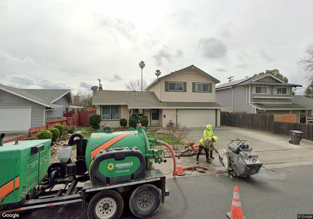
3066 Ramsgate Way Rancho Cordova, CA 95670
White Rock NeighborhoodEstimated Value: $322,000 - $467,000
3
Beds
3
Baths
1,447
Sq Ft
$280/Sq Ft
Est. Value
About This Home
This home is located at 3066 Ramsgate Way, Rancho Cordova, CA 95670 and is currently estimated at $404,455, approximately $279 per square foot. 3066 Ramsgate Way is a home located in Sacramento County with nearby schools including White Rock Elementary School, Mills Middle School, and Cordova High School.
Ownership History
Date
Name
Owned For
Owner Type
Purchase Details
Closed on
Sep 7, 2006
Sold by
Taylor Judy A and Taylor Arlan D
Bought by
Taylor Arlan Dennis and Taylor Judy Ann
Current Estimated Value
Home Financials for this Owner
Home Financials are based on the most recent Mortgage that was taken out on this home.
Original Mortgage
$80,000
Interest Rate
6.56%
Mortgage Type
New Conventional
Purchase Details
Closed on
Nov 4, 2005
Sold by
Taylor Arlan D and Taylor Judy A
Bought by
Taylor Arlan Dennis and Taylor Judy Ann
Create a Home Valuation Report for This Property
The Home Valuation Report is an in-depth analysis detailing your home's value as well as a comparison with similar homes in the area
Home Values in the Area
Average Home Value in this Area
Purchase History
| Date | Buyer | Sale Price | Title Company |
|---|---|---|---|
| Taylor Arlan Dennis | -- | Placer Title Company | |
| Taylor Arlan D | -- | Placer Title Company | |
| Taylor Arlan Dennis | -- | -- |
Source: Public Records
Mortgage History
| Date | Status | Borrower | Loan Amount |
|---|---|---|---|
| Previous Owner | Taylor Arlan D | $80,000 |
Source: Public Records
Tax History Compared to Growth
Tax History
| Year | Tax Paid | Tax Assessment Tax Assessment Total Assessment is a certain percentage of the fair market value that is determined by local assessors to be the total taxable value of land and additions on the property. | Land | Improvement |
|---|---|---|---|---|
| 2025 | $2,172 | $179,398 | $60,660 | $118,738 |
| 2024 | $2,172 | $175,881 | $59,471 | $116,410 |
| 2023 | $2,129 | $172,433 | $58,305 | $114,128 |
| 2022 | $2,101 | $169,053 | $57,162 | $111,891 |
| 2021 | $2,060 | $165,740 | $56,042 | $109,698 |
| 2020 | $2,047 | $164,042 | $55,468 | $108,574 |
| 2019 | $2,014 | $160,827 | $54,381 | $106,446 |
| 2018 | $1,963 | $157,674 | $53,315 | $104,359 |
| 2017 | $1,914 | $154,583 | $52,270 | $102,313 |
| 2016 | $1,868 | $151,553 | $51,246 | $100,307 |
| 2015 | $1,774 | $149,278 | $50,477 | $98,801 |
| 2014 | $1,888 | $146,355 | $49,489 | $96,866 |
Source: Public Records
Map
Nearby Homes
- 3231 Nosler Ct
- 10472 Abbottford Way
- 10433 Rockingham Dr
- 10233 Countryside Way
- 10035 Mills Station Rd
- 10035 Mills Station Rd Unit 136
- 10035 Mills Station Rd Unit 153
- 10276 S White Rock Rd
- 10470 Spaulding Way
- 10167 Country Way
- 2701 El Caprice Dr
- 47 Temple
- 10204 Malaga Way
- 10850 Basie Way
- 60 Count Way
- 2629 La Loma Dr
- 146 Lord Way
- 2904 Poole Dr
- 2926 Poole Dr Unit 25
- 10246 Pistachio Way
- 3068 Ramsgate Way
- 3064 Ramsgate Way
- 3070 Ramsgate Way
- 3061 Portsmouth Dr
- 3062 Ramsgate Way
- 3028 Winchester Way
- 3065 Portsmouth Dr
- 3051 Portsmouth Dr
- 3041 Portsmouth Dr
- 3029 Portsmouth Dr
- 3072 Ramsgate Way
- 3024 Winchester Way
- 3069 Portsmouth Dr
- 3069 Ramsgate Way
- 3025 Portsmouth Dr
- 3060 Ramsgate Way
- 3020 Winchester Way
- 3071 Ramsgate Way
- 3074 Ramsgate Way
- 3036 Ryde Ct