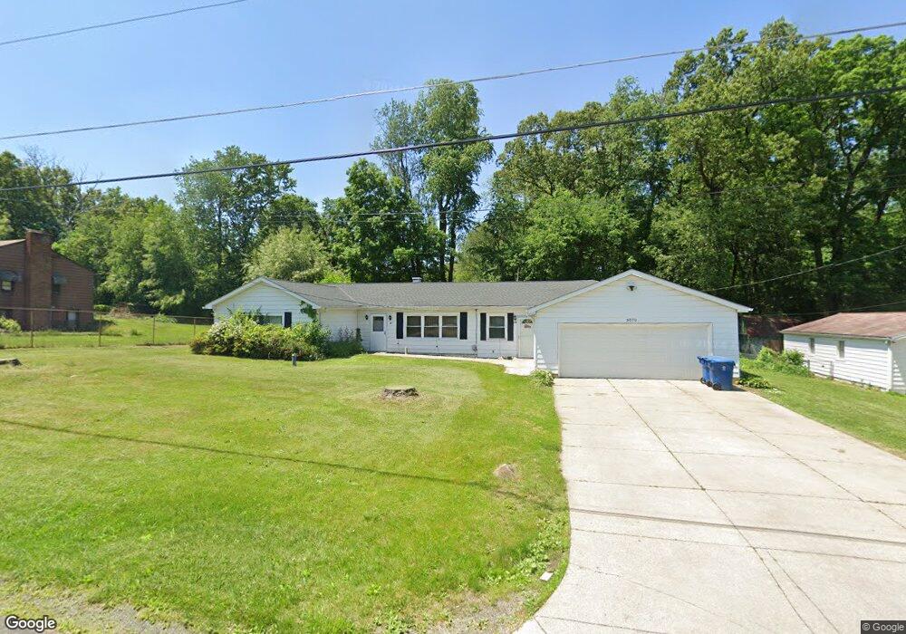
3070 Littledale Rd Akron, OH 44319
East Barberton NeighborhoodEstimated Value: $215,000 - $250,000
3
Beds
2
Baths
1,656
Sq Ft
$139/Sq Ft
Est. Value
About This Home
This home is located at 3070 Littledale Rd, Akron, OH 44319 and is currently estimated at $230,998, approximately $139 per square foot. 3070 Littledale Rd is a home located in Summit County with nearby schools including St. Francis de Sales School and Sam Salem Community Learning Center.
Ownership History
Date
Name
Owned For
Owner Type
Purchase Details
Closed on
Aug 24, 2020
Sold by
Rem Ohio Waivered Services Inc
Bought by
Capgrow Holdings Jv Sub Vi Llc
Current Estimated Value
Home Financials for this Owner
Home Financials are based on the most recent Mortgage that was taken out on this home.
Original Mortgage
$50,889,000
Interest Rate
2.9%
Mortgage Type
Credit Line Revolving
Purchase Details
Closed on
Jun 15, 2000
Sold by
Smith Brett
Bought by
Rem Ohio Residential Services Inc
Create a Home Valuation Report for This Property
The Home Valuation Report is an in-depth analysis detailing your home's value as well as a comparison with similar homes in the area
Home Values in the Area
Average Home Value in this Area
Purchase History
| Date | Buyer | Sale Price | Title Company |
|---|---|---|---|
| Capgrow Holdings Jv Sub Vi Llc | $980,988 | Treinen Arthur R | |
| Rem Ohio Residential Services Inc | $125,000 | Minnesota | |
| Smith Patricia A | -- | Minnesota |
Source: Public Records
Mortgage History
| Date | Status | Borrower | Loan Amount |
|---|---|---|---|
| Previous Owner | Capgrow Holdings Jv Sub Vi Llc | $50,889,000 |
Source: Public Records
Tax History Compared to Growth
Tax History
| Year | Tax Paid | Tax Assessment Tax Assessment Total Assessment is a certain percentage of the fair market value that is determined by local assessors to be the total taxable value of land and additions on the property. | Land | Improvement |
|---|---|---|---|---|
| 2025 | $3,581 | $58,653 | $12,215 | $46,438 |
| 2024 | $3,581 | $58,653 | $12,215 | $46,438 |
| 2023 | $3,581 | $58,653 | $12,215 | $46,438 |
| 2022 | $3,065 | $40,933 | $8,484 | $32,449 |
| 2021 | $2,825 | $41,647 | $8,484 | $33,163 |
| 2020 | $2,844 | $41,640 | $8,480 | $33,160 |
| 2019 | $2,771 | $37,250 | $6,630 | $30,620 |
| 2018 | $2,771 | $37,250 | $6,630 | $30,620 |
| 2017 | $2,766 | $37,250 | $6,630 | $30,620 |
| 2016 | $2,753 | $37,250 | $6,630 | $30,620 |
| 2015 | $2,766 | $37,250 | $6,630 | $30,620 |
| 2014 | $2,691 | $37,250 | $6,630 | $30,620 |
| 2013 | $2,659 | $37,320 | $6,630 | $30,690 |
Source: Public Records
Map
Nearby Homes
- 2984 Manchester Rd
- 0 Joyce Ave NW Unit 35 5043152
- 0 Joyce Ave NW Unit 34 5043158
- 32 Joyce Ave
- 2836 Unclmorse Ave
- 860 Sutherland Ave
- 894 Sutherland Ave
- 2784 Conway St
- 2953 Clearfield Ave
- 2832 Wingate Ave
- 2912 Clearfield Ave
- 1129 Winston St
- V/L 1.16 Acres E Tuscarawas Extension
- 1092 Sutherland Ave
- 2660 Conrad Ave
- 2679 Edwin Ave
- 584 Apple Dr
- 486 W Waterloo Rd
- 449 W Long Lake Blvd
- 802 Portage Lakes Dr
- 3084 Littledale Rd
- 3060 Littledale Rd
- 3065 Littledale Rd
- 3075 Littledale Rd
- 3055 Littledale Rd
- 3127 Ethan Allen Rd
- 3096 Littledale Rd
- 3048 Littledale Rd
- 855 Rood Dr
- 3121 Ethan Allen Rd
- 3133 Ethan Allen Rd
- 3045 Littledale Rd
- 845 Rood Dr
- 3036 Littledale Rd
- 868 Rood Dr
- 3066 Greer Rd
- 3076 Greer Rd
- 846 Garson Dr
- 3030 Littledale Rd
- 3056 Greer Rd