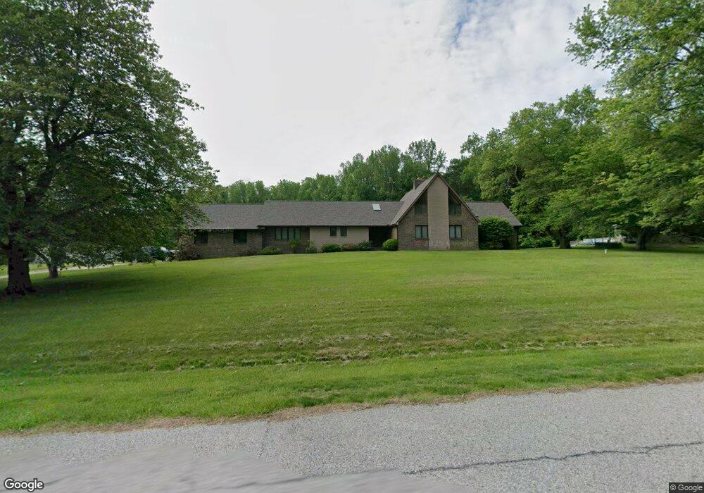
3120 Ashwood Dr Dunkirk, MD 20754
Estimated Value: $646,091 - $769,000
Studio
3
Baths
2,682
Sq Ft
$259/Sq Ft
Est. Value
About This Home
This home is located at 3120 Ashwood Dr, Dunkirk, MD 20754 and is currently estimated at $694,364, approximately $258 per square foot. 3120 Ashwood Dr is a home located in Calvert County with nearby schools including Mount Harmony Elementary School, Northern Middle School, and Northern High School.
Ownership History
Date
Name
Owned For
Owner Type
Purchase Details
Closed on
Sep 16, 2005
Sold by
Decatur Raymond H
Bought by
Decatur Raymond H and Bekavac Peggy Ann
Current Estimated Value
Purchase Details
Closed on
Aug 28, 2005
Sold by
Decatur Raymond H and Decatur Eleanor E
Bought by
Decatur Raymond H and Bekavac Linda Lee Hinkle Peggy A
Purchase Details
Closed on
May 18, 1984
Sold by
Wood Construction Co Inc
Bought by
Decatur Raymond H and Decatur Eleanor E
Home Financials for this Owner
Home Financials are based on the most recent Mortgage that was taken out on this home.
Original Mortgage
$48,500
Interest Rate
14.04%
Create a Home Valuation Report for This Property
The Home Valuation Report is an in-depth analysis detailing your home's value as well as a comparison with similar homes in the area
Home Values in the Area
Average Home Value in this Area
Purchase History
| Date | Buyer | Sale Price | Title Company |
|---|---|---|---|
| Decatur Raymond H | -- | C P Sheridan Title Co Inc | |
| Decatur Raymond H | -- | -- | |
| Decatur Raymond H | $49,000 | -- |
Source: Public Records
Mortgage History
| Date | Status | Borrower | Loan Amount |
|---|---|---|---|
| Previous Owner | Decatur Raymond H | $48,500 |
Source: Public Records
Tax History
| Year | Tax Paid | Tax Assessment Tax Assessment Total Assessment is a certain percentage of the fair market value that is determined by local assessors to be the total taxable value of land and additions on the property. | Land | Improvement |
|---|---|---|---|---|
| 2025 | $6,185 | $552,600 | $204,600 | $348,000 |
| 2024 | $5,853 | $522,333 | $0 | $0 |
| 2023 | $5,327 | $492,067 | $0 | $0 |
| 2022 | $5,009 | $461,800 | $204,600 | $257,200 |
| 2021 | $4,783 | $450,167 | $0 | $0 |
| 2020 | $4,783 | $438,533 | $0 | $0 |
| 2019 | $4,680 | $426,900 | $204,600 | $222,300 |
| 2018 | $4,660 | $426,233 | $0 | $0 |
| 2017 | $4,714 | $425,567 | $0 | $0 |
| 2016 | -- | $424,900 | $0 | $0 |
| 2015 | $4,826 | $424,900 | $0 | $0 |
| 2014 | $4,826 | $424,900 | $0 | $0 |
Source: Public Records
Map
Nearby Homes
- 3402 King Dr
- 3300 Lancer Ct
- 12110 Longleaf Ln
- 11432 Diantha Ct
- 10401 Three Doctors Rd
- 2850 Dunleigh Dr
- 10623 Fielder Ct
- 2950 Chaney Rd
- 11216 Lakeview Dr
- 3312 Smithville Dr
- 249 Jaguar Dr
- 243 Jaguar Dr
- 11130 Dumbarton Dr
- 1071 Lower Pindell Rd
- 1921 Haven Ln
- 4060 Loving Dr
- 12761 Carronade Ct
- 461 Jewell Rd
- 0 Fenno Rd
- 6125 Fishers Station Rd
- 3121 Ashwood Dr
- 3110 Ashwood Dr
- 3131 Ashwood Dr
- 3140 Ashwood Dr
- 3100 Ashwood Dr
- 3111 Ashwood Dr
- 3141 Ashwood Dr
- 3161 Ashwood Dr
- 3101 Ashwood Dr
- 11720 Beechwood Dr
- 3150 Ashwood Dr
- 3406 King Dr
- 3408 King Dr
- 3404 King Dr
- 3410 King Dr
- 3151 Ashwood Dr
- 3412 King Dr
- 11802 Crown Dr
- 3400 King Dr
- 11710 Beechwood Dr
Your Personal Tour Guide
Ask me questions while you tour the home.