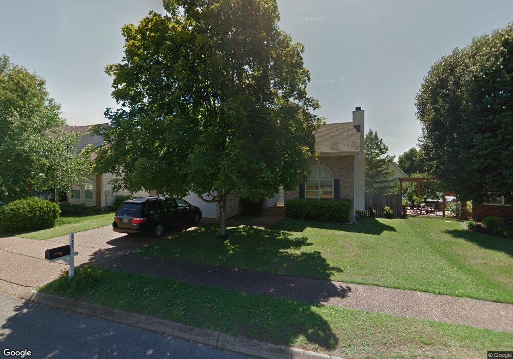
317 Cannonade Cir Franklin, TN 37069
Berrys Chapel NeighborhoodEstimated Value: $594,017 - $662,000
Studio
3
Baths
1,770
Sq Ft
$359/Sq Ft
Est. Value
About This Home
This home is located at 317 Cannonade Cir, Franklin, TN 37069 and is currently estimated at $635,504, approximately $359 per square foot. 317 Cannonade Cir is a home located in Williamson County with nearby schools including Hunters Bend Elementary School, Grassland Middle School, and Franklin High School.
Ownership History
Date
Name
Owned For
Owner Type
Purchase Details
Closed on
Jul 12, 2018
Sold by
Hanock Kelsey and Wilkens Marlene
Bought by
Hill Kelsey and Hancock Kelsey
Current Estimated Value
Purchase Details
Closed on
Apr 7, 2006
Sold by
Schneider Christopher R and Schneider Christine L
Bought by
Hanock Kelsey and Wilkens Marlene
Purchase Details
Closed on
Mar 30, 1999
Sold by
Belli Janice M
Bought by
Schneider Christopher R and Schneider Christine L
Home Financials for this Owner
Home Financials are based on the most recent Mortgage that was taken out on this home.
Original Mortgage
$154,375
Interest Rate
6.82%
Purchase Details
Closed on
Nov 13, 1996
Sold by
Todd Abner Michael
Bought by
Belli Janice M
Create a Home Valuation Report for This Property
The Home Valuation Report is an in-depth analysis detailing your home's value as well as a comparison with similar homes in the area
Home Values in the Area
Average Home Value in this Area
Purchase History
| Date | Buyer | Sale Price | Title Company |
|---|---|---|---|
| Hill Kelsey | -- | None Available | |
| Hanock Kelsey | $249,987 | None Available | |
| Schneider Christopher R | $162,500 | -- | |
| Belli Janice M | $150,000 | -- |
Source: Public Records
Mortgage History
| Date | Status | Borrower | Loan Amount |
|---|---|---|---|
| Previous Owner | Schneider Christopher R | $154,375 |
Source: Public Records
Tax History
| Year | Tax Paid | Tax Assessment Tax Assessment Total Assessment is a certain percentage of the fair market value that is determined by local assessors to be the total taxable value of land and additions on the property. | Land | Improvement |
|---|---|---|---|---|
| 2025 | $2,100 | $151,650 | $56,250 | $95,400 |
| 2024 | $2,100 | $97,400 | $30,000 | $67,400 |
| 2023 | $2,100 | $97,400 | $30,000 | $67,400 |
| 2022 | $2,100 | $97,400 | $30,000 | $67,400 |
| 2021 | $2,100 | $97,400 | $30,000 | $67,400 |
| 2020 | $1,944 | $75,425 | $18,750 | $56,675 |
| 2019 | $1,944 | $75,425 | $18,750 | $56,675 |
| 2018 | $1,891 | $75,425 | $18,750 | $56,675 |
| 2017 | $1,876 | $75,425 | $18,750 | $56,675 |
Source: Public Records
Map
Nearby Homes
- 148 Cavalcade Cir
- 352 Cannonade Cir
- 615 Lawrin Park
- 913 Idlewild Ct
- 114 Stanton Hall Ln Unit 114
- 38 Prescott Place Unit 38
- 1109 Howell Dr
- 426 Essex Park Cir
- 24 Holland Park Ln Unit 24
- 101 Alton Park Ln Unit 101
- 604 Meadowgreen Dr
- 33 Holland Park Ln
- 85 Alton Park Ln Unit 85
- 511 Arbor Dr
- 507 Arbor Dr
- 1927 Berrys Chapel Ct
- 570 Brixham Park Dr
- 201 Lake Ridge Ct
- 237 Halberton Dr
- 703 Shady Glen Ct
- 321 Cannonade Cir
- 311 Cannonade Cir
- 107 Watermill Trace
- 325 Cannonade Cir
- 111 Watermill Trace
- 320 Cannonade Cir
- 320 Cannonade Cr
- 316 Cannonade Cir
- 324 Cannonade Cir
- 312 Cannonade Cir
- 329 Cannonade Cir
- 117 Watermill Trace
- 308 Cannonade Cir
- 104 Watermill Trace
- 100 Watermill Trace
- 123 Watermill Trace
- 108 Watermill Trace
- 332 Cannonade Cir
- 112 Watermill Trace
- 222 Hideaway Trail