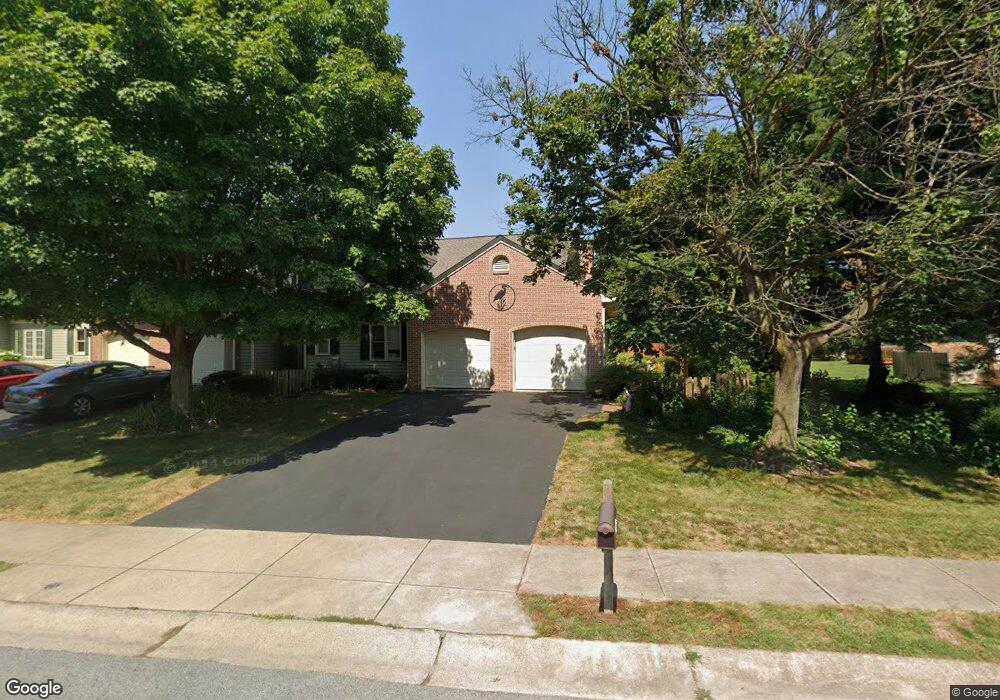
3201 Glengreen Dr Lancaster, PA 17601
Oyster Point NeighborhoodEstimated Value: $321,738 - $361,000
2
Beds
2
Baths
1,755
Sq Ft
$193/Sq Ft
Est. Value
About This Home
This home is located at 3201 Glengreen Dr, Lancaster, PA 17601 and is currently estimated at $338,435, approximately $192 per square foot. 3201 Glengreen Dr is a home located in Lancaster County with nearby schools including Landisville Primary Center, Landisville Middle School, and Hempfield High School.
Ownership History
Date
Name
Owned For
Owner Type
Purchase Details
Closed on
Oct 17, 2001
Sold by
Bish Melanie J and Kerdock John S
Bought by
Miller Jennifer A
Current Estimated Value
Home Financials for this Owner
Home Financials are based on the most recent Mortgage that was taken out on this home.
Original Mortgage
$127,000
Outstanding Balance
$46,910
Interest Rate
6.12%
Estimated Equity
$291,525
Purchase Details
Closed on
Oct 12, 2000
Sold by
Schmitt G Michael and Schmitt Tracy L
Bought by
Bish Melanie J
Home Financials for this Owner
Home Financials are based on the most recent Mortgage that was taken out on this home.
Original Mortgage
$99,920
Interest Rate
7.89%
Create a Home Valuation Report for This Property
The Home Valuation Report is an in-depth analysis detailing your home's value as well as a comparison with similar homes in the area
Home Values in the Area
Average Home Value in this Area
Purchase History
| Date | Buyer | Sale Price | Title Company |
|---|---|---|---|
| Miller Jennifer A | $127,000 | -- | |
| Bish Melanie J | $124,900 | -- |
Source: Public Records
Mortgage History
| Date | Status | Borrower | Loan Amount |
|---|---|---|---|
| Open | Miller Jennifer A | $127,000 | |
| Previous Owner | Bish Melanie J | $99,920 |
Source: Public Records
Tax History
| Year | Tax Paid | Tax Assessment Tax Assessment Total Assessment is a certain percentage of the fair market value that is determined by local assessors to be the total taxable value of land and additions on the property. | Land | Improvement |
|---|---|---|---|---|
| 2025 | $3,967 | $175,900 | $26,600 | $149,300 |
| 2024 | $3,967 | $175,900 | $26,600 | $149,300 |
| 2023 | $3,891 | $175,900 | $26,600 | $149,300 |
| 2022 | $3,788 | $175,900 | $26,600 | $149,300 |
| 2021 | $3,713 | $175,900 | $26,600 | $149,300 |
| 2020 | $3,713 | $175,900 | $26,600 | $149,300 |
| 2019 | $3,652 | $175,900 | $26,600 | $149,300 |
| 2018 | $4,342 | $175,900 | $26,600 | $149,300 |
| 2017 | $3,720 | $144,700 | $39,500 | $105,200 |
| 2016 | $3,646 | $144,700 | $39,500 | $105,200 |
| 2015 | $734 | $144,700 | $39,500 | $105,200 |
| 2014 | $2,692 | $144,700 | $39,500 | $105,200 |
Source: Public Records
Map
Nearby Homes
- 3301 Marietta Ave
- 8 Madge Dr
- 86 Village Dr
- 319 Druid Hill Rd
- 825 Robin Rd
- 900 Cardinal Rd
- 26 E Main St
- 204 Post Oak Rd
- 16 Cedar Chase Dr
- 906 Snapper Dam Rd
- 3481 Coronet Ave
- 3710 Little Mac Dr
- 2808 Spring Valley Rd
- 250 Huntington Dr
- 2816 Mimosa Ln Unit 33
- 923 Jade Ave
- 2842 Wimbledon Ln
- 2707 Kimberly Rd
- 39 Spring Hill Ln
- 24 Spring Hill Ln
- 3205 Glengreen Dr
- 3211 Glengreen Dr
- 3195 Glengreen Dr
- 3199 Thornapple Dr
- 3212 Pinewyn Cir
- 3216 Pinewyn Cir
- 3210 Pinewyn Cir
- 3197 Thornapple Dr
- 3222 Pinewyn Cir
- 3224 Pinewyn Cir
- 3226 Pinewyn Cir
- 3200 Glengreen Dr
- 3202 Glengreen Dr
- 3204 Glengreen Dr
- 3198 Glengreen Dr
- 3228 Pinewyn Cir
- 3195 Thornapple Dr
- 3214 Glengreen Dr
- 3196 Glengreen Dr
- 3191 Glengreen Dr
Your Personal Tour Guide
Ask me questions while you tour the home.