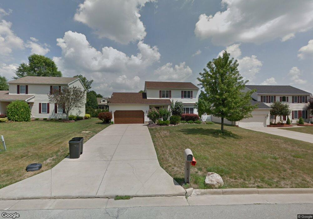
3405 Starwick Dr Canfield, OH 44406
Austintown NeighborhoodEstimated Value: $258,000 - $298,000
3
Beds
3
Baths
1,830
Sq Ft
$152/Sq Ft
Est. Value
About This Home
This home is located at 3405 Starwick Dr, Canfield, OH 44406 and is currently estimated at $278,426, approximately $152 per square foot. 3405 Starwick Dr is a home located in Mahoning County with nearby schools including Austintown Elementary School, Austintown Intermediate School, and Austintown Middle School.
Ownership History
Date
Name
Owned For
Owner Type
Purchase Details
Closed on
Jan 7, 1999
Sold by
David Beil Inc
Bought by
Beardman Robert J and Beardman Jeana M
Current Estimated Value
Home Financials for this Owner
Home Financials are based on the most recent Mortgage that was taken out on this home.
Original Mortgage
$108,800
Outstanding Balance
$25,387
Interest Rate
6.83%
Mortgage Type
Purchase Money Mortgage
Estimated Equity
$253,039
Purchase Details
Closed on
Jul 10, 1998
Bought by
Robert J Beardman and Beardman
Create a Home Valuation Report for This Property
The Home Valuation Report is an in-depth analysis detailing your home's value as well as a comparison with similar homes in the area
Home Values in the Area
Average Home Value in this Area
Purchase History
| Date | Buyer | Sale Price | Title Company |
|---|---|---|---|
| Beardman Robert J | $128,000 | -- | |
| Robert J Beardman | -- | -- |
Source: Public Records
Mortgage History
| Date | Status | Borrower | Loan Amount |
|---|---|---|---|
| Open | Beardman Robert J | $108,800 |
Source: Public Records
Tax History Compared to Growth
Tax History
| Year | Tax Paid | Tax Assessment Tax Assessment Total Assessment is a certain percentage of the fair market value that is determined by local assessors to be the total taxable value of land and additions on the property. | Land | Improvement |
|---|---|---|---|---|
| 2024 | $3,521 | $76,480 | $7,200 | $69,280 |
| 2023 | $3,459 | $76,480 | $7,200 | $69,280 |
| 2022 | $3,150 | $55,850 | $7,270 | $48,580 |
| 2021 | $3,153 | $55,850 | $7,270 | $48,580 |
| 2020 | $3,165 | $55,850 | $7,270 | $48,580 |
| 2019 | $2,981 | $47,730 | $6,210 | $41,520 |
| 2018 | $2,869 | $47,730 | $6,210 | $41,520 |
| 2017 | $2,854 | $47,730 | $6,210 | $41,520 |
| 2016 | $2,968 | $49,150 | $6,630 | $42,520 |
| 2015 | $2,878 | $49,150 | $6,630 | $42,520 |
| 2014 | $2,891 | $49,150 | $6,630 | $42,520 |
| 2013 | $2,859 | $49,150 | $6,630 | $42,520 |
Source: Public Records
Map
Nearby Homes
- 3475 42nd St
- 3481 Forty Second St
- 5285 Kirk Rd
- 3695 High Meadow Dr
- 4651 Warwick Dr S
- 4643 Warwick Dr S
- 3270 S Canfield Niles Rd
- 4674 Barrington Dr
- 4650 Bunny Trail
- 4114 S Raccoon Rd
- 2493 Frostwood Dr
- 2792 S Canfield Niles Rd
- 3798 S Raccoon Rd
- 2211 Penny Ln
- 2414 Ardenwood Place
- 4488 S Raccoon Rd
- 4689 Crabwood Dr
- 40 Woodleigh Ct
- 5260 Revere Run
- 4232 Adeer Dr
- 3413 Starwick Dr
- 3397 Starwick Dr
- 3389 Starwick Dr
- 3419 Starwick Dr
- 3400 42nd St
- 3406 Forty Second St
- 3394 42nd St
- 3406 Starwick Dr
- 3412 42nd St
- 3388 42nd St
- 3398 Starwick Dr
- 3427 Starwick Dr
- 3412 Starwick Dr
- 3381 Starwick Dr
- 3390 Starwick Dr
- 3420 Starwick Dr
- 3382 42nd St
- 3418 42nd St
- 3435 Starwick Dr
- 3426 Starwick Dr