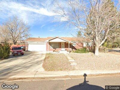
3609 W Chenango Ave Littleton, CO 80123
Fort Logan NeighborhoodEstimated Value: $524,000 - $635,000
3
Beds
2
Baths
1,174
Sq Ft
$481/Sq Ft
Est. Value
About This Home
This home is located at 3609 W Chenango Ave, Littleton, CO 80123 and is currently estimated at $565,188, approximately $481 per square foot. 3609 W Chenango Ave is a home located in Denver County with nearby schools including Kaiser Elementary School, Bear Valley International School, and John F Kennedy High School.
Ownership History
Date
Name
Owned For
Owner Type
Purchase Details
Closed on
May 21, 1998
Sold by
Christine Hilborn Dale
Bought by
Hilborn John Daniel
Current Estimated Value
Home Financials for this Owner
Home Financials are based on the most recent Mortgage that was taken out on this home.
Original Mortgage
$30,000
Interest Rate
7.13%
Mortgage Type
Unknown
Create a Home Valuation Report for This Property
The Home Valuation Report is an in-depth analysis detailing your home's value as well as a comparison with similar homes in the area
Home Values in the Area
Average Home Value in this Area
Purchase History
| Date | Buyer | Sale Price | Title Company |
|---|---|---|---|
| Hilborn John Daniel | -- | -- |
Source: Public Records
Mortgage History
| Date | Status | Borrower | Loan Amount |
|---|---|---|---|
| Closed | Hilborn John Daniel | $35,000 | |
| Closed | Hilborn John Daniel | $91,500 | |
| Closed | Hilborn John D | $105,000 | |
| Closed | Hilborn John Daniel | $27,000 | |
| Closed | Hilborn John Daniel | $100,000 | |
| Closed | Hilborn John Daniel | $10,055 | |
| Closed | Hilborn John Daniel | $30,000 |
Source: Public Records
Tax History Compared to Growth
Tax History
| Year | Tax Paid | Tax Assessment Tax Assessment Total Assessment is a certain percentage of the fair market value that is determined by local assessors to be the total taxable value of land and additions on the property. | Land | Improvement |
|---|---|---|---|---|
| 2024 | $2,483 | $37,150 | $6,240 | $30,910 |
| 2023 | $2,431 | $37,150 | $6,240 | $30,910 |
| 2022 | $2,028 | $31,570 | $10,300 | $21,270 |
| 2021 | $1,958 | $32,490 | $10,600 | $21,890 |
| 2020 | $2,127 | $27,600 | $9,780 | $17,820 |
| 2019 | $2,056 | $27,600 | $9,780 | $17,820 |
| 2018 | $2,011 | $25,300 | $7,390 | $17,910 |
| 2017 | $2,003 | $25,300 | $7,390 | $17,910 |
| 2016 | $1,833 | $21,870 | $8,167 | $13,703 |
| 2015 | $1,755 | $21,870 | $8,167 | $13,703 |
| 2014 | $1,370 | $16,020 | $3,980 | $12,040 |
Source: Public Records
Map
Nearby Homes
- 3741 W Saratoga Ave
- 3937 W Grand Ave
- 3999 W Chenango Ave
- 3379 W Wagon Trail Dr
- 3395 W Union Ave
- 3685 W Union Ave
- 4673 S Lowell Blvd
- 4643 S Lowell Blvd Unit B
- 4291 W Wagon Trail Dr
- 3200 W Chenango Ave
- 4621 S Perry Way
- 3614 W Radcliff Ave Unit D8
- 3103 W Bellewood Dr
- 4569 S Lowell Blvd Unit C
- 4569 S Lowell Blvd Unit B
- 3288 W Tufts Ave
- 4507 S Lowell Blvd
- 5197 S Perry St
- 3150 W Stanford Ave
- 2986 W Union Ave
- 3609 W Chenango Ave
- 3639 W Chenango Ave
- 3600 W Saratoga Ave
- 3393 W Chenango Ave
- 3608 W Chenango Ave
- 3659 W Chenango Ave
- 3618 W Chenango Ave
- 3398 W Saratoga Ave
- 3394 W Chenango Ave
- 3660 W Saratoga Ave
- 3391 W Chenango Ave
- 3638 W Chenango Ave
- 3601 W Saratoga Ave
- 3779 W Chenango Ave
- 3392 W Chenango Ave
- 3617 W Grand Ave
- 3637 W Grand Ave
- 3399 W Saratoga Ave
- 3399 W Grand Ave
- 3690 W Saratoga Ave