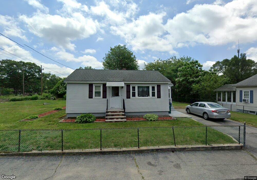
39 Shea St Lowell, MA 01854
Pawtucketville NeighborhoodEstimated Value: $449,000 - $498,000
2
Beds
1
Bath
750
Sq Ft
$626/Sq Ft
Est. Value
About This Home
This home is located at 39 Shea St, Lowell, MA 01854 and is currently estimated at $469,601, approximately $626 per square foot. 39 Shea St is a home located in Middlesex County with nearby schools including Joseph McAvinnue Elementary School, Charlotte M. Murkland Elementary School, and Charles W. Morey Elementary School.
Ownership History
Date
Name
Owned For
Owner Type
Purchase Details
Closed on
Oct 19, 2012
Sold by
Fauval Pauline
Bought by
Fauvel Brian R and Fauvel Pualine
Current Estimated Value
Create a Home Valuation Report for This Property
The Home Valuation Report is an in-depth analysis detailing your home's value as well as a comparison with similar homes in the area
Home Values in the Area
Average Home Value in this Area
Purchase History
| Date | Buyer | Sale Price | Title Company |
|---|---|---|---|
| Fauvel Brian R | -- | -- | |
| Fauvel Brian R | -- | -- |
Source: Public Records
Mortgage History
| Date | Status | Borrower | Loan Amount |
|---|---|---|---|
| Previous Owner | Fauvel Brian R | $88,700 | |
| Previous Owner | Fauvel Brian R | $19,000 | |
| Previous Owner | Fauvel Brian R | $48,000 |
Source: Public Records
Tax History Compared to Growth
Tax History
| Year | Tax Paid | Tax Assessment Tax Assessment Total Assessment is a certain percentage of the fair market value that is determined by local assessors to be the total taxable value of land and additions on the property. | Land | Improvement |
|---|---|---|---|---|
| 2025 | $4,292 | $373,900 | $158,500 | $215,400 |
| 2024 | $3,818 | $320,600 | $127,900 | $192,700 |
| 2023 | $3,552 | $286,000 | $104,400 | $181,600 |
| 2022 | $3,011 | $237,300 | $92,500 | $144,800 |
| 2021 | $3,022 | $224,500 | $80,400 | $144,100 |
| 2020 | $3,094 | $231,600 | $104,000 | $127,600 |
| 2019 | $2,901 | $206,600 | $91,400 | $115,200 |
| 2018 | $2,773 | $192,700 | $87,100 | $105,600 |
| 2017 | $2,726 | $182,700 | $79,200 | $103,500 |
| 2016 | $2,611 | $172,200 | $77,000 | $95,200 |
| 2015 | $2,576 | $166,400 | $73,700 | $92,700 |
| 2013 | $2,412 | $160,700 | $81,400 | $79,300 |
Source: Public Records
Map
Nearby Homes
- 25 Shea St Unit 8
- 382 University Ave
- 380 University Ave
- 107 7th Ave
- 61 7th Ave W
- 33 W Meadow Rd
- 49 Tolman Ave
- 113 5th Ave
- 81 5th Ave
- 35 Honora Ave
- 45 Hoover St
- 30 4th Ave
- 199 University Ave
- 1410 Skyline Dr Unit 9
- 1710 Skyline Dr Unit 10
- 1600 Skyline Dr Unit 2
- 2200 Skyline Dr Unit 5
- 109 Navy Yard Rd
- 14 Endicott St
- 101 Donohue Rd Unit 19
- 35 Shea St
- 100 E Meadow Rd Unit 5
- 100 E Meadow Rd Unit 3
- 100 E Meadow Rd Unit 4
- 100 E Meadow Rd Unit 1
- 100 E Meadow Rd Unit 2
- 100 E Meadow Rd Unit 6
- 100 E Meadow Rd
- 100 E Meadow Rd Unit 6 100
- 100 E Meadow Rd Unit 2,1
- 90 E Meadow Rd
- 82 E Meadow Rd
- 26 Shea St
- 72 E Meadow Rd
- 24 Shea St
- 58 Shea St
- 118 E Meadow Rd
- 60 E Meadow Rd
- 100 East Meadow Unit 4
- 61 Shea St Unit 5