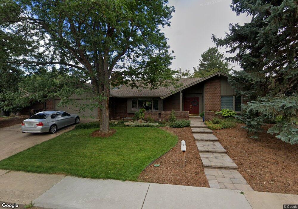
3920 Caddo Pkwy Boulder, CO 80303
Southeast Boulder NeighborhoodEstimated Value: $1,389,000 - $1,623,000
4
Beds
4
Baths
2,874
Sq Ft
$530/Sq Ft
Est. Value
About This Home
This home is located at 3920 Caddo Pkwy, Boulder, CO 80303 and is currently estimated at $1,521,869, approximately $529 per square foot. 3920 Caddo Pkwy is a home located in Boulder County with nearby schools including Eisenhower Elementary School, Manhattan Middle School of the Arts & Academics, and Fairview High School.
Ownership History
Date
Name
Owned For
Owner Type
Purchase Details
Closed on
Feb 8, 2001
Sold by
Sabott David G and Sabott Anne W
Bought by
Smith R Clayton
Current Estimated Value
Home Financials for this Owner
Home Financials are based on the most recent Mortgage that was taken out on this home.
Original Mortgage
$275,000
Outstanding Balance
$99,036
Interest Rate
7.04%
Estimated Equity
$1,422,833
Purchase Details
Closed on
Jun 6, 1983
Bought by
Hyde-Smith Anne Smith R and Hyde-Smith Anne
Create a Home Valuation Report for This Property
The Home Valuation Report is an in-depth analysis detailing your home's value as well as a comparison with similar homes in the area
Home Values in the Area
Average Home Value in this Area
Purchase History
We collect this data history from publicly available records. To have your information removed, we recommend requesting removal directly through your county’s website.
| Date | Buyer | Sale Price | Title Company |
|---|---|---|---|
| Smith R Clayton | $517,000 | Land Title | |
| Hyde-Smith Anne Smith R | $211,000 | -- |
Source: Public Records
Mortgage History
We collect this data history from publicly available records. To have your information removed, we recommend requesting removal directly through your county’s website.
| Date | Status | Borrower | Loan Amount |
|---|---|---|---|
| Open | Smith R Clayton | $275,000 |
Source: Public Records
Tax History
| Year | Tax Paid | Tax Assessment Tax Assessment Total Assessment is a certain percentage of the fair market value that is determined by local assessors to be the total taxable value of land and additions on the property. | Land | Improvement |
|---|---|---|---|---|
| 2025 | $8,052 | $98,675 | $55,230 | $43,445 |
| 2024 | $8,472 | $90,694 | $50,763 | $39,931 |
| 2023 | $8,325 | $103,100 | $61,781 | $45,004 |
| 2022 | $6,626 | $78,306 | $44,195 | $34,111 |
| 2021 | $6,319 | $80,559 | $45,467 | $35,092 |
| 2020 | $5,932 | $75,297 | $37,037 | $38,260 |
| 2019 | $5,841 | $75,297 | $37,037 | $38,260 |
| 2018 | $5,566 | $71,395 | $34,848 | $36,547 |
| 2017 | $5,996 | $78,931 | $38,526 | $40,405 |
| 2016 | $5,261 | $60,774 | $25,631 | $35,143 |
| 2015 | $4,982 | $51,413 | $23,641 | $27,772 |
| 2014 | $4,323 | $51,413 | $23,641 | $27,772 |
Source: Public Records
Map
Nearby Homes
- 650-654 Inca Pkwy
- 4425 Comanche Dr
- 4475 Laguna Place Unit 201
- 3664 Chase Ct
- 4500 Baseline Rd Unit 4302
- 135 S 42nd St
- 500 Mohawk Dr Unit 409
- 700 33rd St
- 4256 Graham Ct
- 200 Mohawk Dr
- 540 Mohawk Dr Unit 15
- 170 S 42nd St
- 530 Mohawk Dr Unit 96
- 735 32nd St
- 265 S 39th St
- 4700 Shawnee Place
- 310 S 40th St
- 4595 Moorhead Ave
- 330 32nd St
- 905 36th St
Your Personal Tour Guide
Ask me questions while you tour the home.