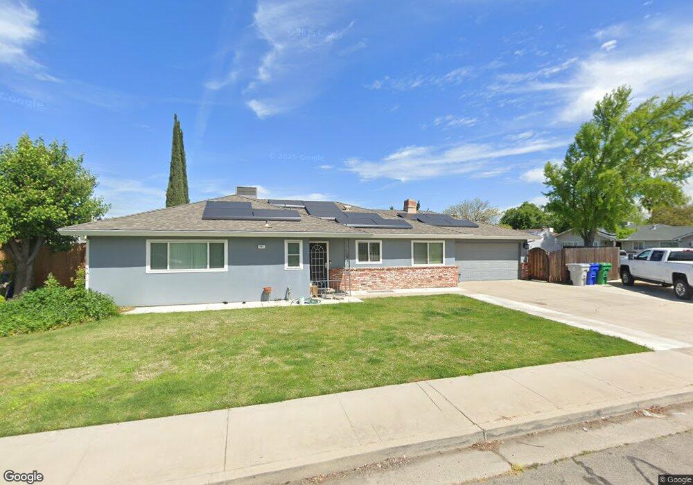
401 Gabriel Dr Atwater, CA 95301
Estimated Value: $377,000 - $401,000
3
Beds
2
Baths
1,504
Sq Ft
$258/Sq Ft
Est. Value
About This Home
This home is located at 401 Gabriel Dr, Atwater, CA 95301 and is currently estimated at $387,648, approximately $257 per square foot. 401 Gabriel Dr is a home located in Merced County with nearby schools including Thomas Olaeta Elementary School, Mitchell Intermediate School, and Buhach Colony High School.
Ownership History
Date
Name
Owned For
Owner Type
Purchase Details
Closed on
Jul 10, 2017
Sold by
Smith Michael and Smith Devin I
Bought by
Smith Michael and Smith Devin I
Current Estimated Value
Home Financials for this Owner
Home Financials are based on the most recent Mortgage that was taken out on this home.
Original Mortgage
$192,918
Outstanding Balance
$160,282
Interest Rate
3.89%
Mortgage Type
FHA
Estimated Equity
$227,366
Purchase Details
Closed on
Oct 14, 2010
Sold by
Bank Of America National Association
Bought by
Smith Michael
Home Financials for this Owner
Home Financials are based on the most recent Mortgage that was taken out on this home.
Original Mortgage
$103,500
Interest Rate
4.17%
Mortgage Type
New Conventional
Purchase Details
Closed on
Jul 21, 2010
Sold by
Sabin Carmen D
Bought by
Bank Of America National Association
Create a Home Valuation Report for This Property
The Home Valuation Report is an in-depth analysis detailing your home's value as well as a comparison with similar homes in the area
Home Values in the Area
Average Home Value in this Area
Purchase History
| Date | Buyer | Sale Price | Title Company |
|---|---|---|---|
| Smith Michael | -- | Title 365 | |
| Smith Michael | $106,500 | Chicago Title | |
| Bank Of America National Association | $79,758 | Accommodation |
Source: Public Records
Mortgage History
| Date | Status | Borrower | Loan Amount |
|---|---|---|---|
| Open | Smith Michael | $192,918 | |
| Previous Owner | Smith Michael | $103,500 |
Source: Public Records
Tax History Compared to Growth
Tax History
| Year | Tax Paid | Tax Assessment Tax Assessment Total Assessment is a certain percentage of the fair market value that is determined by local assessors to be the total taxable value of land and additions on the property. | Land | Improvement |
|---|---|---|---|---|
| 2025 | $1,468 | $137,458 | $12,901 | $124,557 |
| 2024 | $1,468 | $134,764 | $12,649 | $122,115 |
| 2023 | $1,430 | $132,122 | $12,401 | $119,721 |
| 2022 | $1,414 | $129,532 | $12,158 | $117,374 |
| 2021 | $1,416 | $126,993 | $11,920 | $115,073 |
| 2020 | $1,400 | $125,692 | $11,798 | $113,894 |
| 2019 | $1,340 | $123,228 | $11,567 | $111,661 |
| 2018 | $1,307 | $120,813 | $11,341 | $109,472 |
| 2017 | $2,448 | $118,445 | $11,119 | $107,326 |
| 2016 | $1,270 | $116,123 | $10,901 | $105,222 |
| 2015 | $1,255 | $114,380 | $10,738 | $103,642 |
| 2014 | $1,225 | $112,140 | $10,528 | $101,612 |
Source: Public Records
Map
Nearby Homes
- 1943 Pollitt Ct
- 1832 Vann Terrace
- 223 Kadota Ave
- 190 Tammy Dr
- 562 Curtis Ct
- 352 Terri Dr
- 1675 Almador Terrace
- 639 Mulberry Ave
- 1881 Valley St
- 630 Juniper Ave
- 134 E Fir Ave
- 1870 Eucalyptus St
- 851 Boulder Dr
- 1510 High St
- 0 Alabama St Unit MC25081690
- 0 Alabama St Unit MC25081689
- 0 Alabama St Unit MC25081688
- 1620 Fairway Dr
- 400 Elm Ave
- 1012 Huntingdale Way
- 400 Beals Dr
- 381 Gabriel Dr
- 380 Beals Dr
- 400 Gabriel Dr
- 2040 Rancho Del Rey Dr
- 2020 Rancho Del Rey Dr
- 380 Gabriel Dr
- 361 Gabriel Dr
- 2060 Rancho Del Rey Dr
- 360 Beals Dr
- 2000 Rancho Del Rey Dr
- 360 Gabriel Dr
- 401 Marvis Dr
- 381 Marvis Dr
- 2080 Rancho Del Rey Dr
- 381 Beals Dr
- 1998 Rancho Del Rey Dr
- 301 Gabriel Dr
- 361 Marvis Dr
- 330 Gabriel Dr