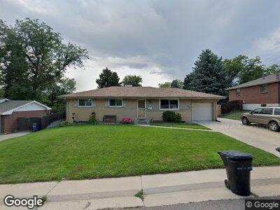
4088 W Chenango Ave Littleton, CO 80123
Fort Logan NeighborhoodEstimated Value: $543,000 - $579,000
3
Beds
2
Baths
1,135
Sq Ft
$491/Sq Ft
Est. Value
About This Home
This home is located at 4088 W Chenango Ave, Littleton, CO 80123 and is currently estimated at $557,308, approximately $491 per square foot. 4088 W Chenango Ave is a home located in Denver County with nearby schools including Kaiser Elementary School, Bear Valley International School, and John F Kennedy High School.
Ownership History
Date
Name
Owned For
Owner Type
Purchase Details
Closed on
Sep 23, 2022
Sold by
Peter H Lujan Trust
Bought by
Brrab Family Trust
Current Estimated Value
Purchase Details
Closed on
Jan 11, 2019
Sold by
Phagan Charla R and Estate Of Peter H Lujan
Bought by
The Peter H Lujan Trust
Create a Home Valuation Report for This Property
The Home Valuation Report is an in-depth analysis detailing your home's value as well as a comparison with similar homes in the area
Home Values in the Area
Average Home Value in this Area
Purchase History
| Date | Buyer | Sale Price | Title Company |
|---|---|---|---|
| Brrab Family Trust | -- | -- | |
| The Peter H Lujan Trust | -- | None Available |
Source: Public Records
Mortgage History
| Date | Status | Borrower | Loan Amount |
|---|---|---|---|
| Open | Brrab Family Trust | $100,000 | |
| Previous Owner | Lujan Peter H | $141,207 | |
| Previous Owner | Lujan Evelyn M | $77,987 | |
| Previous Owner | Lujan Peter H | $87,700 | |
| Previous Owner | Lujan Peter H | $61,500 | |
| Previous Owner | Lujan Peter H | $27,700 | |
| Previous Owner | Lujan Peter H | $25,001 |
Source: Public Records
Tax History Compared to Growth
Tax History
| Year | Tax Paid | Tax Assessment Tax Assessment Total Assessment is a certain percentage of the fair market value that is determined by local assessors to be the total taxable value of land and additions on the property. | Land | Improvement |
|---|---|---|---|---|
| 2024 | $2,862 | $35,100 | $4,430 | $30,670 |
| 2023 | $2,802 | $35,100 | $4,430 | $30,670 |
| 2022 | $2,283 | $27,710 | $8,420 | $19,290 |
| 2021 | $2,203 | $28,500 | $8,660 | $19,840 |
| 2020 | $2,140 | $27,760 | $7,990 | $19,770 |
| 2019 | $2,068 | $27,760 | $7,990 | $19,770 |
| 2018 | $1,215 | $22,480 | $6,030 | $16,450 |
| 2017 | $1,210 | $22,480 | $6,030 | $16,450 |
| 2016 | $981 | $19,670 | $6,670 | $13,000 |
| 2015 | $940 | $19,670 | $6,670 | $13,000 |
| 2014 | $682 | $15,930 | $3,980 | $11,950 |
Source: Public Records
Map
Nearby Homes
- 3999 W Chenango Ave
- 4291 W Wagon Trail Dr
- 3937 W Grand Ave
- 3741 W Saratoga Ave
- 4621 S Perry Way
- 3630 W Saratoga Ave
- 3685 W Union Ave
- 4673 S Lowell Blvd
- 4643 S Lowell Blvd Unit B
- 3379 W Wagon Trail Dr
- 4391 W Tufts Ave
- 4701 Homestead St
- 3614 W Radcliff Ave Unit D8
- 4643 S Vrain St
- 4569 S Lowell Blvd Unit C
- 4569 S Lowell Blvd Unit B
- 5197 S Perry St
- 3395 W Union Ave
- 4507 S Lowell Blvd
- 4474 S Vrain St
- 4088 W Chenango Ave
- 4118 W Chenango Ave
- 4038 W Chenango Ave
- 4137 W Grand Ave
- 4128 W Chenango Ave
- 4157 W Grand Ave
- 4107 W Grand Ave
- 4089 W Chenango Ave
- 4039 W Chenango Ave
- 4109 W Chenango Ave
- 4177 W Grand Ave
- 3998 W Chenango Ave
- 4148 W Chenango Ave
- 4139 W Chenango Ave
- 4757 S Perry St
- 4197 W Grand Ave
- 4097 W Grand Ave
- 4947 S Perry St
- 4747 S Perry St
- 3978 W Chenango Ave