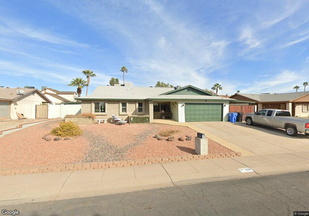
410 E Sack Dr Phoenix, AZ 85024
North Central Phoenix NeighborhoodEstimated Value: $349,072 - $463,000
Studio
2
Baths
1,720
Sq Ft
$250/Sq Ft
Est. Value
About This Home
This home is located at 410 E Sack Dr, Phoenix, AZ 85024 and is currently estimated at $429,268, approximately $249 per square foot. 410 E Sack Dr is a home located in Maricopa County with nearby schools including Eagle Ridge Elementary School, Mountain Trail Middle School, and North Canyon High School.
Ownership History
Date
Name
Owned For
Owner Type
Purchase Details
Closed on
Sep 15, 2005
Sold by
Roush William
Bought by
Roush William and Roush Sandra
Current Estimated Value
Home Financials for this Owner
Home Financials are based on the most recent Mortgage that was taken out on this home.
Original Mortgage
$159,000
Outstanding Balance
$81,925
Interest Rate
5.46%
Mortgage Type
New Conventional
Estimated Equity
$347,343
Purchase Details
Closed on
Jul 18, 2005
Sold by
Roush Sandra L
Bought by
Roush William M
Home Financials for this Owner
Home Financials are based on the most recent Mortgage that was taken out on this home.
Original Mortgage
$159,000
Outstanding Balance
$81,925
Interest Rate
5.46%
Mortgage Type
New Conventional
Estimated Equity
$347,343
Create a Home Valuation Report for This Property
The Home Valuation Report is an in-depth analysis detailing your home's value as well as a comparison with similar homes in the area
Home Values in the Area
Average Home Value in this Area
Purchase History
| Date | Buyer | Sale Price | Title Company |
|---|---|---|---|
| Roush William | -- | -- | |
| Roush William M | -- | Security Title Agency Inc |
Source: Public Records
Mortgage History
| Date | Status | Borrower | Loan Amount |
|---|---|---|---|
| Open | Roush William M | $159,000 |
Source: Public Records
Tax History
| Year | Tax Paid | Tax Assessment Tax Assessment Total Assessment is a certain percentage of the fair market value that is determined by local assessors to be the total taxable value of land and additions on the property. | Land | Improvement |
|---|---|---|---|---|
| 2025 | $1,829 | $21,128 | -- | -- |
| 2024 | $1,742 | $20,122 | -- | -- |
| 2023 | $1,742 | $32,280 | $6,450 | $25,830 |
| 2022 | $1,726 | $25,230 | $5,040 | $20,190 |
| 2021 | $1,754 | $23,250 | $4,650 | $18,600 |
| 2020 | $1,694 | $22,710 | $4,540 | $18,170 |
| 2019 | $1,702 | $21,810 | $4,360 | $17,450 |
| 2018 | $1,640 | $20,460 | $4,090 | $16,370 |
| 2017 | $1,566 | $17,850 | $3,570 | $14,280 |
| 2016 | $1,541 | $17,110 | $3,420 | $13,690 |
| 2015 | $1,430 | $17,630 | $3,520 | $14,110 |
Source: Public Records
Map
Nearby Homes
- 406 E Taro Ln
- 441 E Topeka Dr
- 19209 N 6th St
- 452 E Annette Dr
- 19401 N 7th St Unit 142
- 19401 N 7th St Unit 60
- 19401 N 7th St Unit 187
- 19401 N 7th St Unit 121
- 19401 N 7th St Unit 259
- 19401 N 7th St Unit 226
- 19401 N 7th St Unit 73
- 19401 N 7th St Unit 239
- 18414 N 5th Place
- 437 E Annette Dr
- 19401 N 7st Lot 94 St Unit 94
- 14 E Piute Ave
- 19601 N 7th St Unit 1056
- 19601 N 7th St Unit 2026
- 19601 N 7th St Unit 2107
- 19601 N 7th St Unit 1005
- 404 E Sack Dr
- 418 E Sack Dr
- 417 E Wescott Dr
- 413 E Wescott Dr
- 421 E Wescott Dr
- 409 E Wescott Dr
- 425 E Wescott Dr
- 405 E Wescott Dr
- 409 E Sack Dr
- 426 E Sack Dr
- 417 E Sack Dr
- 401 E Sack Dr
- 429 E Wescott Dr
- 402 E Sack Dr
- 401 E Wescott Dr
- 433 E Wescott Dr
- 425 E Sack Dr
- 414 E Wescott Dr
- 418 E Wescott Dr
- 410 E Wescott Dr
Your Personal Tour Guide
Ask me questions while you tour the home.