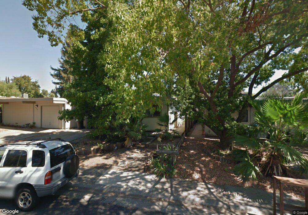
4115 Scranton Cir Carmichael, CA 95608
Del Paso Vale NeighborhoodEstimated Value: $340,000 - $472,000
2
Beds
2
Baths
1,288
Sq Ft
$325/Sq Ft
Est. Value
About This Home
This home is located at 4115 Scranton Cir, Carmichael, CA 95608 and is currently estimated at $418,539, approximately $324 per square foot. 4115 Scranton Cir is a home located in Sacramento County with nearby schools including Cameron Ranch Elementary School, Winston Churchill Middle School, and Mira Loma High School.
Ownership History
Date
Name
Owned For
Owner Type
Purchase Details
Closed on
Jun 16, 1998
Sold by
Ocheltree Ann E
Bought by
Tadlock Jennifer A
Current Estimated Value
Home Financials for this Owner
Home Financials are based on the most recent Mortgage that was taken out on this home.
Original Mortgage
$88,350
Outstanding Balance
$17,767
Interest Rate
7.11%
Estimated Equity
$400,772
Create a Home Valuation Report for This Property
The Home Valuation Report is an in-depth analysis detailing your home's value as well as a comparison with similar homes in the area
Home Values in the Area
Average Home Value in this Area
Purchase History
| Date | Buyer | Sale Price | Title Company |
|---|---|---|---|
| Tadlock Jennifer A | $93,000 | Fidelity National Title Co |
Source: Public Records
Mortgage History
| Date | Status | Borrower | Loan Amount |
|---|---|---|---|
| Open | Tadlock Jennifer A | $88,350 |
Source: Public Records
Tax History
| Year | Tax Paid | Tax Assessment Tax Assessment Total Assessment is a certain percentage of the fair market value that is determined by local assessors to be the total taxable value of land and additions on the property. | Land | Improvement |
|---|---|---|---|---|
| 2025 | $1,683 | $148,467 | $36,710 | $111,757 |
| 2024 | $1,683 | $145,557 | $35,991 | $109,566 |
| 2023 | $1,639 | $142,704 | $35,286 | $107,418 |
| 2022 | $1,629 | $139,907 | $34,595 | $105,312 |
| 2021 | $1,601 | $137,165 | $33,917 | $103,248 |
| 2020 | $1,571 | $135,760 | $33,570 | $102,190 |
| 2019 | $1,538 | $133,099 | $32,912 | $100,187 |
| 2018 | $1,519 | $130,490 | $32,267 | $98,223 |
| 2017 | $1,502 | $127,933 | $31,635 | $96,298 |
| 2016 | $1,403 | $125,425 | $31,015 | $94,410 |
| 2015 | $1,378 | $123,542 | $30,550 | $92,992 |
| 2014 | $1,348 | $121,123 | $29,952 | $91,171 |
Source: Public Records
Map
Nearby Homes
- 5812 Kimberly Hill Ct
- 4448 Hackberry Ln
- 5622 Cypress Ave
- 6141 Lincoln Ave
- 5725 Misty Wind Ct
- 5531 Cypress Ave
- 3905 Apple Blossom Way
- 5500 Stately Oak Ln
- 5424 Valhalla Dr
- 4660 Lue Ln
- 5412 Wildflower Cir
- 5443 Aris Way
- 4343 Virgusell Cir
- 4524 Bela Way
- 6008 Amir Ln
- 5258 Woodvale Way
- 6395 Perrin Way
- 5637 Kiva Dr
- 5940 Rye Way
- 6008 Rye Way
- 4117 Scranton Cir
- 4113 Scranton Cir
- 4119 Scranton Cir
- 4111 Scranton Cir
- 4121 Scranton Cir
- 4109 Scranton Cir
- 4123 Scranton Cir
- 4107 Scranton Cir
- 4116 Scranton Cir
- 4118 Scranton Cir
- 4120 Scranton Cir
- 4105 Scranton Cir
- 5824 Locust Ave
- 4110 Scranton Cir
- 4122 Scranton Cir
- 4125 Scranton Cir
- 4140 Scranton Cir
- 4127 Scranton Cir
- 4106 Scranton Cir
- 4129 Scranton Cir
Your Personal Tour Guide
Ask me questions while you tour the home.