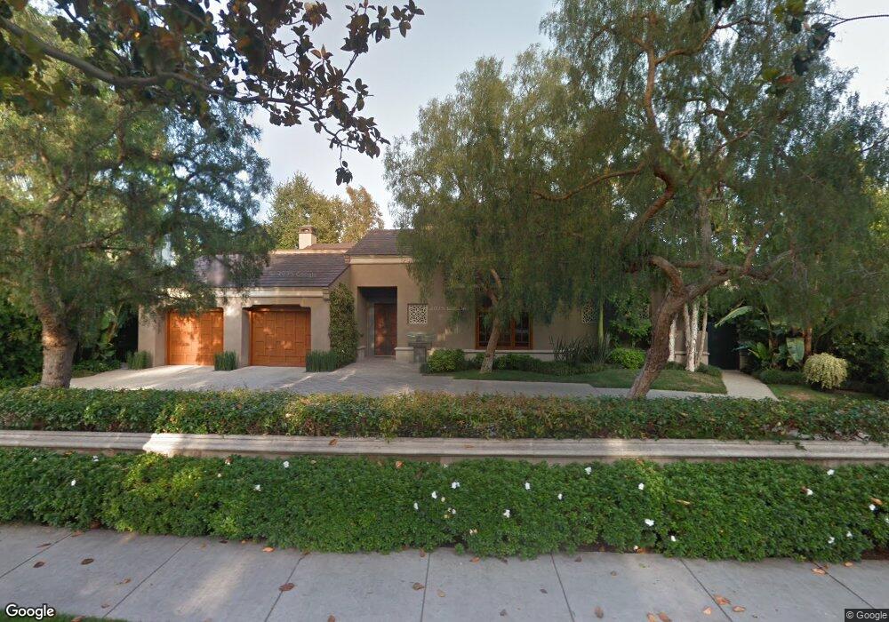
414 Lomond Ave Los Angeles, CA 90024
Westwood NeighborhoodEstimated Value: $6,826,000 - $7,175,000
3
Beds
4
Baths
5,589
Sq Ft
$1,243/Sq Ft
Est. Value
About This Home
This home is located at 414 Lomond Ave, Los Angeles, CA 90024 and is currently estimated at $6,949,786, approximately $1,243 per square foot. 414 Lomond Ave is a home located in Los Angeles County with nearby schools including Warner Avenue Elementary, Ralph Waldo Emerson Community Charter Middle School, and University High School Charter.
Ownership History
Date
Name
Owned For
Owner Type
Purchase Details
Closed on
Feb 16, 2001
Sold by
Louise Denker Morgan Real Estate Ltd Par
Bought by
Tendler Stanley and Tendler Audri May
Current Estimated Value
Create a Home Valuation Report for This Property
The Home Valuation Report is an in-depth analysis detailing your home's value as well as a comparison with similar homes in the area
Home Values in the Area
Average Home Value in this Area
Purchase History
| Date | Buyer | Sale Price | Title Company |
|---|---|---|---|
| Tendler Stanley | $1,500,000 | Fidelity National Title Co |
Source: Public Records
Tax History Compared to Growth
Tax History
| Year | Tax Paid | Tax Assessment Tax Assessment Total Assessment is a certain percentage of the fair market value that is determined by local assessors to be the total taxable value of land and additions on the property. | Land | Improvement |
|---|---|---|---|---|
| 2025 | $51,714 | $4,337,590 | $2,260,274 | $2,077,316 |
| 2024 | $51,714 | $4,252,540 | $2,215,955 | $2,036,585 |
| 2023 | $50,706 | $4,169,157 | $2,172,505 | $1,996,652 |
| 2022 | $48,337 | $4,087,409 | $2,129,907 | $1,957,502 |
| 2021 | $47,745 | $4,007,265 | $2,088,145 | $1,919,120 |
| 2020 | $48,243 | $3,966,176 | $2,066,734 | $1,899,442 |
| 2019 | $46,306 | $3,888,409 | $2,026,210 | $1,862,199 |
| 2018 | $46,115 | $3,812,167 | $1,986,481 | $1,825,686 |
| 2016 | $44,108 | $3,664,139 | $1,909,345 | $1,754,794 |
| 2015 | $43,457 | $3,609,101 | $1,880,665 | $1,728,436 |
| 2014 | $43,572 | $3,538,405 | $1,843,826 | $1,694,579 |
Source: Public Records
Map
Nearby Homes
- 365 Comstock Ave
- 453 Dalehurst Ave
- 365 Norcroft Ave
- 10444 Charing Cross Rd
- 547 Loring Ave
- 601 Woodruff Ave
- 570 S Beverly Glen Blvd
- 570 S Mapleton Dr
- 10386 Strathmore Dr
- 200 S Mapleton Dr
- 101 Bel Air Rd
- 133 S Mapleton Dr
- 107 Delfern Dr
- 740 Warner Ave
- 10301 Strathmore Dr
- 235 St Pierre Rd
- 259 St Pierre Rd
- 112 N Beverly Glen Blvd
- 850 Birchwood Dr
- 820 Glenmont Ave
- 422 Lomond Ave
- 430 Dalehurst Ave
- 415 Loring Ave
- 411 Loring Ave
- 423 Loring Ave
- 411 Lomond Ave
- 401 Loring Ave
- 436 Dalehurst Ave
- 401 Lomond Ave
- 376 Dalehurst Ave
- 429 Loring Ave
- 442 Dalehurst Ave
- 393 Dalehurst Ave
- 431 Dalehurst Ave
- 435 Dalehurst Ave
- 383 Dalehurst Ave
- 368 Dalehurst Ave
- 448 Dalehurst Ave
- 333 Loring Ave
- 374 Comstock Ave