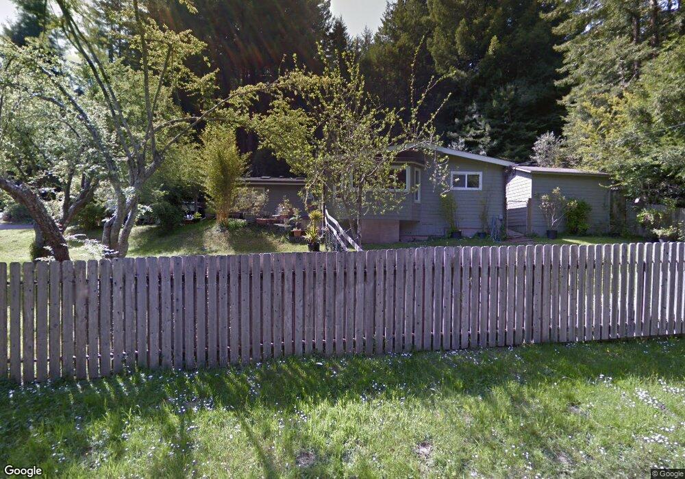
4184 Browns Rd Eureka, CA 95503
Estimated Value: $467,444 - $589,000
3
Beds
2
Baths
1,440
Sq Ft
$359/Sq Ft
Est. Value
About This Home
This home is located at 4184 Browns Rd, Eureka, CA 95503 and is currently estimated at $516,611, approximately $358 per square foot. 4184 Browns Rd is a home located in Humboldt County with nearby schools including Freshwater Elementary School, Mistwood Montessori School, and Gospel Outreach School.
Ownership History
Date
Name
Owned For
Owner Type
Purchase Details
Closed on
Sep 6, 2024
Sold by
Peter M And Michelle A Aronson 2013 Trus and Aronson Peter M
Bought by
Aronson Ethan O
Current Estimated Value
Purchase Details
Closed on
Jul 26, 2013
Sold by
Aronson Peter M and Aronson Michelle A
Bought by
Aronson Peter M and Aronson Michelle A
Purchase Details
Closed on
Jul 13, 2001
Sold by
Stoveland Dale J and Stoveland Enid C
Bought by
Aronson Ethan O and Aronson Peter M
Home Financials for this Owner
Home Financials are based on the most recent Mortgage that was taken out on this home.
Original Mortgage
$180,000
Interest Rate
7.09%
Create a Home Valuation Report for This Property
The Home Valuation Report is an in-depth analysis detailing your home's value as well as a comparison with similar homes in the area
Purchase History
| Date | Buyer | Sale Price | Title Company |
|---|---|---|---|
| Aronson Ethan O | -- | None Listed On Document | |
| Aronson Peter M | -- | None Available | |
| Aronson Ethan O | -- | None Available | |
| Aronson Ethan O | $200,000 | Humboldt Land Title Company |
Source: Public Records
Mortgage History
| Date | Status | Borrower | Loan Amount |
|---|---|---|---|
| Previous Owner | Aronson Ethan O | $180,000 |
Source: Public Records
Tax History
| Year | Tax Paid | Tax Assessment Tax Assessment Total Assessment is a certain percentage of the fair market value that is determined by local assessors to be the total taxable value of land and additions on the property. | Land | Improvement |
|---|---|---|---|---|
| 2025 | $3,158 | $295,434 | $162,491 | $132,943 |
| 2024 | $3,158 | $289,642 | $159,305 | $130,337 |
| 2023 | $3,068 | $283,964 | $156,182 | $127,782 |
| 2022 | $3,182 | $278,397 | $153,120 | $125,277 |
| 2021 | $3,597 | $272,939 | $150,118 | $122,821 |
| 2020 | $3,575 | $270,141 | $148,579 | $121,562 |
| 2019 | $3,516 | $264,845 | $145,666 | $119,179 |
| 2018 | $3,473 | $259,653 | $142,810 | $116,843 |
| 2017 | $3,459 | $254,562 | $140,010 | $114,552 |
| 2016 | $3,460 | $249,571 | $137,265 | $112,306 |
| 2015 | $3,435 | $245,824 | $135,204 | $110,620 |
| 2014 | $3,181 | $241,010 | $132,556 | $108,454 |
Source: Public Records
Map
Nearby Homes
- 4677 Mitchell Rd
- 4928 Cummings Rd
- 4985 Cummings Rd
- 2970 Pigeon Point Rd
- 5423 Cummings Rd
- 3904 Wellington St
- 000 Spears Rd
- 3010 Cedar Ln
- 3979 Cedar St
- 5595 Cummings Rd
- 3515 Mary Ct
- 2437 Bainbridge St
- 3274 Montgomery St
- 2364 Ohio St
- 4286 Walnut Dr
- 2005 Foxwood Dr
- 2917 Wood Gulch Rd
- 2021 Mckeown Ln
- 2305 Harris St
- 2218 Harris St
- 4220 Browns Rd
- 4254 Browns Rd
- 4120 Mitchell Rd
- 4225 Lentell Rd
- 4286 Browns Rd
- 4145 Mitchell Rd
- 0 Lentell Rd
- 4170 Mitchell Rd
- 4185 Lentell Rd
- 4288 Lentell Rd
- 4145 Mitchell Rd
- 4340 Browns Rd
- 4228 Lentell Rd
- 4186 Lentell Rd
- 4312 Lentell Rd
- 4051 Lower Mitchell Rd
- 4336 Lentell Rd
- 4155 Mitchell Rd
- 4208 Lentell Rd
- 4409 Lentell Rd
Your Personal Tour Guide
Ask me questions while you tour the home.