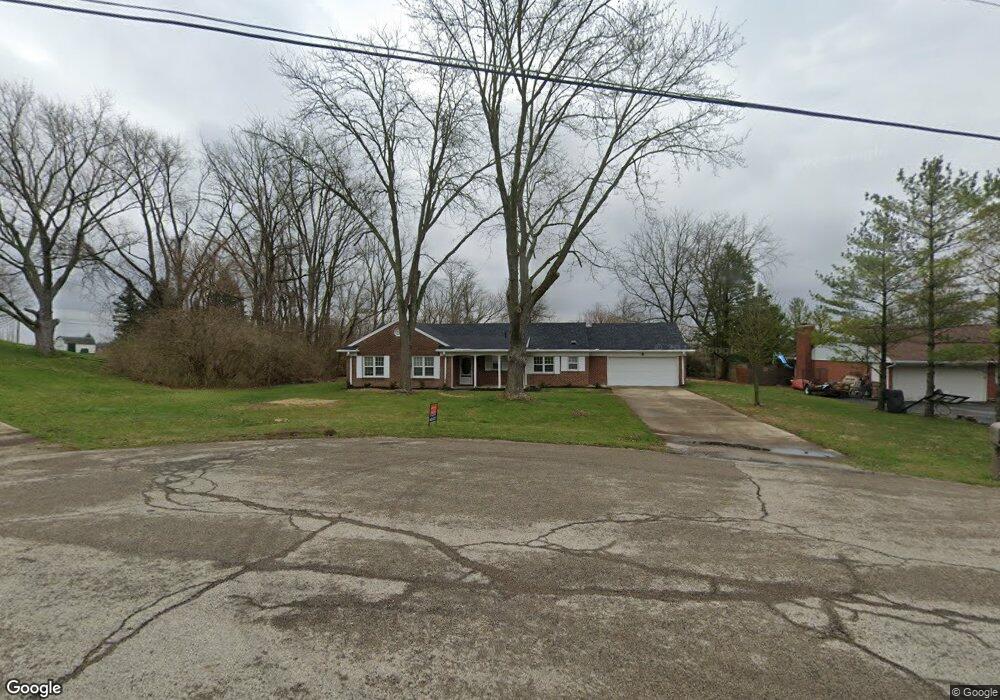
434 Sassafras Dr Springfield, OH 45504
Cedar Hills/Broadview NeighborhoodEstimated Value: $251,000 - $918,170
3
Beds
2
Baths
1,512
Sq Ft
$292/Sq Ft
Est. Value
About This Home
This home is located at 434 Sassafras Dr, Springfield, OH 45504 and is currently estimated at $441,793, approximately $292 per square foot. 434 Sassafras Dr is a home located in Clark County with nearby schools including Possum Elementary School, Shawnee Middle School/High School, and Springfield Christian School.
Ownership History
Date
Name
Owned For
Owner Type
Purchase Details
Closed on
Jan 25, 2021
Sold by
Sheriff Of Clark County Ohio
Current Estimated Value
Purchase Details
Closed on
Jul 5, 2002
Sold by
Estate Of Robert O Moore
Bought by
Whire Anthony C
Create a Home Valuation Report for This Property
The Home Valuation Report is an in-depth analysis detailing your home's value as well as a comparison with similar homes in the area
Home Values in the Area
Average Home Value in this Area
Purchase History
| Date | Buyer | Sale Price | Title Company |
|---|---|---|---|
| -- | -- | None Listed On Document | |
| Whire Anthony C | -- | -- |
Source: Public Records
Tax History
| Year | Tax Paid | Tax Assessment Tax Assessment Total Assessment is a certain percentage of the fair market value that is determined by local assessors to be the total taxable value of land and additions on the property. | Land | Improvement |
|---|---|---|---|---|
| 2025 | $2,932 | $67,330 | $18,760 | $48,570 |
| 2024 | $2,858 | $57,250 | $13,180 | $44,070 |
| 2023 | $2,858 | $57,250 | $13,180 | $44,070 |
| 2022 | $2,784 | $57,250 | $13,180 | $44,070 |
| 2021 | $2,422 | $44,640 | $10,720 | $33,920 |
| 2020 | $2,442 | $44,640 | $10,720 | $33,920 |
| 2019 | $2,481 | $44,640 | $10,720 | $33,920 |
| 2018 | $2,319 | $41,210 | $11,150 | $30,060 |
| 2017 | $2,377 | $37,703 | $11,148 | $26,555 |
| 2016 | $2,145 | $37,703 | $11,148 | $26,555 |
| 2015 | $11,303 | $37,276 | $10,721 | $26,555 |
| 2014 | $1,995 | $37,276 | $10,721 | $26,555 |
| 2013 | $8,587 | $37,276 | $10,721 | $26,555 |
Source: Public Records
Map
Nearby Homes
- 2805 Cottonwood Dr
- 2743 Ironwood Dr
- 190 Oakridge Dr
- 925 Upper Valley Pike
- 917 White Oak Dr
- 624 Aberfelda Dr
- 0 Upper Valley Pike
- 2705 Ash Dr
- 1866 Maiden Ln
- 124 Old Mill Rd
- 106 Walter St
- 110 Walter St
- 1906-1908 W High St
- 1915 W Washington St
- 1715 W North St
- 1828 W Washington St
- 3891 New Carlisle Pike
- 22 Seever St
- 1524 W North St Unit 1526
- 40 Zischler St
- 422 Sassafras Dr
- 444 Sassafras Dr
- 2816 Locust Dr
- 429 Sassafras Dr
- 441 Sassafras Dr
- 411 Sassafras Dr
- 2751 Cottonwood Dr
- 2763 Cottonwood Dr
- 2800 Locust Dr
- 2850 Locust Dr
- 2727 Cottonwood Dr
- 2817 Cottonwood Dr
- 2860 Locust Dr
- 451 Upper Valley Pike
- 2811 Locust Dr
- 2833 Locust Dr
- 2831 Cottonwood Dr
- 551 Upper Valley Pike
- 382 Shrine Rd
- 514 Basswood Dr
Your Personal Tour Guide
Ask me questions while you tour the home.