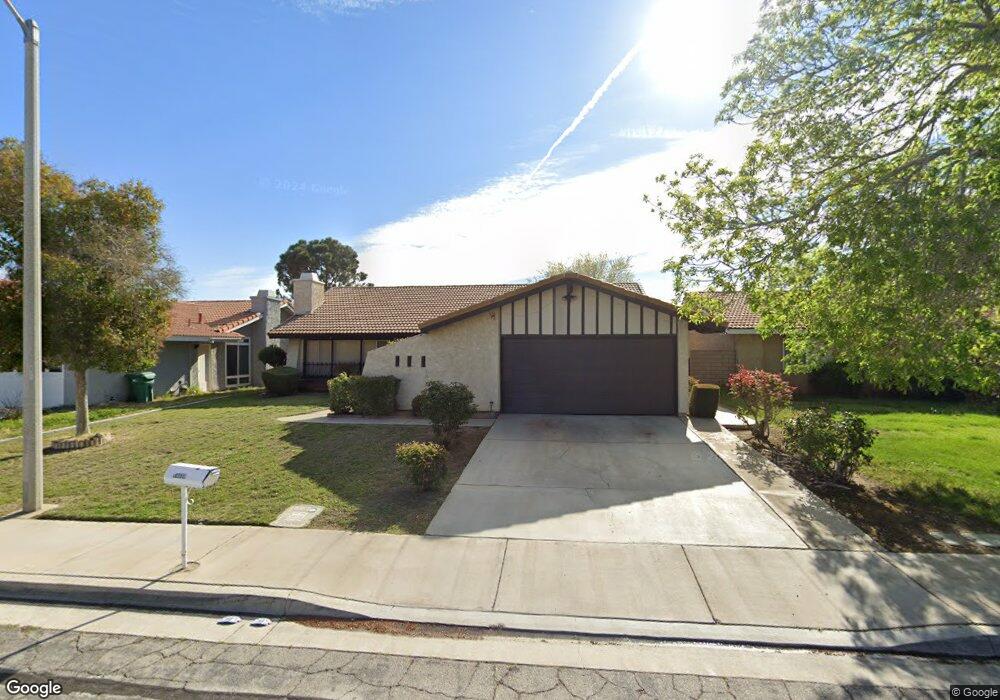
44630 Calston Ave Lancaster, CA 93535
East Lancaster NeighborhoodEstimated Value: $441,000 - $476,000
4
Beds
2
Baths
1,813
Sq Ft
$251/Sq Ft
Est. Value
About This Home
This home is located at 44630 Calston Ave, Lancaster, CA 93535 and is currently estimated at $455,374, approximately $251 per square foot. 44630 Calston Ave is a home located in Los Angeles County with nearby schools including El Dorado Elementary School, Piute Middle School, and Eastside High School.
Ownership History
Date
Name
Owned For
Owner Type
Purchase Details
Closed on
Mar 29, 2004
Sold by
Cerny Vernon T and Cerny Grace
Bought by
Delaguila Oswaldo
Current Estimated Value
Home Financials for this Owner
Home Financials are based on the most recent Mortgage that was taken out on this home.
Original Mortgage
$223,250
Interest Rate
5.77%
Mortgage Type
Purchase Money Mortgage
Create a Home Valuation Report for This Property
The Home Valuation Report is an in-depth analysis detailing your home's value as well as a comparison with similar homes in the area
Home Values in the Area
Average Home Value in this Area
Purchase History
| Date | Buyer | Sale Price | Title Company |
|---|---|---|---|
| Delaguila Oswaldo | $235,000 | Fidelity National Title |
Source: Public Records
Mortgage History
| Date | Status | Borrower | Loan Amount |
|---|---|---|---|
| Previous Owner | Delaguila Oswaldo | $223,250 |
Source: Public Records
Tax History
| Year | Tax Paid | Tax Assessment Tax Assessment Total Assessment is a certain percentage of the fair market value that is determined by local assessors to be the total taxable value of land and additions on the property. | Land | Improvement |
|---|---|---|---|---|
| 2025 | $5,345 | $334,101 | $86,296 | $247,805 |
| 2024 | $5,345 | $327,551 | $84,604 | $242,947 |
| 2023 | $5,231 | $321,130 | $82,946 | $238,184 |
| 2022 | $5,003 | $314,834 | $81,320 | $233,514 |
| 2021 | $4,590 | $308,662 | $79,726 | $228,936 |
| 2020 | $4,374 | $292,000 | $75,500 | $216,500 |
| 2019 | $4,112 | $271,000 | $70,100 | $200,900 |
| 2018 | $3,924 | $256,200 | $66,300 | $189,900 |
| 2016 | $3,027 | $188,000 | $48,700 | $139,300 |
| 2015 | $2,933 | $180,400 | $46,700 | $133,700 |
| 2014 | $2,956 | $180,400 | $46,700 | $133,700 |
Source: Public Records
Map
Nearby Homes
- 44633 Calston Ave
- 44603 13th St E
- 1204 Donatello St
- 1135 E Nugent St
- 44631 Fenhold St
- 44502 Palm Vista Ave
- 44627 11th St E
- 1111 Caperton St
- 44526 15th St E Unit 4
- 44606 Foxboro Ct
- 44662 Foxboro Ct
- 1558 Crestview Ct
- 44460 15th St E Unit 13
- 1607 E Norberry St
- 44827 Rock Island Dr
- 44511 16th St E
- 44353 Downsview Rd
- 44910 12th St E
- 44442 15th St E Unit 5
- 0 15th St E Unit 22010063
- 44624 Calston Ave
- 44636 Calston Ave
- 44631 13th St E
- 44618 Calston Ave
- 44642 Calston Ave
- 44625 13th St E
- 44637 13th St E
- 44619 13th St E
- 44643 13th St E
- 44627 Calston Ave
- 44648 Calston Ave
- 44612 Calston Ave
- 44639 Calston Ave
- 44621 Calston Ave
- 44613 13th St E
- 44649 13th St E
- 44645 Calston Ave
- 44615 Calston Ave
- 44654 Calston Ave
- 44608 Calston Ave
