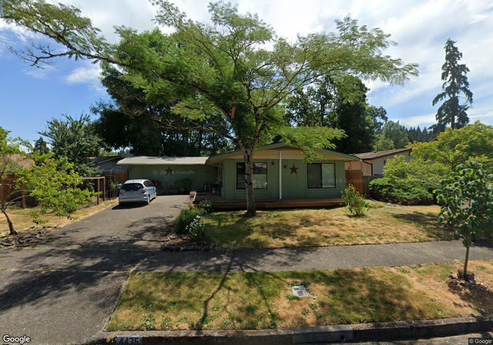
4475 High St Eugene, OR 97405
Southeast Eugene NeighborhoodEstimated Value: $469,859 - $526,000
4
Beds
2
Baths
1,560
Sq Ft
$321/Sq Ft
Est. Value
About This Home
This home is located at 4475 High St, Eugene, OR 97405 and is currently estimated at $501,215, approximately $321 per square foot. 4475 High St is a home located in Lane County with nearby schools including Edgewood Community Elementary School, Spencer Butte Middle School, and South Eugene High School.
Ownership History
Date
Name
Owned For
Owner Type
Purchase Details
Closed on
Jul 10, 2023
Sold by
Ohalloran Mary E
Bought by
Mary E Ohalloran Trust and Ohalloran
Current Estimated Value
Purchase Details
Closed on
Dec 1, 2014
Sold by
Mclaughlin Gwynneth N
Bought by
Ohalloran Mary
Purchase Details
Closed on
Sep 12, 2014
Sold by
Mclaughlin Gwynneth N
Bought by
Mclaughlin Gwynneth N and The Gwynneth N Mclaughlin Revocable Trus
Purchase Details
Closed on
Jul 8, 2005
Sold by
Long Colin
Bought by
Mclaughlin Gwynneth N
Home Financials for this Owner
Home Financials are based on the most recent Mortgage that was taken out on this home.
Original Mortgage
$200,000
Interest Rate
5.55%
Mortgage Type
Fannie Mae Freddie Mac
Create a Home Valuation Report for This Property
The Home Valuation Report is an in-depth analysis detailing your home's value as well as a comparison with similar homes in the area
Home Values in the Area
Average Home Value in this Area
Purchase History
| Date | Buyer | Sale Price | Title Company |
|---|---|---|---|
| Mary E Ohalloran Trust | -- | None Listed On Document | |
| Ohalloran Mary | $252,000 | Fidelity National Title Co | |
| Mclaughlin Gwynneth N | -- | None Available | |
| Mclaughlin Gwynneth N | $255,000 | Western Title & Escrow Compa |
Source: Public Records
Mortgage History
| Date | Status | Borrower | Loan Amount |
|---|---|---|---|
| Previous Owner | Mclaughlin Gwynneth N | $200,000 |
Source: Public Records
Tax History
| Year | Tax Paid | Tax Assessment Tax Assessment Total Assessment is a certain percentage of the fair market value that is determined by local assessors to be the total taxable value of land and additions on the property. | Land | Improvement |
|---|---|---|---|---|
| 2025 | $3,547 | $213,615 | -- | -- |
| 2024 | $3,503 | $207,394 | -- | -- |
| 2023 | $3,503 | $201,354 | $0 | $0 |
| 2022 | $3,282 | $195,490 | $0 | $0 |
| 2021 | $3,082 | $189,797 | $0 | $0 |
| 2020 | $3,093 | $184,269 | $0 | $0 |
| 2019 | $3,505 | $178,902 | $0 | $0 |
| 2018 | $3,300 | $168,633 | $0 | $0 |
| 2017 | $3,152 | $168,633 | $0 | $0 |
| 2016 | $3,074 | $163,721 | $0 | $0 |
| 2015 | $2,985 | $158,952 | $0 | $0 |
| 2014 | $2,911 | $154,322 | $0 | $0 |
Source: Public Records
Map
Nearby Homes
- 17 Westbrook Way
- 21 Westbrook Way
- 36 Westbrook Way
- 4734 Brookwood St
- 4295 Ferry St
- 170 E 40th Ave
- 4083 Donald St Unit A
- 4023 Donald St Unit K
- 4845 Brookwood St
- 278 Rockridge Ct
- 4425 Hilyard St
- 434 E 39th Ave
- 126 Treehill Loop Unit 126
- 143 Treehill Loop Unit 143
- 275 E 39th Ave
- 152 Treehill Loop Unit 152
- 151 Treehill Loop Unit 151
- 0 E 39th Ave
- 4364 Fox Hollow Rd
- 4320 Fox Hollow Rd
Your Personal Tour Guide
Ask me questions while you tour the home.