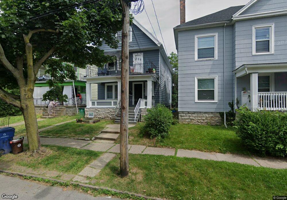
453 Herkimer St Buffalo, NY 14213
Upper West Side NeighborhoodEstimated Value: $210,000 - $278,000
6
Beds
2
Baths
2,200
Sq Ft
$111/Sq Ft
Est. Value
About This Home
This home is located at 453 Herkimer St, Buffalo, NY 14213 and is currently estimated at $244,333, approximately $111 per square foot. 453 Herkimer St is a home located in Erie County with nearby schools including West Buffalo Charter School, Buffalo Creek Academy Charter School, and Buffalo Seminary.
Ownership History
Date
Name
Owned For
Owner Type
Purchase Details
Closed on
Jan 20, 2022
Sold by
Maywalt Michael and Bargnesi James
Bought by
Jm Crescent Llc
Current Estimated Value
Home Financials for this Owner
Home Financials are based on the most recent Mortgage that was taken out on this home.
Original Mortgage
$329,573
Outstanding Balance
$302,684
Interest Rate
3.45%
Mortgage Type
Commercial
Estimated Equity
-$58,351
Purchase Details
Closed on
Jan 19, 2022
Sold by
Jm Crescent Llc
Bought by
M & T Bank
Home Financials for this Owner
Home Financials are based on the most recent Mortgage that was taken out on this home.
Original Mortgage
$329,573
Outstanding Balance
$302,684
Interest Rate
3.45%
Mortgage Type
Commercial
Estimated Equity
-$58,351
Purchase Details
Closed on
Sep 28, 2016
Sold by
Kc Erie Niagara Properties Llc
Bought by
Maywalt Michael and Bargnesi James
Purchase Details
Closed on
May 16, 2008
Sold by
Blum Brandon
Bought by
Norris Robert
Home Financials for this Owner
Home Financials are based on the most recent Mortgage that was taken out on this home.
Original Mortgage
$18,000
Interest Rate
6.47%
Mortgage Type
Seller Take Back
Purchase Details
Closed on
Jul 20, 2006
Sold by
Campanella Mary
Bought by
Blum Brandon
Create a Home Valuation Report for This Property
The Home Valuation Report is an in-depth analysis detailing your home's value as well as a comparison with similar homes in the area
Home Values in the Area
Average Home Value in this Area
Purchase History
| Date | Buyer | Sale Price | Title Company |
|---|---|---|---|
| Jm Crescent Llc | -- | Chicago Title Insurance Co | |
| M & T Bank | -- | None Available | |
| Maywalt Michael | $51,000 | None Available | |
| Norris Robert | $25,000 | Ticor Title Insurance Co | |
| Blum Brandon | $13,500 | None Available |
Source: Public Records
Mortgage History
| Date | Status | Borrower | Loan Amount |
|---|---|---|---|
| Open | M & T Bank | $329,573 | |
| Previous Owner | Norris Robert | $18,000 |
Source: Public Records
Tax History
| Year | Tax Paid | Tax Assessment Tax Assessment Total Assessment is a certain percentage of the fair market value that is determined by local assessors to be the total taxable value of land and additions on the property. | Land | Improvement |
|---|---|---|---|---|
| 2024 | $605 | $108,000 | $5,300 | $102,700 |
| 2023 | $547 | $108,000 | $5,300 | $102,700 |
| 2022 | $543 | $108,000 | $5,300 | $102,700 |
| 2021 | $543 | $108,000 | $5,300 | $102,700 |
| 2020 | $277 | $108,000 | $5,300 | $102,700 |
| 2019 | $988 | $36,000 | $3,800 | $32,200 |
| 2018 | $929 | $36,000 | $3,800 | $32,200 |
| 2017 | $214 | $36,000 | $3,800 | $32,200 |
| 2016 | $876 | $36,000 | $3,800 | $32,200 |
| 2015 | -- | $36,000 | $3,800 | $32,200 |
| 2014 | -- | $36,000 | $3,800 | $32,200 |
Source: Public Records
Map
Nearby Homes
- 48 Garner Ave
- 192 Bird Ave
- 148 Potomac Ave
- 230 Bird Ave
- 28 Pooley Place
- 169 Potomac Ave
- 192 Congress St
- 1332 West Ave
- 350 Herkimer St
- 1258 West Ave
- 303 Potomac Ave
- 90 Greenwood Place
- 52 Dart St
- 315 Herkimer St
- 357 Parkdale Ave
- 443 Parkdale Ave
- 295 Hoyt St
- 371 Potomac Ave
- 238 Barton St
- 43 Congress St
Your Personal Tour Guide
Ask me questions while you tour the home.