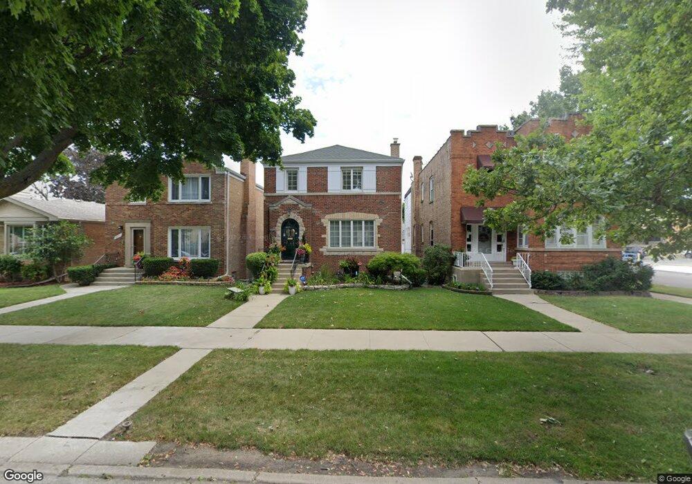
4905 N Monitor Ave Chicago, IL 60630
Jefferson Park NeighborhoodEstimated Value: $528,000 - $598,000
4
Beds
2
Baths
1,962
Sq Ft
$281/Sq Ft
Est. Value
About This Home
This home is located at 4905 N Monitor Ave, Chicago, IL 60630 and is currently estimated at $551,654, approximately $281 per square foot. 4905 N Monitor Ave is a home located in Cook County with nearby schools including Prussing Elementary School, Taft High School, and St. Constance School.
Ownership History
Date
Name
Owned For
Owner Type
Purchase Details
Closed on
May 23, 2020
Sold by
Kolomay Cheryl H
Bought by
Kolomay Cheryl H and The Cheryl H Kolomay Living Tr
Current Estimated Value
Purchase Details
Closed on
Sep 3, 2013
Sold by
Morrissey Dennis J
Bought by
Morrissey Dennis J and Kolomay Cheryl H
Purchase Details
Closed on
Jun 3, 2010
Sold by
Associated Trust Company
Bought by
Associated Trust Company and The Eileen M Morrissey Trust
Purchase Details
Closed on
Sep 13, 2005
Sold by
Morrissey Mary T
Bought by
Morrissey Mary T and Robert E Morrissey Siblings Trust
Purchase Details
Closed on
Aug 7, 1998
Sold by
Morrissey Robert E and Morrissey Elleen M
Bought by
Morrissey Robert E and Morrissey Eileen M
Create a Home Valuation Report for This Property
The Home Valuation Report is an in-depth analysis detailing your home's value as well as a comparison with similar homes in the area
Home Values in the Area
Average Home Value in this Area
Purchase History
| Date | Buyer | Sale Price | Title Company |
|---|---|---|---|
| Kolomay Cheryl H | -- | Attorney | |
| Morrissey Dennis J | -- | None Available | |
| Associated Trust Company | $150,000 | Ticor | |
| Morrissey Mary T | -- | -- | |
| Morrissey Robert E | -- | -- |
Source: Public Records
Tax History Compared to Growth
Tax History
| Year | Tax Paid | Tax Assessment Tax Assessment Total Assessment is a certain percentage of the fair market value that is determined by local assessors to be the total taxable value of land and additions on the property. | Land | Improvement |
|---|---|---|---|---|
| 2024 | $8,444 | $48,000 | $11,532 | $36,468 |
| 2023 | $8,232 | $40,000 | $9,300 | $30,700 |
| 2022 | $8,232 | $40,000 | $9,300 | $30,700 |
| 2021 | $8,048 | $40,000 | $9,300 | $30,700 |
| 2020 | $7,009 | $31,447 | $5,394 | $26,053 |
| 2019 | $7,024 | $34,942 | $5,394 | $29,548 |
| 2018 | $6,906 | $34,942 | $5,394 | $29,548 |
| 2017 | $6,570 | $30,503 | $4,836 | $25,667 |
| 2016 | $6,113 | $30,503 | $4,836 | $25,667 |
| 2015 | $5,593 | $30,503 | $4,836 | $25,667 |
| 2014 | $5,404 | $29,102 | $4,464 | $24,638 |
| 2013 | $5,297 | $29,102 | $4,464 | $24,638 |
Source: Public Records
Map
Nearby Homes
- 5754 W Lawrence Ave Unit 1A
- 5915 W Gunnison St Unit 2F
- 5646 W Grover St
- 5107 N Mango Ave
- 5921 W Lawrence Ave
- 4886 N Austin Ave
- 5741 W Lawrence Ave Unit 2
- 5641 W Carmen Ave
- 5132 N Mango Ave
- 5119 N Mason Ave
- 5148 N Monitor Ave Unit 301
- 5901 W Foster Ave
- 4915 N Central Ave Unit 16-3E
- 5710 W Leland Ave
- 6046 W Giddings St
- 4702 N Austin Ave Unit 302
- 5942 W Eastwood Ave
- 6140 W Gunnison St Unit 3
- 5254 N Mason Ave
- 5940 W Wilson Ave
- 4907 N Monitor Ave
- 4901 N Monitor Ave
- 4911 N Monitor Ave
- 4913 N Monitor Ave
- 4917 N Monitor Ave
- 4932 N Menard Ave
- 4928 N Menard Ave
- 4934 N Menard Ave
- 4919 N Monitor Ave
- 4938 N Menard Ave
- 4940 N Menard Ave
- 4900 N Monitor Ave
- 4921 N Monitor Ave
- 4921 N Monitor Ave Unit 1
- 4944 N Menard Ave
- 4906 N Monitor Ave
- 4910 N Monitor Ave
- 4910 N Monitor Ave
- 4910 N Monitor Ave Unit 1
- 4925 N Monitor Ave