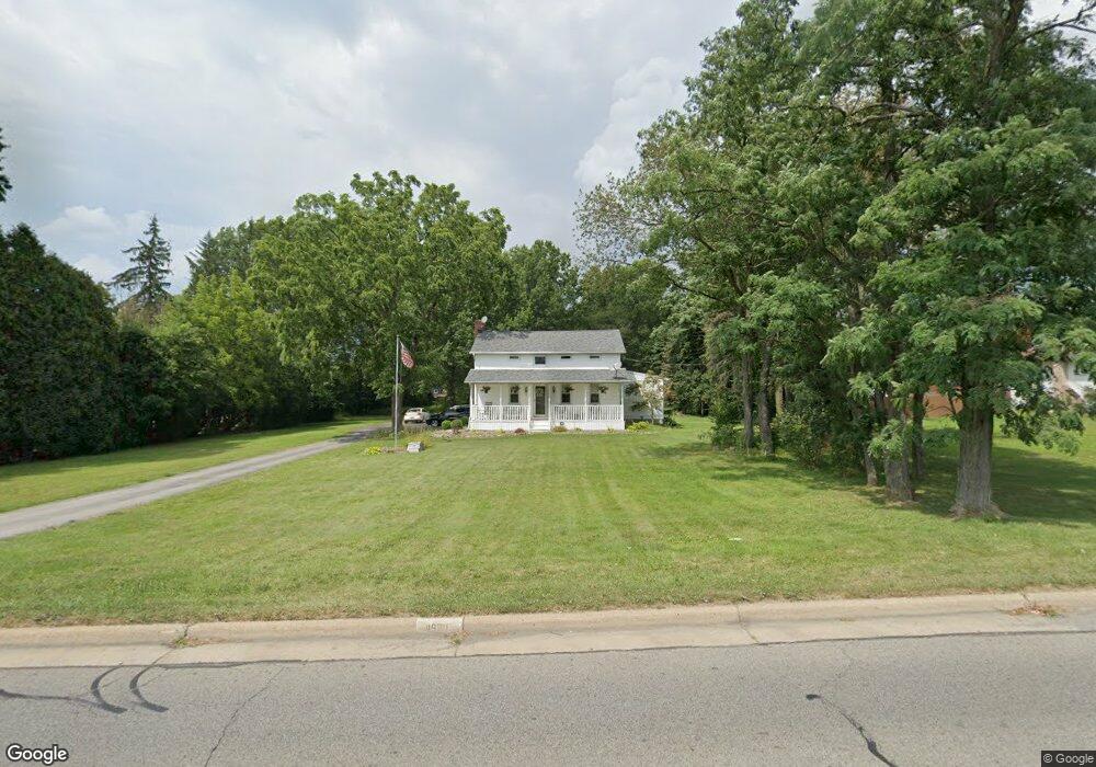
4920 Kirk Rd Youngstown, OH 44515
Austintown NeighborhoodEstimated Value: $177,000 - $240,000
3
Beds
2
Baths
1,592
Sq Ft
$135/Sq Ft
Est. Value
About This Home
This home is located at 4920 Kirk Rd, Youngstown, OH 44515 and is currently estimated at $215,055, approximately $135 per square foot. 4920 Kirk Rd is a home located in Mahoning County with nearby schools including Austintown Elementary School, Austintown Intermediate School, and Austintown Middle School.
Ownership History
Date
Name
Owned For
Owner Type
Purchase Details
Closed on
Nov 1, 2002
Sold by
Colangelo Benjamin F
Bought by
Colangelo Benjamin F and Colangelo Christina
Current Estimated Value
Home Financials for this Owner
Home Financials are based on the most recent Mortgage that was taken out on this home.
Original Mortgage
$102,000
Interest Rate
5.51%
Purchase Details
Closed on
May 5, 1993
Bought by
Colangelo Benjamin F
Create a Home Valuation Report for This Property
The Home Valuation Report is an in-depth analysis detailing your home's value as well as a comparison with similar homes in the area
Home Values in the Area
Average Home Value in this Area
Purchase History
| Date | Buyer | Sale Price | Title Company |
|---|---|---|---|
| Colangelo Benjamin F | -- | Tower City Title Agency Inc | |
| Colangelo Benjamin F | $50,000 | -- |
Source: Public Records
Mortgage History
| Date | Status | Borrower | Loan Amount |
|---|---|---|---|
| Closed | Colangelo Benjamin F | $102,000 | |
| Closed | Colangelo Benjamin F | $25,500 |
Source: Public Records
Tax History Compared to Growth
Tax History
| Year | Tax Paid | Tax Assessment Tax Assessment Total Assessment is a certain percentage of the fair market value that is determined by local assessors to be the total taxable value of land and additions on the property. | Land | Improvement |
|---|---|---|---|---|
| 2024 | $2,901 | $63,370 | $13,040 | $50,330 |
| 2023 | $2,855 | $63,370 | $13,040 | $50,330 |
| 2022 | $2,129 | $37,870 | $11,890 | $25,980 |
| 2021 | $2,130 | $37,870 | $11,890 | $25,980 |
| 2020 | $2,139 | $37,870 | $11,890 | $25,980 |
| 2019 | $2,115 | $34,120 | $10,710 | $23,410 |
| 2018 | $2,137 | $34,120 | $10,710 | $23,410 |
| 2017 | $2,032 | $34,120 | $10,710 | $23,410 |
| 2016 | $2,025 | $33,670 | $10,710 | $22,960 |
| 2015 | $1,964 | $33,670 | $10,710 | $22,960 |
| 2014 | $1,973 | $33,670 | $10,710 | $22,960 |
| 2013 | $1,951 | $33,670 | $10,710 | $22,960 |
Source: Public Records
Map
Nearby Homes
- 3475 42nd St
- 3481 Forty Second St
- 5285 Kirk Rd
- 2388 Innwood Dr
- 4674 Barrington Dr
- 3270 S Canfield Niles Rd
- 3695 High Meadow Dr
- 4651 Warwick Dr S
- 2211 Penny Ln
- 4643 Warwick Dr S
- 2493 Frostwood Dr
- 2792 S Canfield Niles Rd
- 2414 Ardenwood Place
- 4689 Crabwood Dr
- 4650 Bunny Trail
- 4114 S Raccoon Rd
- 3798 S Raccoon Rd
- 40 Woodleigh Ct
- 4815 New Rd
- 4488 S Raccoon Rd
- 4900 Kirk Rd
- 3301 Starwick Dr
- 5008 Kirk Rd
- 2 Starwick Dr
- 4 Starwick Dr
- 3 Starwick Dr
- 1 Starwick Dr
- 3307 Starwick Dr
- 0 Starwick Dr Unit 3221164
- 0 Starwick Dr Unit 3221160
- 0 Starwick Dr Unit 3221143
- 0 Starwick Dr Unit 3221128
- 4915 Kirk Rd
- 3032 Spring Meadow Cir
- 3040 Spring Meadow Cir
- 2925 Penny Ln
- 3313 Starwick Dr
- 3300 Starwick Dr
- 3024 Spring Meadow Cir
- 3008 Spring Meadow Cir