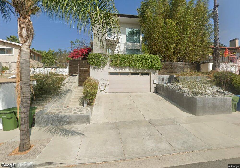
4929 Range View Ave Los Angeles, CA 90042
Eagle Rock NeighborhoodEstimated Value: $1,314,000 - $1,948,797
3
Beds
4
Baths
2,836
Sq Ft
$573/Sq Ft
Est. Value
About This Home
This home is located at 4929 Range View Ave, Los Angeles, CA 90042 and is currently estimated at $1,625,199, approximately $573 per square foot. 4929 Range View Ave is a home located in Los Angeles County with nearby schools including Buchanan Street Elementary and Franklin Middle School & High School.
Ownership History
Date
Name
Owned For
Owner Type
Purchase Details
Closed on
Feb 23, 2026
Sold by
Bae Kim
Bought by
Kim Choung
Current Estimated Value
Purchase Details
Closed on
Jul 3, 2008
Sold by
Raynes Mark
Bought by
Kim Seong Bae and Kim Choung Shil
Purchase Details
Closed on
Jun 6, 2006
Sold by
Davis Karen A
Bought by
Raynes Mark
Home Financials for this Owner
Home Financials are based on the most recent Mortgage that was taken out on this home.
Original Mortgage
$200,000
Interest Rate
6.56%
Mortgage Type
Purchase Money Mortgage
Purchase Details
Closed on
Oct 26, 2004
Sold by
Raynes Mark
Bought by
Davis Karen A
Home Financials for this Owner
Home Financials are based on the most recent Mortgage that was taken out on this home.
Original Mortgage
$65,000
Interest Rate
5.65%
Mortgage Type
Purchase Money Mortgage
Purchase Details
Closed on
Sep 27, 2001
Sold by
Hamasaki Paul Y and Hamasaki Mutsuko
Bought by
Raynes Mark
Home Financials for this Owner
Home Financials are based on the most recent Mortgage that was taken out on this home.
Original Mortgage
$30,000
Interest Rate
6.91%
Mortgage Type
Seller Take Back
Create a Home Valuation Report for This Property
The Home Valuation Report is an in-depth analysis detailing your home's value as well as a comparison with similar homes in the area
Home Values in the Area
Average Home Value in this Area
Purchase History
| Date | Buyer | Sale Price | Title Company |
|---|---|---|---|
| Kim Choung | -- | None Listed On Document | |
| Kim Seong Bae | $125,000 | Southland Title Company | |
| Raynes Mark | -- | Old Republic Title Company | |
| Davis Karen A | $65,000 | Fatcola | |
| Raynes Mark | $30,000 | Stewart Title |
Source: Public Records
Mortgage History
| Date | Status | Borrower | Loan Amount |
|---|---|---|---|
| Previous Owner | Raynes Mark | $200,000 | |
| Previous Owner | Davis Karen A | $65,000 | |
| Previous Owner | Raynes Mark | $30,000 |
Source: Public Records
Tax History
| Year | Tax Paid | Tax Assessment Tax Assessment Total Assessment is a certain percentage of the fair market value that is determined by local assessors to be the total taxable value of land and additions on the property. | Land | Improvement |
|---|---|---|---|---|
| 2025 | $9,923 | $810,367 | $160,962 | $649,405 |
| 2024 | $9,923 | $794,478 | $157,806 | $636,672 |
| 2023 | $9,734 | $778,901 | $154,712 | $624,189 |
| 2022 | $9,285 | $763,629 | $151,679 | $611,950 |
| 2021 | $9,161 | $748,656 | $148,705 | $599,951 |
| 2019 | $8,889 | $726,453 | $144,296 | $582,157 |
| 2018 | $8,800 | $712,210 | $141,467 | $570,743 |
| 2016 | $8,395 | $684,556 | $135,975 | $548,581 |
| 2015 | $8,273 | $674,274 | $133,933 | $540,341 |
| 2014 | $8,305 | $661,067 | $131,310 | $529,757 |
Source: Public Records
Map
Nearby Homes
- 5007 Almaden Dr
- 4920 Stratford Rd
- 4816 Stratford Rd
- 5132 Range View Ave
- 5001 Buchanan St
- 1411 Armadale Ave
- 5240 Barker Dr
- 1932 Phillips Way
- 5144 Buchanan St
- 1942 Phillips Way
- 1048 Dexter St
- 1938 Phillips Way
- 4666 York Blvd
- 1621 Campus Rd
- 4650 York Blvd
- 5055 Hub St
- 1817 N Avenue 55
- 5118 Hub St
- 5330 Lincoln Ave
- 917 N Avenue 51
- 4933 Range View Ave
- 4917 Range View Ave
- 4919 Range View Ave
- 4939 Range View Ave
- 4956 Coringa Dr
- 4943 Range View Ave
- 4913 Range View Ave
- 4952 Coringa Dr
- 4949 Range View Ave
- 4948 Coringa Dr
- 4930 Range View Ave
- 4926 Range View Ave
- 4922 Range View Ave
- 4934 Range View Ave
- 4918 Range View Ave
- 4938 Range View Ave
- 4914 Range View Ave
- 4914 4914 1/2 Range View Ave
- 4942 Range View Ave
- 4910 Range View Ave
Your Personal Tour Guide
Ask me questions while you tour the home.