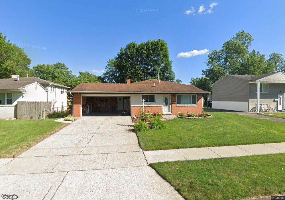
4933 Comstock Dr Columbus, OH 43232
Walnut Heights NeighborhoodEstimated Value: $178,485 - $252,000
3
Beds
2
Baths
960
Sq Ft
$223/Sq Ft
Est. Value
About This Home
This home is located at 4933 Comstock Dr, Columbus, OH 43232 and is currently estimated at $214,121, approximately $223 per square foot. 4933 Comstock Dr is a home located in Franklin County with nearby schools including Liberty Elementary School, Yorktown Middle School, and Independence High School.
Ownership History
Date
Name
Owned For
Owner Type
Purchase Details
Closed on
Jun 19, 1996
Sold by
Brown Elaine K
Bought by
Holly Joseph N and Holly Cheri E
Current Estimated Value
Home Financials for this Owner
Home Financials are based on the most recent Mortgage that was taken out on this home.
Original Mortgage
$83,640
Outstanding Balance
$3,089
Interest Rate
8.29%
Mortgage Type
VA
Estimated Equity
$211,032
Purchase Details
Closed on
Apr 30, 1990
Purchase Details
Closed on
Jan 1, 1984
Create a Home Valuation Report for This Property
The Home Valuation Report is an in-depth analysis detailing your home's value as well as a comparison with similar homes in the area
Home Values in the Area
Average Home Value in this Area
Purchase History
| Date | Buyer | Sale Price | Title Company |
|---|---|---|---|
| Holly Joseph N | $82,000 | -- | |
| -- | $67,500 | -- | |
| -- | -- | -- |
Source: Public Records
Mortgage History
| Date | Status | Borrower | Loan Amount |
|---|---|---|---|
| Open | Holly Joseph N | $83,640 |
Source: Public Records
Tax History
| Year | Tax Paid | Tax Assessment Tax Assessment Total Assessment is a certain percentage of the fair market value that is determined by local assessors to be the total taxable value of land and additions on the property. | Land | Improvement |
|---|---|---|---|---|
| 2025 | $2,423 | $63,780 | $17,820 | $45,960 |
| 2024 | $2,423 | $63,780 | $17,820 | $45,960 |
| 2023 | $2,826 | $63,770 | $17,815 | $45,955 |
| 2022 | $1,868 | $36,020 | $6,300 | $29,720 |
| 2021 | $1,871 | $36,020 | $6,300 | $29,720 |
| 2020 | $1,874 | $36,020 | $6,300 | $29,720 |
| 2019 | $1,837 | $30,280 | $5,250 | $25,030 |
| 2018 | $1,715 | $30,280 | $5,250 | $25,030 |
| 2017 | $1,836 | $30,280 | $5,250 | $25,030 |
| 2016 | $1,760 | $26,570 | $4,340 | $22,230 |
| 2015 | $1,598 | $26,570 | $4,340 | $22,230 |
| 2014 | $1,074 | $26,570 | $4,340 | $22,230 |
| 2013 | $617 | $29,505 | $4,830 | $24,675 |
Source: Public Records
Map
Nearby Homes
- 0 Noe Bixby Rd
- 5114 Carbondale Dr
- 5123 Jameson Dr
- 2336 Noe Bixby Rd
- 2348 Noe Bixby Rd
- 2342 Noe Bixby Rd
- 2360 Noe Bixby Rd
- 2354 Noe Bixby Rd
- 5144 Botsford Dr
- 2608 Hubbell Rd
- 0 Colvin Rd
- 5137 Holbrook Dr
- 2651 Brownfield Rd
- 4942 Talbert Dr
- 5278 Glenbriar Ct
- 2932 Renfro Rd
- 1945 Riverdale Rd
- 2706 Moundcrest St
- 5207 Kornwal Dr
- 5290 Quincy Dr
- 4941 Comstock Dr
- 4925 Comstock Dr
- 4949 Comstock Dr
- 4946 Keelson Dr
- 4919 Comstock Dr
- 4954 Keelson Dr
- 4940 Keelson Dr
- 4964 Keelson Dr
- 4928 Comstock Dr
- 4936 Comstock Dr
- 4920 Keelson Dr
- 4955 Comstock Dr
- 4930 Keelson Dr
- 4926 Keelson Dr
- 2436 Botsford Place
- 4944 Comstock Dr
- 4915 Comstock Dr
- 4932 Keelson Dr
- 4970 Keelson Dr
- 4938 Keelson Dr
Your Personal Tour Guide
Ask me questions while you tour the home.