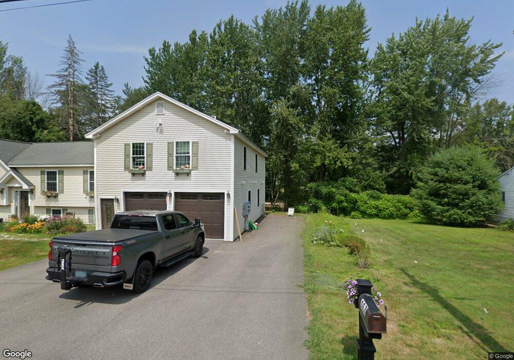
51 River St Conway, NH 03818
Estimated Value: $440,716 - $557,000
4
Beds
1
Bath
1,993
Sq Ft
$242/Sq Ft
Est. Value
About This Home
This home is located at 51 River St, Conway, NH 03818 and is currently estimated at $482,179, approximately $241 per square foot. 51 River St is a home with nearby schools including A. Crosby Kennett Middle School, Kennett High School, and Robert Frost Charter School.
Ownership History
Date
Name
Owned For
Owner Type
Purchase Details
Closed on
Nov 6, 2018
Sold by
Eastern Slop Inn Assoc
Bought by
River Run Co Inc
Current Estimated Value
Purchase Details
Closed on
Mar 13, 2018
Sold by
River Run Co Inc
Bought by
Eastern Slope Inn
Purchase Details
Closed on
Mar 8, 2001
Sold by
Schrader Faith B
Bought by
River Run Co Inc
Home Financials for this Owner
Home Financials are based on the most recent Mortgage that was taken out on this home.
Original Mortgage
$153,125
Interest Rate
7.15%
Create a Home Valuation Report for This Property
The Home Valuation Report is an in-depth analysis detailing your home's value as well as a comparison with similar homes in the area
Home Values in the Area
Average Home Value in this Area
Purchase History
| Date | Buyer | Sale Price | Title Company |
|---|---|---|---|
| River Run Co Inc | -- | -- | |
| Eastern Slope Inn | $168,000 | -- | |
| River Run Co Inc | $175,000 | -- |
Source: Public Records
Mortgage History
| Date | Status | Borrower | Loan Amount |
|---|---|---|---|
| Previous Owner | River Run Co Inc | $153,125 |
Source: Public Records
Tax History Compared to Growth
Tax History
| Year | Tax Paid | Tax Assessment Tax Assessment Total Assessment is a certain percentage of the fair market value that is determined by local assessors to be the total taxable value of land and additions on the property. | Land | Improvement |
|---|---|---|---|---|
| 2024 | $5,283 | $419,300 | $198,000 | $221,300 |
| 2023 | $4,805 | $419,300 | $198,000 | $221,300 |
| 2022 | $3,734 | $194,700 | $88,300 | $106,400 |
| 2021 | $3,181 | $194,700 | $88,300 | $106,400 |
| 2020 | $3,635 | $194,700 | $88,300 | $106,400 |
| 2019 | $3,372 | $194,700 | $88,300 | $106,400 |
| 2018 | $3,063 | $138,400 | $53,300 | $85,100 |
| 2017 | $2,765 | $138,400 | $53,300 | $85,100 |
| 2016 | $2,673 | $138,400 | $53,300 | $85,100 |
| 2015 | $2,642 | $138,400 | $53,300 | $85,100 |
| 2014 | -- | $138,400 | $53,300 | $85,100 |
| 2013 | $2,472 | $138,400 | $53,300 | $85,100 |
Source: Public Records
Map
Nearby Homes
- 196 E Main St Unit 5 (old 103)
- 9 E Side Rd
- 0 W Side Rd Unit 54 5049810
- 20 Washington St
- 58 Wilder St
- 6 Main St
- 237 Eaton Rd
- 45 Haynesville Ave Unit 3
- 66 Woodland Grove
- 18 Woodland Grove Rd
- 204 Limac Cir
- 27 Firelite Rd
- 357 Lamplighters Park
- 115 Swift Valley Rd
- 15 Trailer Ave
- 66 Lamplighter's Dr
- 74 Lamplighter's Dr
- 26 Campfire St
- 33 Longbow Dr
- 357 Lamplighters Dr