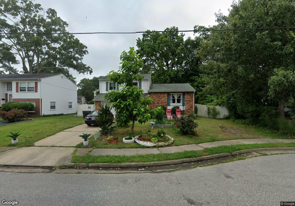
512 Brockridge Hunt Dr Hampton, VA 23666
Northampton NeighborhoodEstimated Value: $312,000 - $342,000
4
Beds
2
Baths
2,052
Sq Ft
$162/Sq Ft
Est. Value
About This Home
This home is located at 512 Brockridge Hunt Dr, Hampton, VA 23666 and is currently estimated at $331,880, approximately $161 per square foot. 512 Brockridge Hunt Dr is a home located in Hampton City with nearby schools including Christopher C. Kraft Elementary School, Cesar Tarrant Middle School, and Bethel High School.
Ownership History
Date
Name
Owned For
Owner Type
Purchase Details
Closed on
Mar 27, 2019
Sold by
Salib Kastour S
Bought by
Chin Vivienne Cowles and Manning Kerisha Dena
Current Estimated Value
Home Financials for this Owner
Home Financials are based on the most recent Mortgage that was taken out on this home.
Original Mortgage
$215,916
Outstanding Balance
$191,037
Interest Rate
4.62%
Mortgage Type
FHA
Estimated Equity
$140,843
Purchase Details
Closed on
Dec 19, 2013
Sold by
Federal Home Loan Mortgage Corporation
Bought by
Abdelmalak Kastour S
Home Financials for this Owner
Home Financials are based on the most recent Mortgage that was taken out on this home.
Original Mortgage
$134,900
Interest Rate
4.29%
Mortgage Type
New Conventional
Purchase Details
Closed on
Apr 24, 2013
Sold by
Samuel I White Pc Sub
Bought by
Federal Home Loan Mortgage Corporation
Create a Home Valuation Report for This Property
The Home Valuation Report is an in-depth analysis detailing your home's value as well as a comparison with similar homes in the area
Home Values in the Area
Average Home Value in this Area
Purchase History
| Date | Buyer | Sale Price | Title Company |
|---|---|---|---|
| Chin Vivienne Cowles | $219,900 | Stewart Title & Settlements | |
| Abdelmalak Kastour S | $149,900 | -- | |
| Federal Home Loan Mortgage Corporation | $153,000 | -- |
Source: Public Records
Mortgage History
| Date | Status | Borrower | Loan Amount |
|---|---|---|---|
| Open | Chin Vivienne Cowles | $215,916 | |
| Previous Owner | Abdelmalak Kastour S | $134,900 |
Source: Public Records
Tax History Compared to Growth
Tax History
| Year | Tax Paid | Tax Assessment Tax Assessment Total Assessment is a certain percentage of the fair market value that is determined by local assessors to be the total taxable value of land and additions on the property. | Land | Improvement |
|---|---|---|---|---|
| 2025 | $3,665 | $325,800 | $65,000 | $260,800 |
| 2024 | $3,665 | $318,700 | $65,000 | $253,700 |
| 2023 | $3,365 | $290,100 | $65,000 | $225,100 |
| 2022 | $3,044 | $258,000 | $60,000 | $198,000 |
| 2021 | $2,885 | $222,200 | $53,800 | $168,400 |
| 2020 | $2,642 | $213,100 | $53,800 | $159,300 |
| 2019 | $2,666 | $215,000 | $53,800 | $161,200 |
| 2018 | $2,363 | $183,000 | $53,800 | $129,200 |
| 2017 | $2,363 | $0 | $0 | $0 |
| 2016 | $2,363 | $183,000 | $0 | $0 |
| 2015 | $2,363 | $0 | $0 | $0 |
| 2014 | $2,473 | $183,000 | $53,800 | $129,200 |
Source: Public Records
Map
Nearby Homes
- 506 Concord Dr
- 2 Edith Key St
- 303 Dover Rd
- 307 Dover Rd
- 13 Beatrice Dr
- 32 Gunter Ct
- 11 Madrone Place
- 426 Berkshire Terrace
- 31 Gunter Ct
- 15 Steeplechase Loop
- 10 Steeplechase Loop
- 113 Lynnhaven Dr
- 103 Londonshire Terrace
- 405 Terry Ct
- 102 Lynnhaven Dr
- 109 Cape Dorey Dr
- 119 Cape Dorey Dr Unit 3A
- 806 Burton St
- 814 Sheffield St
- 344 Wells Ct Unit 2
- 514 Brockridge Hunt Dr
- 510 Brockridge Hunt Dr
- 516 Eubank Dr
- 216 Lowden Hunt Dr
- 508 Brockridge Hunt Dr
- 218 Lowden Hunt Dr
- 513 Brockridge Hunt Dr
- 508 Eubank Dr
- 506 Brockridge Hunt Dr
- 212 Lowden Hunt Dr
- 509 Dafia Dr
- 511 Eubank Dr
- 511 Dafia Dr
- 507 Dafia Dr
- 505 Brockridge Hunt Dr
- 215 Lowden Hunt Dr
- 506 Eubank Dr
- 509 Eubank Dr
- 210 Lowden Hunt Dr
- 217 Lowden Hunt Dr