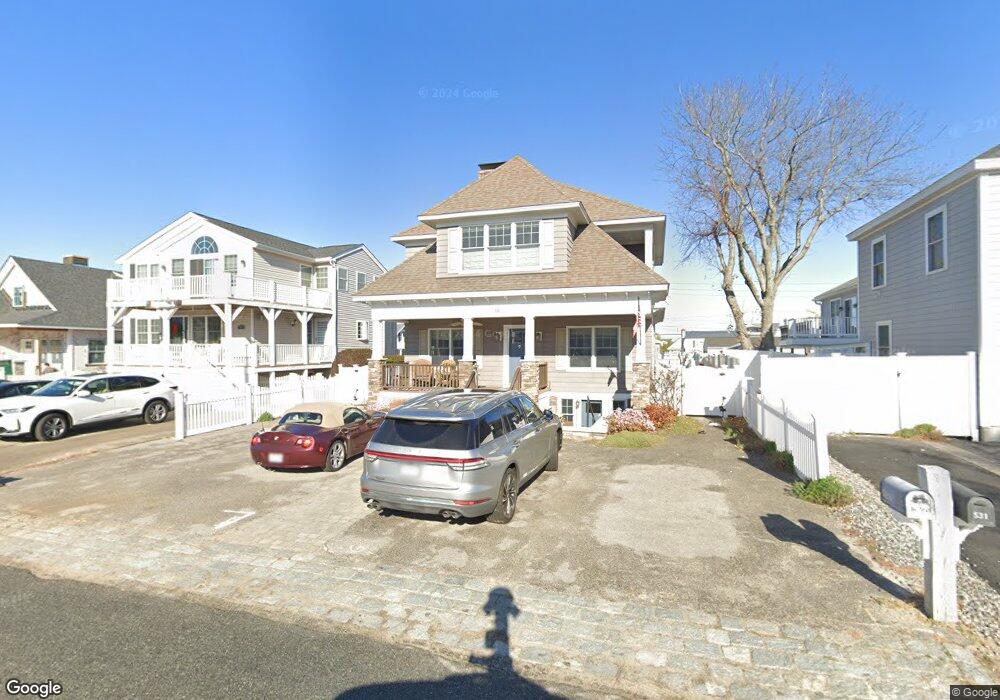
526 Manchester St Seabrook, NH 03874
Seabrook Beach NeighborhoodEstimated Value: $1,293,000 - $1,619,000
3
Beds
3
Baths
2,246
Sq Ft
$644/Sq Ft
Est. Value
About This Home
This home is located at 526 Manchester St, Seabrook, NH 03874 and is currently estimated at $1,446,739, approximately $644 per square foot. 526 Manchester St is a home located in Rockingham County with nearby schools including Seabrook Elementary School, Seabrook Middle School, and Winnacunnet High School.
Ownership History
Date
Name
Owned For
Owner Type
Purchase Details
Closed on
May 3, 1999
Sold by
Somma Anthony and Somma Nancy A
Bought by
Keaney Stephen
Current Estimated Value
Home Financials for this Owner
Home Financials are based on the most recent Mortgage that was taken out on this home.
Original Mortgage
$183,000
Interest Rate
6.95%
Mortgage Type
Purchase Money Mortgage
Create a Home Valuation Report for This Property
The Home Valuation Report is an in-depth analysis detailing your home's value as well as a comparison with similar homes in the area
Home Values in the Area
Average Home Value in this Area
Purchase History
| Date | Buyer | Sale Price | Title Company |
|---|---|---|---|
| Keaney Stephen | $197,000 | -- |
Source: Public Records
Mortgage History
| Date | Status | Borrower | Loan Amount |
|---|---|---|---|
| Open | Keaney Stephen | $150,000 | |
| Open | Keaney Stephen | $400,000 | |
| Closed | Keaney Stephen | $183,000 |
Source: Public Records
Tax History Compared to Growth
Tax History
| Year | Tax Paid | Tax Assessment Tax Assessment Total Assessment is a certain percentage of the fair market value that is determined by local assessors to be the total taxable value of land and additions on the property. | Land | Improvement |
|---|---|---|---|---|
| 2024 | $15,121 | $1,290,200 | $809,700 | $480,500 |
| 2023 | $15,651 | $1,037,200 | $715,300 | $321,900 |
| 2022 | $13,743 | $1,037,200 | $715,300 | $321,900 |
| 2021 | $14,241 | $1,037,200 | $715,300 | $321,900 |
| 2020 | $12,390 | $775,800 | $533,000 | $242,800 |
| 2019 | $12,219 | $775,800 | $533,000 | $242,800 |
| 2018 | $12,119 | $745,800 | $503,000 | $242,800 |
| 2017 | $10,457 | $643,500 | $406,000 | $237,500 |
| 2016 | $9,517 | $643,500 | $406,000 | $237,500 |
| 2015 | $8,185 | $553,400 | $335,800 | $217,600 |
| 2014 | $8,047 | $527,000 | $309,400 | $217,600 |
| 2013 | $8,030 | $525,900 | $309,400 | $216,500 |
Source: Public Records
Map
Nearby Homes
- 376 Ocean Blvd
- 9 Tyngsboro St
- 18 River St
- 8 Portsmouth Ave
- 27 Cross Beach Rd
- 387 Ocean Blvd
- 595 N End Blvd Unit 2
- 13-15 Ocean Blvd
- 13 Ocean Blvd
- 308 State Route 286 Unit Lot 73
- 308 State Route 286 Unit Lot 108
- 308 State Route 286 Unit Lot 87
- 15 Ocean Blvd
- 3 Harris Ave
- 5 Fellows Ave
- 10 Haverhill Ave Unit 1
- 10 Haverhill Ave Unit 2
- 19 Riverview Terrace
- 17 Johnson Ave
- 7 Perkins Ave
- 525 Manchester St
- 12 Atlantic Ave
- 16 Atlantic Ave
- 524 Manchester St
- 513 Hooksett St
- 8 Atlantic Ave
- 514 Hooksett St
- 531 Manchester St
- 531 Manchester St
- 515 Hooksett St
- 512 Hooksett St
- 24 Atlantic Ave
- 523 Manchester St
- 532 Manchester St
- 20 Atlantic Ave Unit 20
- 516 Hooksett St
- 533 Manchester St
- 28 Atlantic Ave
- 522 Manchester St
- 534 Manchester St