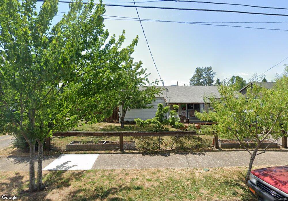
530 1/2 E 31st Ave Unit 1 Eugene, OR 97405
Southeast Eugene NeighborhoodEstimated Value: $341,006 - $389,000
2
Beds
1
Bath
1,036
Sq Ft
$346/Sq Ft
Est. Value
About This Home
This home is located at 530 1/2 E 31st Ave Unit 1, Eugene, OR 97405 and is currently estimated at $358,252, approximately $345 per square foot. 530 1/2 E 31st Ave Unit 1 is a home located in Lane County with nearby schools including Adams Elementary School, Spencer Butte Middle School, and South Eugene High School.
Ownership History
Date
Name
Owned For
Owner Type
Purchase Details
Closed on
Mar 11, 2010
Sold by
Terry Sherman D
Bought by
Singer Robert
Current Estimated Value
Home Financials for this Owner
Home Financials are based on the most recent Mortgage that was taken out on this home.
Original Mortgage
$122,800
Outstanding Balance
$80,544
Interest Rate
4.93%
Mortgage Type
New Conventional
Estimated Equity
$277,708
Create a Home Valuation Report for This Property
The Home Valuation Report is an in-depth analysis detailing your home's value as well as a comparison with similar homes in the area
Home Values in the Area
Average Home Value in this Area
Purchase History
| Date | Buyer | Sale Price | Title Company |
|---|---|---|---|
| Singer Robert | $153,500 | First American Title |
Source: Public Records
Mortgage History
| Date | Status | Borrower | Loan Amount |
|---|---|---|---|
| Open | Singer Robert | $122,800 |
Source: Public Records
Tax History
| Year | Tax Paid | Tax Assessment Tax Assessment Total Assessment is a certain percentage of the fair market value that is determined by local assessors to be the total taxable value of land and additions on the property. | Land | Improvement |
|---|---|---|---|---|
| 2025 | $2,726 | $139,916 | -- | -- |
| 2024 | $2,692 | $135,841 | -- | -- |
| 2023 | $2,692 | $131,885 | $0 | $0 |
| 2022 | $2,522 | $128,044 | $0 | $0 |
| 2021 | $2,369 | $124,315 | $0 | $0 |
| 2020 | $2,377 | $120,695 | $0 | $0 |
| 2019 | $2,296 | $117,180 | $0 | $0 |
| 2018 | $2,161 | $110,453 | $0 | $0 |
| 2017 | $2,064 | $110,453 | $0 | $0 |
| 2016 | $2,013 | $107,236 | $0 | $0 |
| 2015 | $1,955 | $104,113 | $0 | $0 |
| 2014 | $1,916 | $101,081 | $0 | $0 |
Source: Public Records
Map
Nearby Homes
- 3023 Hummingbird Ln
- 478 E 32nd Ave
- 3031 Hummingbird Ln
- 790 E 32nd Ave
- 2990 Kincaid St
- 2815 Hilyard St
- 2749 Hilyard St
- 894 E 35th Ave
- 2707 Hilyard St
- 3615 Donald St
- 810 E 37th Ave
- 3855 Ferry St
- 3605 Emerald St
- 0 E 39th Ave
- 2925 Charnelton St
- 275 E 39th Ave
- 2610 Elinor St
- 434 E 39th Ave
- 3790 Onyx St
- 1210 E 38th Ave
- 540 E 31st Ave
- 514 E 31st Ave
- 520 E 31st Ave
- 520 E 31st Ave Unit Parc2
- 550 E 31st Ave
- 651 E 32nd Ave
- 525 E 32nd Ave
- 655 E 32nd Ave
- 3117 Ferry St
- 661 E 32nd Ave
- 3115 Ferry St
- 646 E 31st Ave
- 523 E 32nd Ave
- 510 E 31st Ave
- 675 E 32nd Ave
- 650 E 31st Ave
- 3185 Ferry St
- 685 E 32nd Ave
- 555 E 31st Ave
- 515 E 31st Ave
Your Personal Tour Guide
Ask me questions while you tour the home.