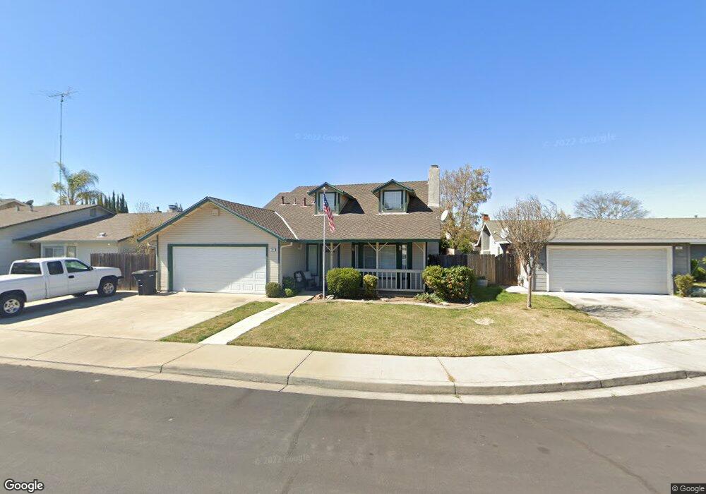
56 Obsidian Dr Oakdale, CA 95361
Estimated Value: $359,000 - $470,000
3
Beds
2
Baths
1,435
Sq Ft
$301/Sq Ft
Est. Value
About This Home
This home is located at 56 Obsidian Dr, Oakdale, CA 95361 and is currently estimated at $431,342, approximately $300 per square foot. 56 Obsidian Dr is a home located in Stanislaus County with nearby schools including Fair Oaks Elementary School, Oakdale Junior High School, and East Stanislaus High School.
Ownership History
Date
Name
Owned For
Owner Type
Purchase Details
Closed on
May 3, 2023
Sold by
Echols Randal D and Echols Mattie
Bought by
Randal D Echols And Mattie C Echols Revocable
Current Estimated Value
Purchase Details
Closed on
Dec 22, 2003
Sold by
Echols Randy
Bought by
Echols Randy and Echols Mattie
Purchase Details
Closed on
Dec 28, 2001
Sold by
Echols Mattie
Bought by
Echols Randy
Home Financials for this Owner
Home Financials are based on the most recent Mortgage that was taken out on this home.
Original Mortgage
$143,900
Interest Rate
6.73%
Purchase Details
Closed on
Dec 17, 2001
Sold by
Keeslar Arden Ralph
Bought by
Echols Randy
Home Financials for this Owner
Home Financials are based on the most recent Mortgage that was taken out on this home.
Original Mortgage
$143,900
Interest Rate
6.73%
Create a Home Valuation Report for This Property
The Home Valuation Report is an in-depth analysis detailing your home's value as well as a comparison with similar homes in the area
Home Values in the Area
Average Home Value in this Area
Purchase History
| Date | Buyer | Sale Price | Title Company |
|---|---|---|---|
| Randal D Echols And Mattie C Echols Revocable | -- | None Listed On Document | |
| Echols Randy | -- | -- | |
| Echols Randy | -- | Chicago Title Co | |
| Echols Randy | $180,000 | Chicago Title Co |
Source: Public Records
Mortgage History
| Date | Status | Borrower | Loan Amount |
|---|---|---|---|
| Previous Owner | Echols Randy | $143,900 |
Source: Public Records
Tax History Compared to Growth
Tax History
| Year | Tax Paid | Tax Assessment Tax Assessment Total Assessment is a certain percentage of the fair market value that is determined by local assessors to be the total taxable value of land and additions on the property. | Land | Improvement |
|---|---|---|---|---|
| 2025 | $2,968 | $265,892 | $103,400 | $162,492 |
| 2024 | $2,814 | $260,679 | $101,373 | $159,306 |
| 2023 | $2,755 | $255,569 | $99,386 | $156,183 |
| 2022 | $2,708 | $250,559 | $97,438 | $153,121 |
| 2021 | $2,663 | $245,647 | $95,528 | $150,119 |
| 2020 | $2,634 | $243,129 | $94,549 | $148,580 |
| 2019 | $2,594 | $238,363 | $92,696 | $145,667 |
| 2018 | $2,558 | $233,690 | $90,879 | $142,811 |
| 2017 | $2,514 | $229,109 | $89,098 | $140,011 |
| 2016 | $2,470 | $224,617 | $87,351 | $137,266 |
| 2015 | $2,439 | $221,244 | $86,039 | $135,205 |
| 2014 | $2,256 | $202,500 | $50,000 | $152,500 |
Source: Public Records
Map
Nearby Homes
- 2337 Rainwood Ln
- 2295 Pontiac St
- 1972 Sugar Pine Dr
- 1948 Sugar Pine Dr
- 2306 W F St
- 15 Willowood Dr
- 1625 Valmor Ct
- 8400 Crane Rd
- 311 Carriage Ln
- The Skyline Plan at Saddlewood
- The Pinnacle Plan at Saddlewood
- The Vantage Plan at Saddlewood
- 491 Nicholas Ct
- 2272 Tori Way
- 549 Fresian Dr
- 1421 Pontiac St
- 2532 Laurel Ridge Ct
- 2319 Tori Way
- 1863 Vintage Cir
- 2030 Baluchi Way