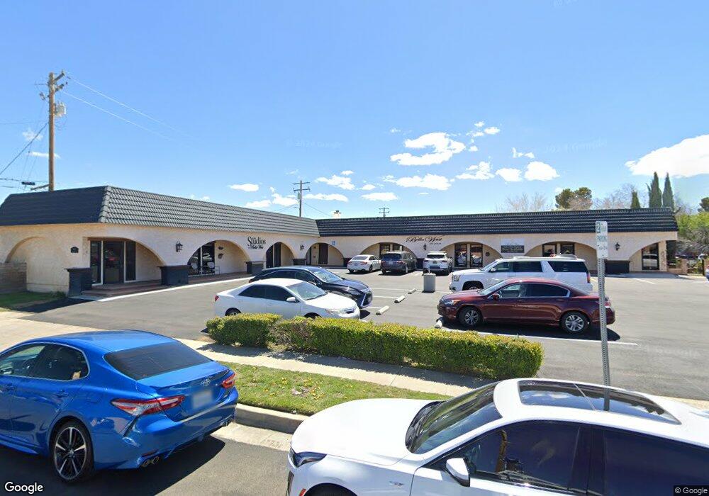
560 W Milling St Unit A Lancaster, CA 93534
Central Lancaster NeighborhoodEstimated Value: $1,318,265
--
Bed
--
Bath
5,432
Sq Ft
$243/Sq Ft
Est. Value
About This Home
This home is located at 560 W Milling St Unit A, Lancaster, CA 93534 and is currently estimated at $1,318,265, approximately $242 per square foot. 560 W Milling St Unit A is a home located in Los Angeles County with nearby schools including Sierra Elementary School, Amargosa Creek Middle School, and Antelope Valley High School.
Ownership History
Date
Name
Owned For
Owner Type
Purchase Details
Closed on
Oct 12, 2005
Sold by
Orcutt Bradley J and Orcutt Valerie A
Bought by
Orcutt Bradley J
Current Estimated Value
Purchase Details
Closed on
Nov 8, 2002
Sold by
Gagamin Lp
Bought by
Orcutt Bradley J
Home Financials for this Owner
Home Financials are based on the most recent Mortgage that was taken out on this home.
Original Mortgage
$425,000
Interest Rate
5.76%
Mortgage Type
Commercial
Create a Home Valuation Report for This Property
The Home Valuation Report is an in-depth analysis detailing your home's value as well as a comparison with similar homes in the area
Home Values in the Area
Average Home Value in this Area
Purchase History
| Date | Buyer | Sale Price | Title Company |
|---|---|---|---|
| Orcutt Bradley J | -- | -- | |
| Orcutt Bradley J | $440,000 | Fidelity Title |
Source: Public Records
Mortgage History
| Date | Status | Borrower | Loan Amount |
|---|---|---|---|
| Previous Owner | Orcutt Bradley J | $425,000 |
Source: Public Records
Tax History Compared to Growth
Tax History
| Year | Tax Paid | Tax Assessment Tax Assessment Total Assessment is a certain percentage of the fair market value that is determined by local assessors to be the total taxable value of land and additions on the property. | Land | Improvement |
|---|---|---|---|---|
| 2025 | $11,165 | $637,244 | $202,754 | $434,490 |
| 2024 | $11,165 | $624,750 | $198,779 | $425,971 |
| 2023 | $10,928 | $612,501 | $194,882 | $417,619 |
| 2022 | $10,665 | $600,492 | $191,061 | $409,431 |
| 2021 | $10,451 | $588,718 | $187,315 | $401,403 |
| 2019 | $14,082 | $571,259 | $181,760 | $389,499 |
| 2018 | $13,822 | $560,059 | $178,197 | $381,862 |
| 2016 | $13,319 | $538,313 | $171,278 | $367,035 |
| 2015 | $13,208 | $530,228 | $168,706 | $361,522 |
| 2014 | $13,275 | $519,843 | $165,402 | $354,441 |
Source: Public Records
Map
Nearby Homes
- 44709 Beech Ave
- 14 SR Sierra Hwy Unit K8
- 44606 Date Ave
- 44655 Fig Ave
- 44645 Fig Ave
- 44520 Date Ave
- 44632 Fern Ave
- 44931 Trevor Ave
- 44442 Beech Ave
- 44817 Redwood Ave
- 44441 Sierra Hwy
- 317 W Kildare St
- 0 Vac Vic Avenue F8 75 Stw Unit SR19141185
- 0 Vac Vic 195 Ste Ave 06 Unit 23-270071
- 215 W Lancaster Blvd
- 1 Sierra Hwy
- 126 Nicobar St
- 44515 Fern Ave
- 6717 6999 Avenue J
- 0 0 Unit CV25218952
- 560 W Milling St
- 44744 Cedar Ave
- 44745 Beech Ave
- 44739 Beech Ave
- 44732 Cedar Ave
- 44733 Beech Ave
- 44724 Cedar Ave
- 44725 Beech Ave
- 44720 Cedar Ave
- 44742 Beech Ave
- 44719 Beech Ave Unit 2
- 44719 Beech Ave
- 44803 Cedar Ave
- 44714 Cedar Ave
- 44715 Beech Ave
- 44807 Cedar Ave
- 44815 Cedar Ave
- 44846 Beech Ave
- 44821 Cedar Ave
- 539 W Newgrove St