S
Seller's Agent in 2026
Steve Haskins
PREFERRED PROPERTIES REALTY GROUP
(805) 705-3695
15 in this area
17 Total Sales
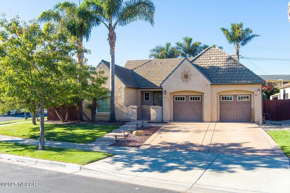
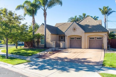
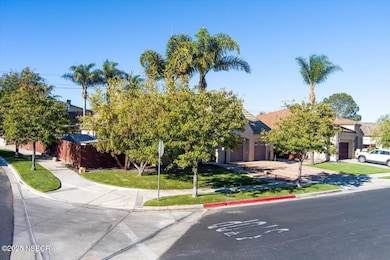
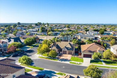
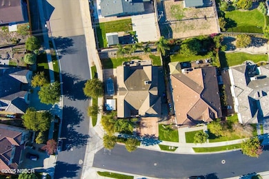
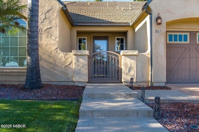
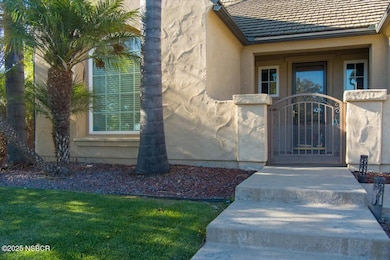
This home has a well designed floor plan on a corner lot in the highly desirable Providence Landing in the Vandenberg Village. With 4 bedrooms and 3-1 bathrooms, one room is a loft makes this a ideal home for a family. Title wood flooring in living area, dinning area and kitchen. The primary suite offers two spacious walk-in closets, a soaking tub, and walk-in shower. The loft has plenty of room, a separate living room, bedroom and full bathroom.. This loft is ideal for an office, a children's room, in-law's living space or just a relaxing area to get away from it all. For entertaining, the backyard has a built in Santa Maria Style BBQ with a hot and cold water sink. One side yard has a full length concrete pad, the other side is very spacious for lots of storage. Residents can enjoy many additional amenities, including a swimming pool ,spa, clubhouse, tennis courts, basketball courts, pickleball courts, sports fields, and walking trails. Conveniently located near Vandenburg Space Force, highly rated schools. Make an appointment soon, don't miss out on this wonderful family home.
Last Agent to Sell the Property
PREFERRED PROPERTIES REALTY GROUP License #01295591 Listed on: 11/19/2025
| Date | Type | Sale Price | Title Company |
|---|---|---|---|
| Deed | -- | -- | |
| Grant Deed | $483,500 | First American Title Company |
| Date | Status | Loan Amount | Loan Type |
|---|---|---|---|
| Previous Owner | $96,000 | Credit Line Revolving | |
| Previous Owner | $384,000 | New Conventional |
| Date | Event | Price | List to Sale | Price per Sq Ft |
|---|---|---|---|---|
| 03/12/2026 03/12/26 | Sold | $810,000 | -1.8% | $320 / Sq Ft |
| 11/20/2025 11/20/25 | For Sale | $825,000 | -- | $326 / Sq Ft |
| Year | Tax Paid | Tax Assessment Tax Assessment Total Assessment is a certain percentage of the fair market value that is determined by local assessors to be the total taxable value of land and additions on the property. | Land | Improvement |
|---|---|---|---|---|
| 2025 | $8,224 | $673,546 | $313,618 | $359,928 |
| 2023 | $8,224 | $613,000 | $287,000 | $326,000 |
| 2022 | $7,722 | $601,000 | $281,000 | $320,000 |
| 2021 | $7,019 | $522,000 | $244,000 | $278,000 |
| 2020 | $6,470 | $475,000 | $222,000 | $253,000 |
| 2019 | $6,490 | $475,000 | $222,000 | $253,000 |
| 2018 | $6,514 | $475,000 | $222,000 | $253,000 |
| 2017 | $6,163 | $452,000 | $211,000 | $241,000 |
| 2016 | $5,643 | $430,000 | $201,000 | $229,000 |
| 2014 | $5,151 | $383,000 | $179,000 | $204,000 |
S
Seller's Agent in 2026
Steve Haskins
PREFERRED PROPERTIES REALTY GROUP
(805) 705-3695
15 in this area
17 Total Sales

Buyer's Agent in 2026
Jan Finley
Santa Ynez Branch eXp Realty
(888) 652-1314
3 in this area
31 Total Sales
C
Buyer Co-Listing Agent in 2026
Cameron Holmes
Santa Ynez Branch eXp Realty
(805) 260-4992
1 in this area
5 Total Sales
Source: North Santa Barbara County Regional MLS
MLS Number: 25002289
APN: 098-001-014
Disclaimer: Certain information contained herein is derived from information provided by parties other than Homes.com. All information provided is deemed reliable, but is not guaranteed to be accurate and should be independently verified.
![]() IDX information is provided exclusively for personal, non-commercial use, and may not be used for any purpose other than to identify prospective properties consumers may be interested in purchasing. Information is deemed reliable but not guaranteed.
IDX information is provided exclusively for personal, non-commercial use, and may not be used for any purpose other than to identify prospective properties consumers may be interested in purchasing. Information is deemed reliable but not guaranteed.
Ask me questions while you tour the home.