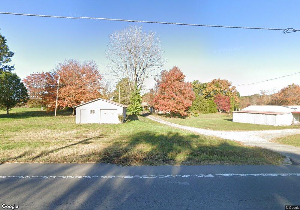
5936 S York Hwy Clarkrange, TN 38553
Estimated Value: $198,000 - $245,000
--
Bed
1
Bath
1,200
Sq Ft
$176/Sq Ft
Est. Value
About This Home
This home is located at 5936 S York Hwy, Clarkrange, TN 38553 and is currently estimated at $211,272, approximately $176 per square foot. 5936 S York Hwy is a home located in Fentress County.
Ownership History
Date
Name
Owned For
Owner Type
Purchase Details
Closed on
Jan 4, 2024
Sold by
Tweedy Stephanie
Bought by
Reeves Wendell M
Current Estimated Value
Purchase Details
Closed on
Sep 14, 2018
Sold by
Union Bank Of Jamestown
Bought by
Tweedy Stephanie
Purchase Details
Closed on
Aug 9, 2018
Sold by
Mccoy Nicosia
Bought by
Union Bank Of Jamestown
Purchase Details
Closed on
Jul 30, 2009
Bought by
Bridges James
Home Financials for this Owner
Home Financials are based on the most recent Mortgage that was taken out on this home.
Original Mortgage
$60,000
Interest Rate
5.26%
Mortgage Type
Cash
Purchase Details
Closed on
May 21, 2009
Purchase Details
Closed on
Apr 7, 1992
Bought by
Evans Laura
Create a Home Valuation Report for This Property
The Home Valuation Report is an in-depth analysis detailing your home's value as well as a comparison with similar homes in the area
Home Values in the Area
Average Home Value in this Area
Purchase History
| Date | Buyer | Sale Price | Title Company |
|---|---|---|---|
| Reeves Wendell M | -- | None Listed On Document | |
| Tweedy Stephanie | $72,000 | None Available | |
| Union Bank Of Jamestown | $50,000 | None Available | |
| Bridges James | $32,000 | -- | |
| -- | $20,000 | -- | |
| Evans Laura | $39,300 | -- |
Source: Public Records
Mortgage History
| Date | Status | Borrower | Loan Amount |
|---|---|---|---|
| Previous Owner | Evans Laura | $60,000 |
Source: Public Records
Tax History Compared to Growth
Tax History
| Year | Tax Paid | Tax Assessment Tax Assessment Total Assessment is a certain percentage of the fair market value that is determined by local assessors to be the total taxable value of land and additions on the property. | Land | Improvement |
|---|---|---|---|---|
| 2025 | $457 | $35,025 | $0 | $0 |
| 2024 | $457 | $33,825 | $2,775 | $31,050 |
| 2023 | $457 | $33,825 | $2,775 | $31,050 |
| 2022 | $363 | $19,025 | $1,825 | $17,200 |
| 2021 | $363 | $19,025 | $1,825 | $17,200 |
| 2020 | $363 | $19,025 | $1,825 | $17,200 |
| 2019 | $363 | $19,025 | $1,825 | $17,200 |
| 2018 | $363 | $19,025 | $1,825 | $17,200 |
| 2017 | $380 | $19,150 | $1,825 | $17,325 |
| 2016 | $380 | $19,150 | $1,825 | $17,325 |
| 2015 | $380 | $19,153 | $0 | $0 |
| 2014 | $341 | $17,202 | $0 | $0 |
Source: Public Records
Map
Nearby Homes
- 6006 S York Hwy
- 145 Rhum Rd
- 6105 S York Hwy
- 6105 S South York Hwy
- 1101 Franklin Loop
- 5740 S York Hwy
- 545 Shelby Way
- 101 MacA Ridge Cir
- 106 MacA Ridge Cir
- 1255 Franklin Loop
- 1011 Fox Ridge Dr
- 00 Fox Ridge Dr
- 164 Green Acres
- 634 Robs Rd
- 1383 Old Bean Shed Rd
- 338 Swallows Crossing
- 5550 S York Hwy
- 5534 S York Hwy
- 2019 Martha Washington Rd
- 2059 Martha Washington Rd
- 5936 S York Hwy
- 104 S Shady Lane Loop
- 1007 N Shady Lane Loop
- 1002 N Shady Lane Loop
- 36 N Shady Lane Loop
- 32 Shady Lane Loop
- 116 S Shady Lane Loop
- 1023 N Shady Lane Loop
- 5930 S York Hwy
- 1020 N Shady Lane Loop
- 117 S Shady Lane Loop
- 6007 S York Hwy Unit YORK
- 6007 S York 127 Hwy
- 6007 S York Highway 127 Hwy
- 6014 S York Hwy
- 1033 N Shady Lane Loop
- 124 S Shady Lane Loop
- 6003 S York Hwy
- 5925 S York Hwy
- 125 S Shady Lane Loop