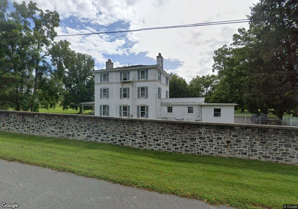
6020 Kennett Pike Wilmington, DE 19807
Ashland NeighborhoodEstimated Value: $1,674,056 - $1,734,000
8
Beds
7
Baths
7,202
Sq Ft
$237/Sq Ft
Est. Value
About This Home
This home is located at 6020 Kennett Pike, Wilmington, DE 19807 and is currently estimated at $1,704,028, approximately $236 per square foot. 6020 Kennett Pike is a home located in New Castle County with nearby schools including Alexis I. du Pont Middle School, Alexis I. du Pont High School, and Centreville Layton School.
Ownership History
Date
Name
Owned For
Owner Type
Purchase Details
Closed on
Mar 22, 2012
Sold by
Lunger Robert Brett and Lunger Brett R
Bought by
Oberod Estate Llc
Current Estimated Value
Home Financials for this Owner
Home Financials are based on the most recent Mortgage that was taken out on this home.
Original Mortgage
$1,994,300
Outstanding Balance
$1,372,555
Interest Rate
3.91%
Mortgage Type
Seller Take Back
Estimated Equity
$331,473
Create a Home Valuation Report for This Property
The Home Valuation Report is an in-depth analysis detailing your home's value as well as a comparison with similar homes in the area
Home Values in the Area
Average Home Value in this Area
Purchase History
| Date | Buyer | Sale Price | Title Company |
|---|---|---|---|
| Oberod Estate Llc | $3,900,000 | None Available |
Source: Public Records
Mortgage History
| Date | Status | Borrower | Loan Amount |
|---|---|---|---|
| Open | Oberod Estate Llc | $1,994,300 |
Source: Public Records
Tax History Compared to Growth
Tax History
| Year | Tax Paid | Tax Assessment Tax Assessment Total Assessment is a certain percentage of the fair market value that is determined by local assessors to be the total taxable value of land and additions on the property. | Land | Improvement |
|---|---|---|---|---|
| 2024 | $16,169 | $437,600 | $155,000 | $282,600 |
| 2023 | $14,264 | $437,600 | $155,000 | $282,600 |
| 2022 | $14,433 | $437,600 | $155,000 | $282,600 |
| 2021 | $14,432 | $437,600 | $155,000 | $282,600 |
| 2020 | $0 | $437,600 | $155,000 | $282,600 |
| 2019 | $14,457 | $437,600 | $155,000 | $282,600 |
| 2018 | $14,169 | $437,600 | $155,000 | $282,600 |
| 2017 | $13,996 | $437,600 | $155,000 | $282,600 |
| 2016 | $13,367 | $437,600 | $155,000 | $282,600 |
| 2015 | -- | $437,600 | $155,000 | $282,600 |
| 2014 | $11,591 | $437,600 | $155,000 | $282,600 |
Source: Public Records
Map
Nearby Homes
- 6410 Kennett Pike
- 22 Mount Airy Dr
- 101 Burnt Mill Cir
- 101 Burnt Mill Cir Unit 1A
- 101 Burnt Mill Cir Unit 1B
- 1 Quail Crossing
- 200 Dogwood Slope Rd
- 208 Haystack Ln
- 239 S Fairville Rd
- 0 Old Kennett Rd
- 1540 Fairville Rd
- 1 Laurel Ridge Ln
- 102 Alford Ct
- 504 Kennett Pike
- 336 Edinburgh Rd Unit 89
- 417 Burnt Mill Rd
- 800 Fairville Rd
- 10 Pheasants Ridge N Unit RG
- 110 Hannah Ln
- 821 Burrows Run Rd
- 6201 Kennett Pike
- 6301 Kennett Pike
- 705 Sycamore Ln
- 23 Selborne Dr
- 301 Snuff Mill Rd
- 6411 Kennett Pike
- 800 Sycamore Ln
- 25 Selborne Dr
- 801 Sycamore Ln
- 101 Burnt Mill Rd
- 281 Snuff Mill Rd
- 83 Snuff Mill Rd
- 730 Kennett Pike
- 19 Selborne Dr
- 802 Sycamore Ln
- 752 Kennett Pike
- 803 Sycamore Ln
- 700 Sycamore Ln
- 21 Raintree Rd
- 84 Snuff Mill Rd