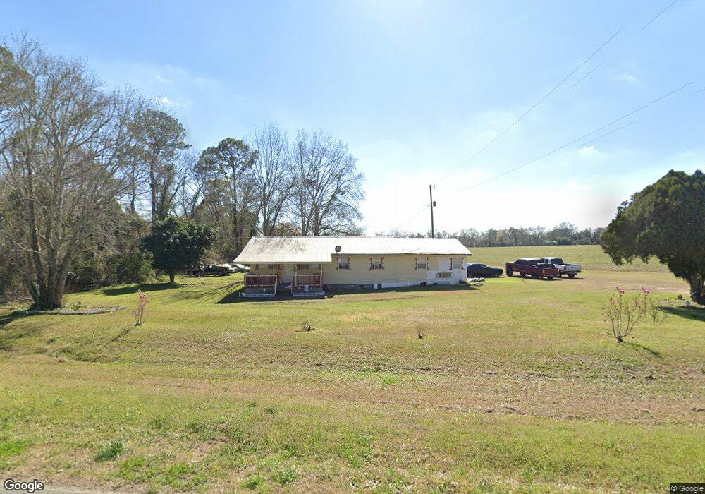
6076 Ga Highway 133 S Moultrie, GA 31788
Estimated Value: $82,000 - $208,000
3
Beds
1
Bath
1,500
Sq Ft
$87/Sq Ft
Est. Value
About This Home
This home is located at 6076 Ga Highway 133 S, Moultrie, GA 31788 and is currently estimated at $130,034, approximately $86 per square foot. 6076 Ga Highway 133 S is a home located in Colquitt County with nearby schools including Odom Elementary School, Willie J. Williams Middle School, and C.A. Gray Junior High School.
Ownership History
Date
Name
Owned For
Owner Type
Purchase Details
Closed on
Jan 27, 2021
Sold by
Boyd Richard Edward
Bought by
Godfrey Octavia
Current Estimated Value
Purchase Details
Closed on
Oct 6, 2014
Sold by
Godfrey Samuel E
Bought by
Godfrey Stephanie Michaelle and Boyd Nicole Deanne
Purchase Details
Closed on
Jan 10, 2007
Sold by
Godfrey Samuel E
Bought by
Godfrey Samuel E
Purchase Details
Closed on
Dec 31, 2002
Sold by
Tillman L B
Bought by
Godfrey Samuel E
Create a Home Valuation Report for This Property
The Home Valuation Report is an in-depth analysis detailing your home's value as well as a comparison with similar homes in the area
Home Values in the Area
Average Home Value in this Area
Purchase History
| Date | Buyer | Sale Price | Title Company |
|---|---|---|---|
| Godfrey Octavia | -- | -- | |
| Godfrey Stephanie Michaelle | -- | -- | |
| Godfrey Samuel E | -- | -- | |
| Godfrey Samuel E | $2,300 | -- |
Source: Public Records
Tax History Compared to Growth
Tax History
| Year | Tax Paid | Tax Assessment Tax Assessment Total Assessment is a certain percentage of the fair market value that is determined by local assessors to be the total taxable value of land and additions on the property. | Land | Improvement |
|---|---|---|---|---|
| 2024 | $711 | $25,824 | $1,350 | $24,474 |
| 2023 | $726 | $21,469 | $1,350 | $20,119 |
| 2022 | $570 | $17,542 | $1,350 | $16,192 |
| 2021 | $399 | $11,949 | $1,350 | $10,599 |
| 2020 | $405 | $11,949 | $1,350 | $10,599 |
| 2019 | $421 | $11,366 | $1,350 | $10,016 |
| 2018 | $417 | $11,366 | $1,350 | $10,016 |
| 2017 | $414 | $11,366 | $1,350 | $10,016 |
| 2016 | $417 | $11,366 | $1,350 | $10,016 |
| 2015 | $418 | $11,366 | $1,350 | $10,016 |
| 2014 | -- | $11,366 | $1,350 | $10,016 |
| 2013 | -- | $11,366 | $1,350 | $10,016 |
Source: Public Records
Map
Nearby Homes
- 410 Railroad St
- 313 Langford St
- 0 Southerland Ave
- 5808 Georgia 133
- 8774 Antioch Rd
- 1114 Cannon Rd
- 277 Indian Creek Subdivision
- 0 Burton Rd Unit 23760976
- 0 Burton Rd Unit 23669194
- 0 Upper Trail Unit 913421
- 0 Upper Trail Unit 913422
- 2262 Sardis Church Rd
- 5940 Georgia 37
- 9283 Tallokas Rd Unit 54/13
- 9283 Tallokas Rd
- 182 Horseshoe Dr
- 421 Best Cir
- 0 Sardis Church Rd
- 693 Old Quitman Annex Rd
- 916 Robinson Rd
- 6142 Ga Highway 133 S
- 5962 Ga Highway 133 S
- 6192 Ga Highway 133 S
- 6258 Ga Highway 133 S
- 524 Brice St
- 181 2nd St
- 910 Brice St
- 502 Brice St
- 490 Brice St
- 482 Brice St
- 245 Ashley St
- 111 Tillman St
- 452 Brice St
- 128 Ingram St
- 393 Railroad St
- 104 Tillman St
- 225 Ashley St
- 125 Martin L King Jr Dr
- 239 Ashley St
- 373 Railroad St