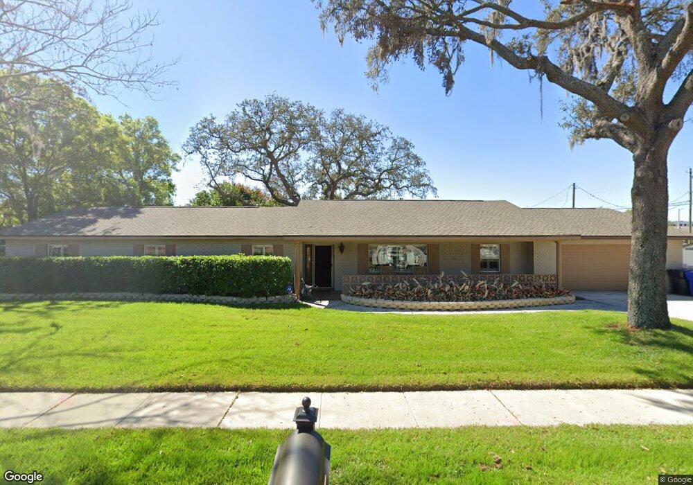
609 Larrie Ellen Way Brandon, FL 33511
Estimated Value: $398,303 - $433,000
4
Beds
2
Baths
2,144
Sq Ft
$195/Sq Ft
Est. Value
About This Home
This home is located at 609 Larrie Ellen Way, Brandon, FL 33511 and is currently estimated at $417,326, approximately $194 per square foot. 609 Larrie Ellen Way is a home located in Hillsborough County with nearby schools including Yates Elementary School, Mclane Middle School, and Brandon High School.
Ownership History
Date
Name
Owned For
Owner Type
Purchase Details
Closed on
Jul 28, 2022
Sold by
Craig Hal C and Whitten Melinda
Bought by
Hal C Craig And Melinda Whitten Craig Joint R
Current Estimated Value
Purchase Details
Closed on
Jun 4, 1997
Sold by
Raul and Salgado Leanor
Bought by
Craig Melinda W
Home Financials for this Owner
Home Financials are based on the most recent Mortgage that was taken out on this home.
Original Mortgage
$96,550
Interest Rate
8.13%
Mortgage Type
New Conventional
Create a Home Valuation Report for This Property
The Home Valuation Report is an in-depth analysis detailing your home's value as well as a comparison with similar homes in the area
Home Values in the Area
Average Home Value in this Area
Purchase History
| Date | Buyer | Sale Price | Title Company |
|---|---|---|---|
| Hal C Craig And Melinda Whitten Craig Joint R | -- | Trinkle Redman Pa | |
| Craig Melinda W | $101,700 | -- |
Source: Public Records
Mortgage History
| Date | Status | Borrower | Loan Amount |
|---|---|---|---|
| Previous Owner | Craig Melinda W | $112,000 | |
| Previous Owner | Craig Melinda W | $96,550 |
Source: Public Records
Tax History Compared to Growth
Tax History
| Year | Tax Paid | Tax Assessment Tax Assessment Total Assessment is a certain percentage of the fair market value that is determined by local assessors to be the total taxable value of land and additions on the property. | Land | Improvement |
|---|---|---|---|---|
| 2024 | $2,002 | $117,633 | -- | -- |
| 2023 | $1,906 | $114,207 | $0 | $0 |
| 2022 | $1,758 | $110,881 | $0 | $0 |
| 2021 | $1,712 | $107,651 | $0 | $0 |
| 2020 | $1,633 | $106,165 | $0 | $0 |
| 2019 | $1,444 | $100,277 | $0 | $0 |
| 2018 | $1,392 | $98,407 | $0 | $0 |
| 2017 | $1,363 | $149,054 | $0 | $0 |
| 2016 | $1,328 | $94,401 | $0 | $0 |
| 2015 | $1,340 | $93,745 | $0 | $0 |
| 2014 | $1,316 | $93,001 | $0 | $0 |
| 2013 | -- | $91,627 | $0 | $0 |
Source: Public Records
Map
Nearby Homes
- 514 Ole Plantation Dr
- 705 Westwood Dr
- 605 Chippenham Blvd
- 780 Spring Flowers Trail
- 707 Westwood Ln
- 314 Summer Clouds Place
- 906 Stanberry Dr
- 308 Cambridge Place
- 708 Westwood Cir
- 832 S Parsons Ave
- 703 Sailfish Dr
- 724 Tradewinds Dr
- 732 Tradewinds Dr
- 308 Lake Parsons Green Unit 106
- 923 Lumsden Reserve Dr
- 146 W Robertson St
- 314 Lake Parsons Green Unit 102
- 1214 Mitchell St
- 0 W Robertson St
- 134 Barrington Dr
- 618 Overland Dr
- 607 Larrie Ellen Way
- 610 Larrie Ellen Way
- 614 Overland Dr
- 608 Larrie Ellen Way
- 605 Larrie Ellen Way
- 610 Overland Dr
- 617 Overland Dr
- 606 Larrie Ellen Way
- 613 Overland Dr
- 618 Ole Plantation Dr
- 710 S Kings Ave
- 616 Ole Plantation Dr
- 614 Ole Plantation Dr
- 803 S Kings Ave
- 609 Overland Dr
- 603 Larrie Ellen Way
- 612 Ole Plantation Dr
- 606 Overland Dr
- 604 Larrie Ellen Way