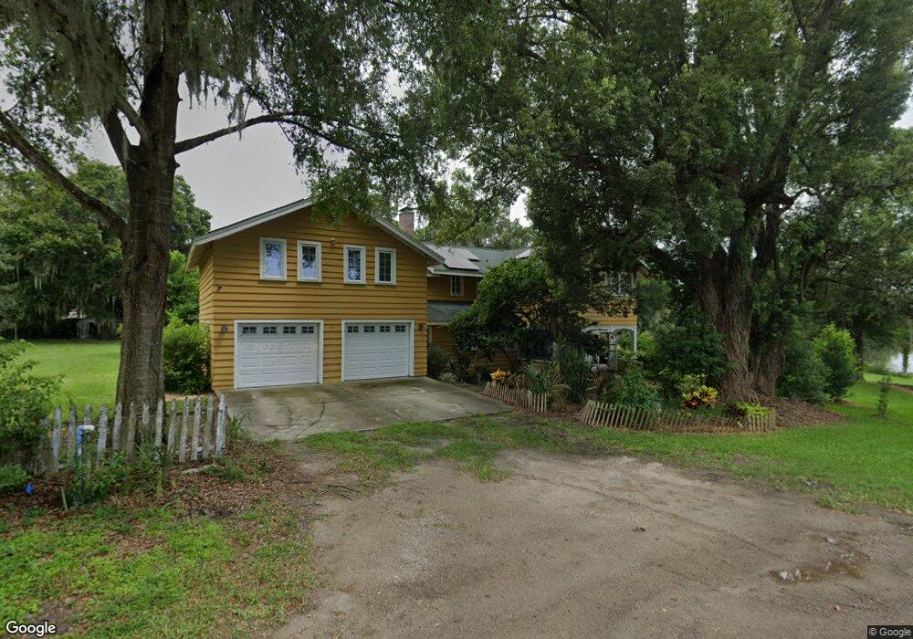
61 S Kentucky Ave Umatilla, FL 32784
Estimated Value: $463,000 - $623,000
3
Beds
3
Baths
3,565
Sq Ft
$159/Sq Ft
Est. Value
About This Home
This home is located at 61 S Kentucky Ave, Umatilla, FL 32784 and is currently estimated at $565,896, approximately $158 per square foot. 61 S Kentucky Ave is a home located in Lake County with nearby schools including Umatilla Elementary School, Umatilla Middle School, and Umatilla High School.
Ownership History
Date
Name
Owned For
Owner Type
Purchase Details
Closed on
Jun 5, 2018
Sold by
Snyder Scott M and Wolda Marianne
Bought by
Snyder Scott M
Current Estimated Value
Purchase Details
Closed on
Aug 29, 2006
Sold by
Dempsey Marianne
Bought by
Dempsey Marianne and Snyder Scott M
Purchase Details
Closed on
Apr 24, 2006
Sold by
Barlow Portus C and Barlow Kathleen C
Bought by
Snyder Scott M
Home Financials for this Owner
Home Financials are based on the most recent Mortgage that was taken out on this home.
Original Mortgage
$145,000
Interest Rate
8.75%
Mortgage Type
Seller Take Back
Purchase Details
Closed on
Feb 14, 2006
Sold by
Snyder Scott M and Dempsey Marianne
Bought by
Snyder Scott M and Dempsey Marianne Wolda
Home Financials for this Owner
Home Financials are based on the most recent Mortgage that was taken out on this home.
Original Mortgage
$544,500
Interest Rate
6.17%
Mortgage Type
New Conventional
Purchase Details
Closed on
Sep 23, 2005
Sold by
Schroeder Kaaren and Schroeder Chad T
Bought by
Dempsey Marianne
Home Financials for this Owner
Home Financials are based on the most recent Mortgage that was taken out on this home.
Original Mortgage
$418,500
Interest Rate
6.85%
Mortgage Type
Purchase Money Mortgage
Purchase Details
Closed on
Sep 22, 2005
Sold by
Dempsey Michael E
Bought by
Dempsey Marianne
Home Financials for this Owner
Home Financials are based on the most recent Mortgage that was taken out on this home.
Original Mortgage
$418,500
Interest Rate
6.85%
Mortgage Type
Purchase Money Mortgage
Purchase Details
Closed on
Mar 22, 2005
Sold by
Harris Brian E and Harris Stephanie
Bought by
Schroeder Kaaren
Home Financials for this Owner
Home Financials are based on the most recent Mortgage that was taken out on this home.
Original Mortgage
$223,000
Interest Rate
7.5%
Mortgage Type
Purchase Money Mortgage
Purchase Details
Closed on
Aug 8, 1995
Sold by
Demuth Frances B
Bought by
Harris Brian E and Harris Stephanie
Home Financials for this Owner
Home Financials are based on the most recent Mortgage that was taken out on this home.
Original Mortgage
$90,000
Interest Rate
7.48%
Create a Home Valuation Report for This Property
The Home Valuation Report is an in-depth analysis detailing your home's value as well as a comparison with similar homes in the area
Home Values in the Area
Average Home Value in this Area
Purchase History
| Date | Buyer | Sale Price | Title Company |
|---|---|---|---|
| Snyder Scott M | $32,500 | Attorney | |
| Dempsey Marianne | $207,500 | None Available | |
| Snyder Scott M | $200,000 | Attorney | |
| Snyder Scott M | -- | Attorney | |
| Dempsey Marianne | $465,000 | -- | |
| Dempsey Marianne | -- | Attorney | |
| Schroeder Kaaren | $266,000 | -- | |
| Harris Brian E | $30,000 | -- |
Source: Public Records
Mortgage History
| Date | Status | Borrower | Loan Amount |
|---|---|---|---|
| Previous Owner | Snyder Scott M | $145,000 | |
| Previous Owner | Snyder Scott M | $544,500 | |
| Previous Owner | Dempsey Marianne | $418,500 | |
| Previous Owner | Schroeder Kaaren | $223,000 | |
| Previous Owner | Harris Brian E | $90,000 |
Source: Public Records
Tax History Compared to Growth
Tax History
| Year | Tax Paid | Tax Assessment Tax Assessment Total Assessment is a certain percentage of the fair market value that is determined by local assessors to be the total taxable value of land and additions on the property. | Land | Improvement |
|---|---|---|---|---|
| 2025 | $4,888 | $297,760 | -- | -- |
| 2024 | $4,888 | $297,760 | -- | -- |
| 2023 | $4,888 | $280,670 | $0 | $0 |
| 2022 | $4,755 | $272,500 | $0 | $0 |
| 2021 | $4,566 | $264,563 | $0 | $0 |
| 2020 | $4,795 | $264,885 | $0 | $0 |
| 2019 | $4,740 | $258,930 | $0 | $0 |
| 2018 | $4,567 | $254,103 | $0 | $0 |
| 2017 | $4,336 | $248,877 | $0 | $0 |
| 2016 | $4,291 | $243,759 | $0 | $0 |
| 2015 | $4,402 | $242,065 | $0 | $0 |
| 2014 | $4,388 | $240,144 | $0 | $0 |
Source: Public Records
Map
Nearby Homes
- 16 Davis Ave
- 0 State Road 19 Unit O5924960
- 211 S Central Ave
- 57 N Orange Ave
- 112 Turtle Run
- 106 Turtle Run
- 0 Guerrant St Unit MFRG5094082
- 243 S Central Ave
- 102 S Trowell Ave
- TBD Tennessee Ave
- 87 Lone Star St
- 305 Lakeside Ave
- 114 Wingfield Dr
- 205 Lori Ct
- 177 Boardman Dr
- 211 Cassady St
- 200 Devault St Unit 35
- 200 Devault St Unit 60
- 200 Devault St Unit Lot 11
- 200 Devault St Unit 113
- 58 S Kentucky Ave
- 51 S Kentucky Ave
- 66 S Central Ave
- 44 S Kentucky Ave
- 82 S Central Ave
- 46 S Kentucky Ave
- 55 Davis Ave
- 60 S Central Ave
- 40 S Central Ave
- 39 S Kentucky Ave
- 46 S Central Ave Unit B
- 46 S Central Ave Unit A
- 46 S Central Ave
- 47 Davis Ave
- 35 S Kentucky Ave
- 40 S Kentucky Ave
- 35 Davis Ave
- 24 S Central Ave
- 35 S Central Ave
- 38 Davis Ave