Estimated Value: $230,870 - $287,000
2
Beds
3
Baths
1,013
Sq Ft
$256/Sq Ft
Est. Value
About This Home
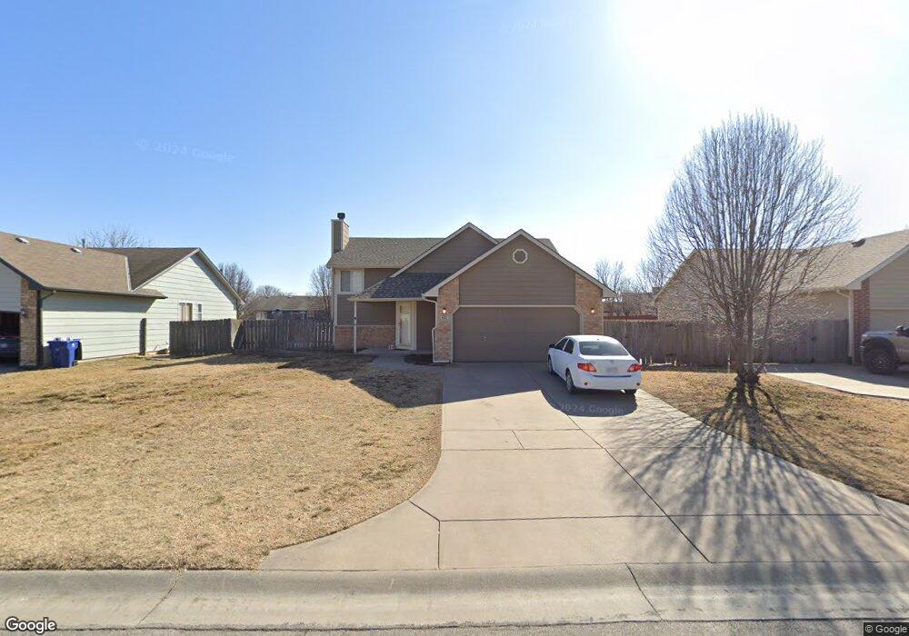
This home is located at 621 High Plains Cir, Maize, KS 67101 and is currently estimated at $258,935, approximately $255 per square foot. 621 High Plains Cir is a home located in Sedgwick County with nearby schools including Vermillion Elementary School, Pray-Woodman Elementary, and Maize Elementary School.
Ownership History
Date
Name
Owned For
Owner Type
Purchase Details
Closed on
Jan 19, 2018
Sold by
Yaeger Brad E and Yaeger Janice E
Bought by
B&M Rentals Llc
Current Estimated Value
Home Financials for this Owner
Home Financials are based on the most recent Mortgage that was taken out on this home.
Original Mortgage
$126,834
Outstanding Balance
$107,033
Interest Rate
3.94%
Mortgage Type
Future Advance Clause Open End Mortgage
Estimated Equity
$151,902
Purchase Details
Closed on
Jul 2, 2014
Sold by
Suncrest 8 Llc
Bought by
Yaeger Brad E and Yaeger Janice E
Purchase Details
Closed on
Oct 22, 1998
Sold by
Clint Miller Construction Inc
Bought by
Whightsil Kevin C and Whightsil Robin M
Home Financials for this Owner
Home Financials are based on the most recent Mortgage that was taken out on this home.
Original Mortgage
$94,050
Interest Rate
6.73%
Create a Home Valuation Report for This Property
The Home Valuation Report is an in-depth analysis detailing your home's value as well as a comparison with similar homes in the area
Home Values in the Area
Average Home Value in this Area
Purchase History
| Date | Buyer | Sale Price | Title Company |
|---|---|---|---|
| B&M Rentals Llc | -- | Security 1St Title | |
| Yaeger Brad E | -- | None Available | |
| Whightsil Kevin C | -- | Columbian Natl Title Ins Co |
Source: Public Records
Mortgage History
| Date | Status | Borrower | Loan Amount |
|---|---|---|---|
| Open | B&M Rentals Llc | $126,834 | |
| Previous Owner | Whightsil Kevin C | $94,050 |
Source: Public Records
Tax History Compared to Growth
Tax History
| Year | Tax Paid | Tax Assessment Tax Assessment Total Assessment is a certain percentage of the fair market value that is determined by local assessors to be the total taxable value of land and additions on the property. | Land | Improvement |
|---|---|---|---|---|
| 2025 | $2,915 | $21,942 | $5,244 | $16,698 |
| 2023 | $2,915 | $17,848 | $4,209 | $13,639 |
| 2022 | $2,681 | $17,849 | $3,968 | $13,881 |
| 2021 | $2,486 | $16,377 | $2,703 | $13,674 |
| 2020 | $2,338 | $15,445 | $2,703 | $12,742 |
| 2019 | $2,178 | $14,433 | $2,703 | $11,730 |
| 2018 | $2,059 | $13,616 | $2,116 | $11,500 |
| 2017 | $1,988 | $0 | $0 | $0 |
| 2016 | $1,927 | $0 | $0 | $0 |
| 2015 | -- | $0 | $0 | $0 |
| 2014 | -- | $0 | $0 | $0 |
Source: Public Records
Map
Nearby Homes
- 530 Conestoga Rd
- 727 E High Plains St
- 613 S Sweetwater Cir
- 403 S Sweetwater Rd
- 510 S Sweetwater Rd
- 862 Plantation Rd
- 429 S Longbranch Dr
- 634 S Sweetwater Rd
- 609 S Horseshoe Bend
- 9658 W Cedar Ln
- 9657 W Cedar Ln
- Boccherini Plan at Henwick
- 319 Jonathan St
- 4461 N Bluestem St
- 9630 W Cedar Ln
- 9637 W Cedar Ln
- 10494 W Wilkinson St
- 10498 W Wilkinson St
- 4456 N Bluestem St
- 4560 N Atherton St
- 629 High Plains Cir
- 615 High Plains Cir
- 637 High Plains Cir
- 600 Laramie Cir
- 611 High Plains Cir
- 614 Laramie Cir
- 628 High Plains Cir
- 622 High Plains Cir
- 624 Laramie Cir
- 643 High Plains Cir
- 638 High Plains Cir
- 608 High Plains Cir
- 638 Laramie Cir
- 611 Laramie Cir
- 605 High Plains Cir
- 642 High Plains Cir
- 705 High Plains Cir
- 642 High Plains Cr
- 600 High Plains Cir
- 600 High Plains Cir