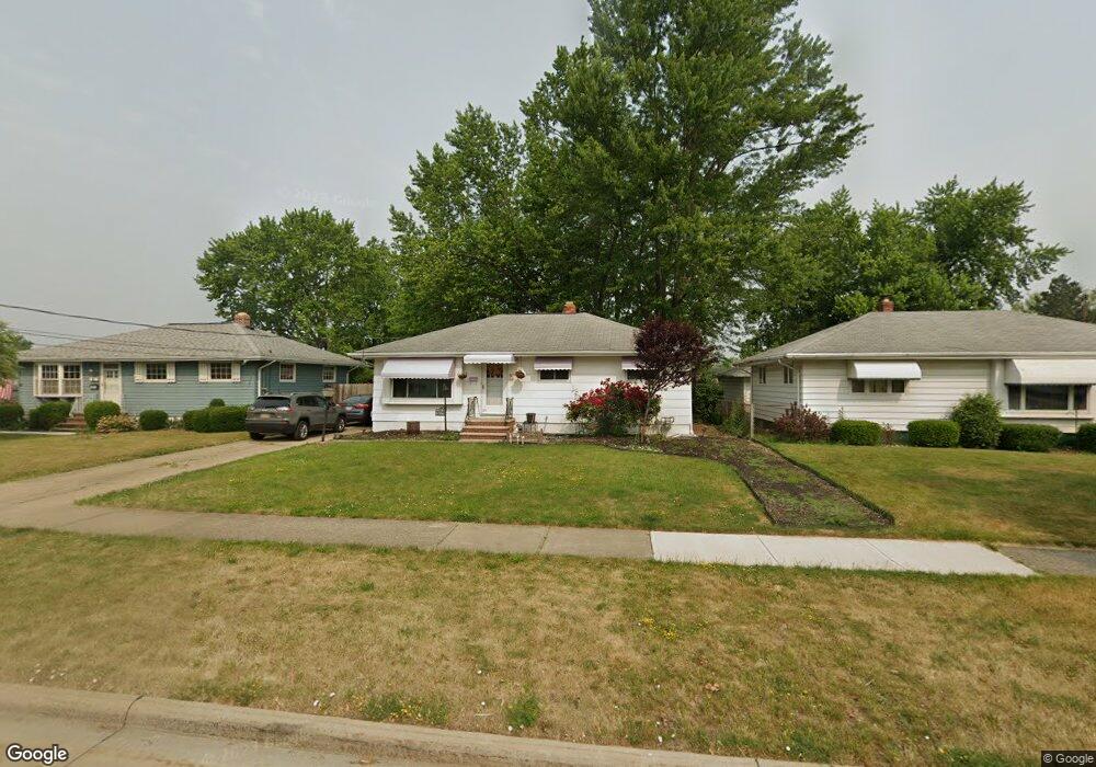
6392 Michael Dr Brookpark, OH 44142
Estimated Value: $147,000 - $213,000
3
Beds
1
Bath
988
Sq Ft
$179/Sq Ft
Est. Value
About This Home
This home is located at 6392 Michael Dr, Brookpark, OH 44142 and is currently estimated at $176,639, approximately $178 per square foot. 6392 Michael Dr is a home located in Cuyahoga County with nearby schools including Berea-Midpark Middle School, Berea-Midpark High School, and Huber Heights Preparatory Academy Parma Academy.
Ownership History
Date
Name
Owned For
Owner Type
Purchase Details
Closed on
Feb 26, 2025
Sold by
Magalski Zachary
Bought by
Th Property Owner I Llc
Current Estimated Value
Purchase Details
Closed on
Mar 5, 2024
Sold by
Magalski Zachary and Orr Isabella
Bought by
Magalski Zachary
Purchase Details
Closed on
May 25, 2005
Sold by
Magalski Kunzen Barbara E and Kunzen Donald
Bought by
Orr Andrea L
Home Financials for this Owner
Home Financials are based on the most recent Mortgage that was taken out on this home.
Original Mortgage
$60,000
Interest Rate
6.07%
Mortgage Type
New Conventional
Purchase Details
Closed on
Jan 22, 2003
Sold by
Magalski Beth M
Bought by
Magalski Kunzen Barbara E and Magalski Andrea L
Purchase Details
Closed on
Mar 21, 2001
Sold by
Magalski Barbara E and Magalski Barbara E
Bought by
Magalski Kunzen Barbara E and Magalski Beth M
Purchase Details
Closed on
Jan 1, 1975
Bought by
Magalski Barbara E
Create a Home Valuation Report for This Property
The Home Valuation Report is an in-depth analysis detailing your home's value as well as a comparison with similar homes in the area
Home Values in the Area
Average Home Value in this Area
Purchase History
| Date | Buyer | Sale Price | Title Company |
|---|---|---|---|
| Th Property Owner I Llc | $145,000 | First Source Title | |
| Magalski Zachary | -- | None Listed On Document | |
| Orr Andrea L | -- | Cleveland Home | |
| Magalski Kunzen Barbara E | -- | -- | |
| Magalski Kunzen Barbara E | -- | -- | |
| Magalski Barbara E | -- | -- |
Source: Public Records
Mortgage History
| Date | Status | Borrower | Loan Amount |
|---|---|---|---|
| Previous Owner | Orr Andrea L | $60,000 |
Source: Public Records
Tax History
| Year | Tax Paid | Tax Assessment Tax Assessment Total Assessment is a certain percentage of the fair market value that is determined by local assessors to be the total taxable value of land and additions on the property. | Land | Improvement |
|---|---|---|---|---|
| 2024 | $2,803 | $55,580 | $13,580 | $42,000 |
| 2023 | $2,823 | $46,340 | $10,220 | $36,120 |
| 2022 | $2,803 | $46,340 | $10,220 | $36,120 |
| 2021 | $2,786 | $46,340 | $10,220 | $36,120 |
| 2020 | $2,513 | $36,790 | $8,120 | $28,670 |
| 2019 | $2,438 | $105,100 | $23,200 | $81,900 |
| 2018 | $2,318 | $36,790 | $8,120 | $28,670 |
| 2017 | $2,391 | $33,460 | $7,210 | $26,250 |
| 2016 | $2,371 | $33,460 | $7,210 | $26,250 |
| 2015 | $2,225 | $33,460 | $7,210 | $26,250 |
| 2014 | $2,225 | $33,460 | $7,210 | $26,250 |
Source: Public Records
Map
Nearby Homes
- 6363 Lockhaven Dr
- 6131 Hardin Dr
- 15504 Roxboro Dr
- 15490 Oakshire Ct
- 16001 Sylvia Dr
- 14024 Donald Dr
- 6710 Woodruff Ct
- 15472 Meigs Blvd
- 6759 Quarrystone Ln
- 6014 Westbrook Dr
- 6815 Middlebrook Blvd
- 13874 Heatherwood Dr
- 13602 Holland Rd
- 15532 Rademaker Dr
- 16117 Hocking Blvd
- 6871 Franke Rd
- 6744 Fry Rd Unit 4
- 6720 Benedict Dr
- 6752 Benedict Dr
- 6748 Benedict Dr
- 6388 Michael Dr
- 6396 Michael Dr
- 14973 Lindmont Dr
- 6400 Michael Dr
- 14995 Lindmont Dr
- 6404 Michael Dr
- 6378 Michael Dr
- 15036 Montvale Dr
- 15017 Lindmont Dr
- 14966 Lindmont Dr
- 6393 Michael Dr
- 6389 Michael Dr
- 6397 Michael Dr
- 6408 Michael Dr
- 6372 Michael Dr
- 6385 Michael Dr
- 15048 Montvale Dr
- 6401 Michael Dr
- 15039 Lindmont Dr
- 6381 Michael Dr
Your Personal Tour Guide
Ask me questions while you tour the home.