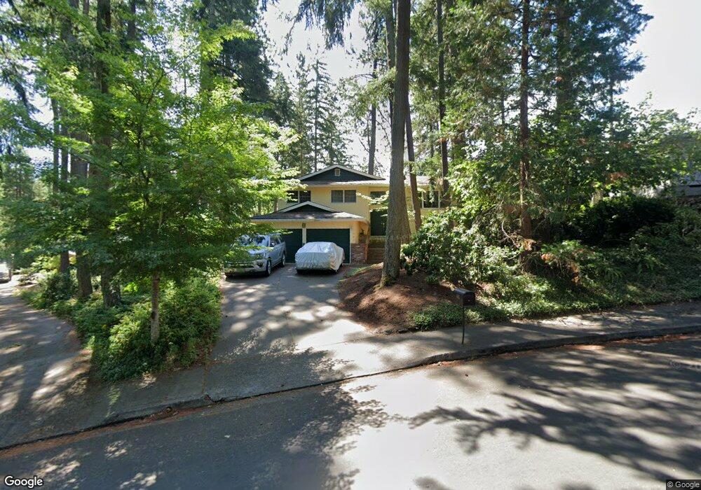
642 Empress Ave Eugene, OR 97405
Southeast Eugene NeighborhoodEstimated Value: $596,967 - $647,000
5
Beds
3
Baths
1,236
Sq Ft
$501/Sq Ft
Est. Value
About This Home
This home is located at 642 Empress Ave, Eugene, OR 97405 and is currently estimated at $619,742, approximately $501 per square foot. 642 Empress Ave is a home located in Lane County with nearby schools including Edgewood Community Elementary School, Spencer Butte Middle School, and South Eugene High School.
Ownership History
Date
Name
Owned For
Owner Type
Purchase Details
Closed on
Oct 8, 2025
Sold by
Lewis Debra L and Scherpf Debra L
Bought by
Scherpf Debra L and Scherpf Robert J
Current Estimated Value
Home Financials for this Owner
Home Financials are based on the most recent Mortgage that was taken out on this home.
Original Mortgage
$340,000
Outstanding Balance
$340,000
Interest Rate
6.5%
Mortgage Type
New Conventional
Estimated Equity
$279,742
Purchase Details
Closed on
Sep 14, 2007
Sold by
Lewis Debra L and Lewis Charles A
Bought by
Lewis Debra L
Purchase Details
Closed on
Jul 25, 2007
Sold by
Lewis Debra L
Bought by
Lewis Debra L and Lewis Charles A
Purchase Details
Closed on
Aug 17, 1999
Sold by
Gibbs Bruce C and Ann Lou
Bought by
Lewis Debra L
Home Financials for this Owner
Home Financials are based on the most recent Mortgage that was taken out on this home.
Original Mortgage
$171,000
Interest Rate
10.37%
Create a Home Valuation Report for This Property
The Home Valuation Report is an in-depth analysis detailing your home's value as well as a comparison with similar homes in the area
Home Values in the Area
Average Home Value in this Area
Purchase History
| Date | Buyer | Sale Price | Title Company |
|---|---|---|---|
| Scherpf Debra L | -- | Mortgage Connect | |
| Lewis Debra L | -- | Accommodation | |
| Lewis Debra L | -- | None Available | |
| Lewis Debra L | $190,000 | Western Pioneer Title Co |
Source: Public Records
Mortgage History
| Date | Status | Borrower | Loan Amount |
|---|---|---|---|
| Open | Scherpf Debra L | $340,000 | |
| Previous Owner | Lewis Debra L | $171,000 |
Source: Public Records
Tax History
| Year | Tax Paid | Tax Assessment Tax Assessment Total Assessment is a certain percentage of the fair market value that is determined by local assessors to be the total taxable value of land and additions on the property. | Land | Improvement |
|---|---|---|---|---|
| 2025 | $6,487 | $332,939 | -- | -- |
| 2024 | $6,406 | $323,242 | -- | -- |
| 2023 | $6,406 | $313,828 | $0 | $0 |
| 2022 | $6,002 | $304,688 | $0 | $0 |
| 2021 | $5,637 | $295,814 | $0 | $0 |
| 2020 | $5,657 | $287,199 | $0 | $0 |
| 2019 | $5,463 | $278,834 | $0 | $0 |
| 2018 | $5,143 | $262,828 | $0 | $0 |
| 2017 | $4,912 | $262,828 | $0 | $0 |
| 2016 | $4,751 | $255,173 | $0 | $0 |
| 2015 | $4,610 | $247,741 | $0 | $0 |
| 2014 | $4,541 | $240,525 | $0 | $0 |
Source: Public Records
Map
Nearby Homes
- 4845 Brookwood St
- 4680 W Hillside Dr
- 4734 Brookwood St
- 892 Sprague St
- 4425 Hilyard St
- 4733 E Amazon Dr
- 395 E 46th Ave
- 296 Woodridge Dr
- 4429 Fox Hollow Rd Unit 3
- 4295 Ferry St
- 202 Foxtail Dr
- 4364 Fox Hollow Rd
- 36 Westbrook Way
- 21 Westbrook Way
- 17 Westbrook Way
- 4320 Fox Hollow Rd
- 910 E 43rd Ave
- 126 Treehill Loop Unit 126
- 143 Treehill Loop Unit 143
- 4023 Donald St Unit K
- 628 Empress Ave
- 656 Empress Ave
- 668 Empress Ave
- 4950 Fox Hollow Rd
- 610 Empress Ave
- 5170 Miramar St
- 681 Empress Ave
- 5150 Miramar St
- 4962 Fox Hollow Rd
- 4960 Fox Hollow Rd
- 594 Empress Ave
- 599 Empress Ave
- 5180 Miramar St
- 4919 Fox Hollow Rd
- 4927 Fox Hollow Rd
- 4883 Fox Hollow Rd
- 4931 Fox Hollow Rd
- 4867 Fox Hollow Rd
- 5125 Miramar St
Your Personal Tour Guide
Ask me questions while you tour the home.