Estimated Value: $281,556 - $282,000
3
Beds
3
Baths
1,526
Sq Ft
$185/Sq Ft
Est. Value
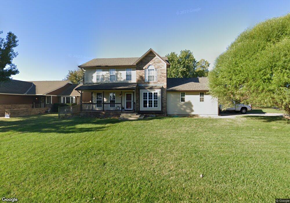
About This Home
This home is located at 657 Conestoga Rd, Maize, KS 67101 and is currently estimated at $281,778, approximately $184 per square foot. 657 Conestoga Rd is a home located in Sedgwick County with nearby schools including Vermillion Elementary School, Pray-Woodman Elementary, and Maize Elementary School.
Ownership History
Date
Name
Owned For
Owner Type
Purchase Details
Closed on
Apr 1, 2012
Sold by
Carver Michelle
Bought by
Larson D
Current Estimated Value
Purchase Details
Closed on
Sep 19, 2006
Sold by
Woodard Alan R and Woodard Stacy L
Bought by
Owen Ii Lanson D and Carver Michelle
Home Financials for this Owner
Home Financials are based on the most recent Mortgage that was taken out on this home.
Original Mortgage
$142,750
Interest Rate
6.55%
Mortgage Type
New Conventional
Create a Home Valuation Report for This Property
The Home Valuation Report is an in-depth analysis detailing your home's value as well as a comparison with similar homes in the area
Home Values in the Area
Average Home Value in this Area
Purchase History
| Date | Buyer | Sale Price | Title Company |
|---|---|---|---|
| Larson D | -- | None Available | |
| Owen Ii Lanson D | -- | Lawyers Title Insurance Corp |
Source: Public Records
Mortgage History
| Date | Status | Borrower | Loan Amount |
|---|---|---|---|
| Previous Owner | Owen Ii Lanson D | $142,750 |
Source: Public Records
Tax History Compared to Growth
Tax History
| Year | Tax Paid | Tax Assessment Tax Assessment Total Assessment is a certain percentage of the fair market value that is determined by local assessors to be the total taxable value of land and additions on the property. | Land | Improvement |
|---|---|---|---|---|
| 2025 | $3,561 | $26,543 | $5,555 | $20,988 |
| 2023 | $3,561 | $24,346 | $4,324 | $20,022 |
| 2022 | $3,278 | $21,701 | $4,071 | $17,630 |
| 2021 | $3,029 | $19,907 | $2,806 | $17,101 |
| 2020 | $2,851 | $18,780 | $2,806 | $15,974 |
| 2019 | $2,656 | $17,549 | $2,806 | $14,743 |
| 2018 | $2,513 | $16,560 | $2,208 | $14,352 |
| 2017 | $2,429 | $0 | $0 | $0 |
| 2016 | $2,354 | $0 | $0 | $0 |
| 2015 | $2,367 | $0 | $0 | $0 |
| 2014 | $2,342 | $0 | $0 | $0 |
Source: Public Records
Map
Nearby Homes
- 727 E High Plains St
- 530 Conestoga Rd
- 403 S Sweetwater Rd
- 510 S Sweetwater Rd
- 613 S Sweetwater Cir
- 429 S Longbranch Dr
- 634 S Sweetwater Rd
- 609 S Horseshoe Bend
- 862 Plantation Rd
- 319 Jonathan St
- 9658 W Cedar Ln
- 9657 W Cedar Ln
- Boccherini Plan at Henwick
- 9630 W Cedar Ln
- 9637 W Cedar Ln
- 4461 N Bluestem St
- 4456 N Bluestem St
- 10494 W Wilkinson St
- 10498 W Wilkinson St
- 9623 W Wilkinson Ct
- 719 Plantation St
- 645 Conestoga Rd
- 727 S Plantation
- 727 Plantation St
- 718 Plantation St
- 710 Plantation Rd
- 636 Conestoga Rd
- 726 Plantation St
- 733 Plantation St
- 637 Conestoga Rd
- 664 Plantation St
- 732 Plantation St
- 732 Plantation Rd
- 700 High Plains Cir
- 642 High Plains Cr
- 716 High Plains Cir
- 642 High Plains Cir
- 645 Plantation St
- 741 Plantation St
- 629 Conestoga Rd