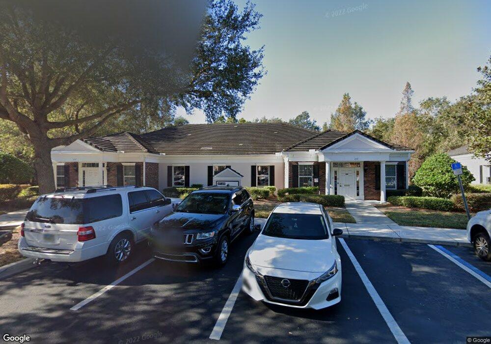
657 W Lumsden Rd Brandon, FL 33511
Estimated Value: $1,230,355
--
Bed
2
Baths
4,016
Sq Ft
$306/Sq Ft
Est. Value
About This Home
This home is located at 657 W Lumsden Rd, Brandon, FL 33511 and is currently estimated at $1,230,355, approximately $306 per square foot. 657 W Lumsden Rd is a home located in Hillsborough County with nearby schools including Kingswood Elementary School, Rodgers Middle School, and Brandon High School.
Ownership History
Date
Name
Owned For
Owner Type
Purchase Details
Closed on
Apr 8, 2019
Sold by
M & S Holding Llc
Bought by
New Dorado Llc
Current Estimated Value
Home Financials for this Owner
Home Financials are based on the most recent Mortgage that was taken out on this home.
Original Mortgage
$607,750
Outstanding Balance
$535,396
Interest Rate
4.4%
Mortgage Type
Future Advance Clause Open End Mortgage
Estimated Equity
$694,959
Purchase Details
Closed on
Jan 10, 2003
Sold by
Mccullagh & Scott Development Inc
Bought by
M & S Holding Llc
Home Financials for this Owner
Home Financials are based on the most recent Mortgage that was taken out on this home.
Original Mortgage
$480,000
Interest Rate
6.1%
Mortgage Type
Commercial
Create a Home Valuation Report for This Property
The Home Valuation Report is an in-depth analysis detailing your home's value as well as a comparison with similar homes in the area
Home Values in the Area
Average Home Value in this Area
Purchase History
| Date | Buyer | Sale Price | Title Company |
|---|---|---|---|
| New Dorado Llc | $715,000 | Attorney | |
| M & S Holding Llc | $192,000 | All American Title |
Source: Public Records
Mortgage History
| Date | Status | Borrower | Loan Amount |
|---|---|---|---|
| Open | New Dorado Llc | $607,750 | |
| Previous Owner | M & S Holding Llc | $480,000 |
Source: Public Records
Tax History Compared to Growth
Tax History
| Year | Tax Paid | Tax Assessment Tax Assessment Total Assessment is a certain percentage of the fair market value that is determined by local assessors to be the total taxable value of land and additions on the property. | Land | Improvement |
|---|---|---|---|---|
| 2024 | $12,045 | $689,000 | $80,320 | $608,680 |
| 2023 | $11,508 | $656,000 | $80,320 | $575,680 |
| 2022 | $11,595 | $664,511 | $80,320 | $584,191 |
| 2021 | $10,726 | $594,135 | $122,890 | $471,245 |
| 2020 | $9,948 | $546,485 | $81,926 | $464,559 |
| 2019 | $9,008 | $514,961 | $81,926 | $433,035 |
| 2018 | $8,145 | $433,237 | $0 | $0 |
| 2017 | $7,677 | $404,212 | $0 | $0 |
| 2016 | $7,394 | $382,977 | $0 | $0 |
| 2015 | $7,294 | $369,709 | $0 | $0 |
| 2014 | $7,010 | $356,030 | $0 | $0 |
| 2013 | -- | $350,696 | $0 | $0 |
Source: Public Records
Map
Nearby Homes
- 703 Sailfish Dr
- 906 Stanberry Dr
- 724 Tradewinds Dr
- 732 Tradewinds Dr
- 1607 Loriana St
- 308 Cambridge Place
- 832 S Parsons Ave
- 1726 Loriana St
- 134 Barrington Dr
- 780 Spring Flowers Trail
- 112 Julie Ln
- 514 Ole Plantation Dr
- 124 Barrington Dr
- 314 Summer Clouds Place
- 923 Lumsden Reserve Dr
- 705 Westwood Dr
- 1001 English Bluffs Ct
- 2207 Princess Way
- 707 Westwood Ln
- 613 Royal Crest Way
- 633 W Lumsden Rd
- 702 Sailfish Dr
- 701 Oak Park Place
- 625 W Lumsden Rd
- 621 W Lumsden Rd Unit A
- 621 W Lumsden Rd
- 677 W Lumsden Rd
- 705 Oak Park Place
- 704 Sailfish Dr
- 707 Oak Park Place
- 707 Oak Park Place
- 701 Sailfish Dr
- 706 Sailfish Dr
- 681 W Lumsden Rd
- 681 W Lumsden Rd
- 709 Oak Park Place
- 1402 S Kings Ave
- 711 Oak Park Place
- 708 Sailfish Dr
- 1404 S Kings Ave