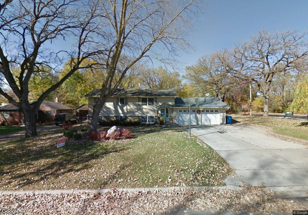
670 Independence Ave N Champlin, MN 55316
Estimated Value: $291,000 - $337,000
5
Beds
2
Baths
1,040
Sq Ft
$311/Sq Ft
Est. Value
About This Home
This home is located at 670 Independence Ave N, Champlin, MN 55316 and is currently estimated at $322,980, approximately $310 per square foot. 670 Independence Ave N is a home located in Hennepin County with nearby schools including Champlin-Brooklyn Park Academy, Jackson Middle School, and Champlin Park High School.
Ownership History
Date
Name
Owned For
Owner Type
Purchase Details
Closed on
Nov 5, 2012
Sold by
Birhanzel Thomas C and Birhanzel Susan
Bought by
Keithley Carla
Current Estimated Value
Purchase Details
Closed on
Nov 2, 2012
Sold by
Lacey John
Bought by
Birhanzel Thomas C and Birhanzel Lonnie J
Purchase Details
Closed on
Aug 28, 2009
Sold by
The Bank Of New York Mellon
Bought by
Birhanzel James F
Purchase Details
Closed on
May 13, 2005
Sold by
Vandemark Tony and Van Demark Tracy
Bought by
Cloutier Jamie J and Cloutier Jason W
Purchase Details
Closed on
Aug 28, 2001
Sold by
Waibel Dean A and Waibel Orma
Bought by
Vandemark Tony and Vandemark Tracy
Purchase Details
Closed on
Sep 5, 1997
Sold by
Jensen Scott D and Jensen Luvette
Bought by
Lee Orma
Create a Home Valuation Report for This Property
The Home Valuation Report is an in-depth analysis detailing your home's value as well as a comparison with similar homes in the area
Home Values in the Area
Average Home Value in this Area
Purchase History
| Date | Buyer | Sale Price | Title Company |
|---|---|---|---|
| Keithley Carla | -- | None Available | |
| Birhanzel Thomas C | -- | None Available | |
| Birhanzel James F | $102,000 | -- | |
| Cloutier Jamie J | $238,500 | -- | |
| Vandemark Tony | $196,500 | -- | |
| Lee Orma | $87,900 | -- |
Source: Public Records
Mortgage History
| Date | Status | Borrower | Loan Amount |
|---|---|---|---|
| Closed | Lee Orma | -- | |
| Closed | Lee Orma | $29,581 |
Source: Public Records
Tax History
| Year | Tax Paid | Tax Assessment Tax Assessment Total Assessment is a certain percentage of the fair market value that is determined by local assessors to be the total taxable value of land and additions on the property. | Land | Improvement |
|---|---|---|---|---|
| 2024 | $3,119 | $278,500 | $87,000 | $191,500 |
| 2023 | $3,105 | $280,800 | $89,000 | $191,800 |
| 2022 | $2,611 | $261,000 | $78,000 | $183,000 |
| 2021 | $2,423 | $221,000 | $65,000 | $156,000 |
| 2020 | $2,343 | $206,000 | $56,000 | $150,000 |
| 2019 | $2,259 | $196,000 | $58,000 | $138,000 |
| 2018 | $2,238 | $187,000 | $49,000 | $138,000 |
| 2017 | $1,969 | $163,000 | $36,000 | $127,000 |
| 2016 | $1,924 | $155,000 | $42,000 | $113,000 |
| 2015 | $1,838 | $149,000 | $37,000 | $112,000 |
| 2014 | -- | $139,000 | $40,000 | $99,000 |
Source: Public Records
Map
Nearby Homes
- 719 Keniston St N
- 516 Dayton Rd
- 413 Orleans Ct N
- 701 Parkview Ln
- 10300 Parkview Ln
- 1334 3rd Ave
- 1625 3rd Ave
- 706 Benton St
- 431 Fremont St
- 413 Fremont St
- 809 Bradford Ave
- 216 Monroe St
- 1167 Benton St
- 12972 Bauer Dr N
- 2111 Green Ave
- 1021 Fremont St
- 1319 7th Ln
- 13360 Wellington Cir
- 8020 122nd Ln N
- 13348 Linwood Forest Cir
- 672 Independence Ave N
- 102 Sunset Dr W
- 564 Independence Ave N
- 674 Independence Ave N
- 671 Independence Ave N
- 103 Kimball Dr
- 101 Sunset Dr W
- 673 Independence Ave N
- 105 Sunset Dr W
- 106 Sunset Dr W
- 563 Independence Ave N
- 107 Kimball Dr
- 18 Sunset Dr E
- 107 Sunset Dr W
- 456 Independence Ave N
- 111 Kimball Dr
- 681 Independence Ave N
- 110 Sunset Dr W
- 14 Dean Ave E
- 11 Trussel Ave