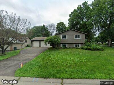
670 Randy Ave Saint Paul, MN 55126
Grass Lake NeighborhoodEstimated Value: $438,000 - $470,100
6
Beds
3
Baths
2,018
Sq Ft
$226/Sq Ft
Est. Value
About This Home
This home is located at 670 Randy Ave, Saint Paul, MN 55126 and is currently estimated at $456,525, approximately $226 per square foot. 670 Randy Ave is a home located in Ramsey County with nearby schools including Island Lake Elementary School, Chippewa Middle School, and Mounds View Senior High School.
Ownership History
Date
Name
Owned For
Owner Type
Purchase Details
Closed on
Apr 24, 2020
Sold by
Stadler Peter P
Bought by
Burba Collette and Urban Rachael
Current Estimated Value
Home Financials for this Owner
Home Financials are based on the most recent Mortgage that was taken out on this home.
Original Mortgage
$280,000
Outstanding Balance
$252,098
Interest Rate
3.6%
Mortgage Type
New Conventional
Estimated Equity
$204,427
Purchase Details
Closed on
Nov 30, 1999
Sold by
Thomas Timothy M
Bought by
Stadler Peter P and Stadler Natalie
Purchase Details
Closed on
Jun 19, 1997
Sold by
Orourke Daniel J and Orourke Denise A
Bought by
Walker Eleanore F and Hartman Joseph T
Create a Home Valuation Report for This Property
The Home Valuation Report is an in-depth analysis detailing your home's value as well as a comparison with similar homes in the area
Home Values in the Area
Average Home Value in this Area
Purchase History
| Date | Buyer | Sale Price | Title Company |
|---|---|---|---|
| Burba Collette | $350,000 | Titlesmart Inc | |
| Stadler Peter P | $179,900 | -- | |
| Walker Eleanore F | $147,750 | -- | |
| Thomas Timothy M | $145,000 | -- |
Source: Public Records
Mortgage History
| Date | Status | Borrower | Loan Amount |
|---|---|---|---|
| Open | Burba Collette | $280,000 | |
| Previous Owner | Stadler Peter P | $243,428 |
Source: Public Records
Tax History Compared to Growth
Tax History
| Year | Tax Paid | Tax Assessment Tax Assessment Total Assessment is a certain percentage of the fair market value that is determined by local assessors to be the total taxable value of land and additions on the property. | Land | Improvement |
|---|---|---|---|---|
| 2023 | $5,584 | $426,800 | $92,600 | $334,200 |
| 2022 | $5,062 | $410,400 | $92,600 | $317,800 |
| 2021 | $4,842 | $356,400 | $92,600 | $263,800 |
| 2020 | $5,318 | $348,600 | $92,600 | $256,000 |
| 2019 | $4,664 | $355,400 | $92,600 | $262,800 |
| 2018 | $4,516 | $332,900 | $92,600 | $240,300 |
| 2017 | $4,034 | $313,300 | $92,600 | $220,700 |
| 2016 | $3,994 | $0 | $0 | $0 |
| 2015 | $3,852 | $267,200 | $92,600 | $174,600 |
| 2014 | $3,780 | $0 | $0 | $0 |
Source: Public Records
Map
Nearby Homes
- 782 Randy Ave
- 792 Gramsie Rd
- 656 Evans Ct
- 742 County Road F W Unit D
- 760 County Road F W Unit 709
- 553 Lakeridge Ct
- 708 Brigadoon Cir
- 888 Nancy Cir
- xxx Island Lake Dr
- 1011 Hesli Hill Ct
- 4336 Victoria St N
- 4045 Hodgson Rd Unit 114
- 4045 Hodgson Rd Unit 316
- 3431 Kent St Unit 704
- 3452 Vivian Ave
- 530 Lake Cove Ct
- 3421 Kent St Unit 508
- 192 Demar Ave
- 239 Hawes Ave
- 1049 Westcliff Curve
- 670 Randy Ave
- 660 Randy Ave
- 3900 Highland Dr
- 3930 Highland Dr
- 650 Randy Ave
- 3905 Highland Dr
- 3915 Highland Dr
- 3890 Highland Dr
- 3925 Highland Dr
- 644 Randy Ave
- 655 Randy Ave
- 3936 Highland Dr
- 3901 Highland Dr
- 3895 Highland Dr
- 3935 Highland Dr
- 640 Randy Ave
- 649 Randy Ave
- 3944 Highland Dr
- 3945 Highland Dr
- 634 Randy Ave