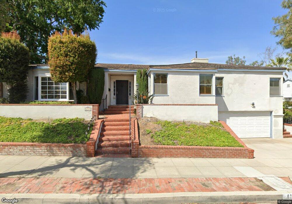
6735 Worsham Dr Whittier, CA 90602
Whittier College NeighborhoodEstimated Value: $1,005,389 - $1,184,000
2
Beds
3
Baths
2,186
Sq Ft
$498/Sq Ft
Est. Value
About This Home
This home is located at 6735 Worsham Dr, Whittier, CA 90602 and is currently estimated at $1,089,597, approximately $498 per square foot. 6735 Worsham Dr is a home located in Los Angeles County with nearby schools including Lou Henry Hoover Elementary School, Walter F. Dexter Middle School, and Whittier High School.
Ownership History
Date
Name
Owned For
Owner Type
Purchase Details
Closed on
May 17, 2018
Sold by
Mcbride Michael John
Bought by
Mcbride Michael J and Mcbride Gail A
Current Estimated Value
Create a Home Valuation Report for This Property
The Home Valuation Report is an in-depth analysis detailing your home's value as well as a comparison with similar homes in the area
Home Values in the Area
Average Home Value in this Area
Purchase History
| Date | Buyer | Sale Price | Title Company |
|---|---|---|---|
| Mcbride Michael J | -- | None Available |
Source: Public Records
Tax History Compared to Growth
Tax History
| Year | Tax Paid | Tax Assessment Tax Assessment Total Assessment is a certain percentage of the fair market value that is determined by local assessors to be the total taxable value of land and additions on the property. | Land | Improvement |
|---|---|---|---|---|
| 2025 | $2,309 | $142,948 | $46,057 | $96,891 |
| 2024 | $2,309 | $140,146 | $45,154 | $94,992 |
| 2023 | $2,253 | $137,399 | $44,269 | $93,130 |
| 2022 | $2,233 | $134,705 | $43,401 | $91,304 |
| 2021 | $2,183 | $132,064 | $42,550 | $89,514 |
| 2019 | $2,113 | $128,149 | $41,289 | $86,860 |
| 2018 | $2,026 | $125,637 | $40,480 | $85,157 |
| 2016 | $1,942 | $120,760 | $38,909 | $81,851 |
| 2015 | $1,917 | $118,947 | $38,325 | $80,622 |
| 2014 | $1,903 | $116,618 | $37,575 | $79,043 |
Source: Public Records
Map
Nearby Homes
- 6723 Hillside Ln
- 6769 Hillside Ln
- 7013 Hillside Ln
- 13707 Philadelphia St
- 13867 Philadelphia St
- 13751 Penn St
- 13664 Earlham Dr
- 13733 Franklin St
- 6233 Haviland Ave
- 14001 Summit Dr
- 7339 College Ave
- 13570 Turnbull Canyon Rd
- 13513 Penn St
- 7604 Forest Ave
- 6231 Painter Ave
- 13517 Franklin St
- 6256 Friends Ave
- 13702 Mar Vista St
- 7251 Painter Ave Unit 7255
- 7032 Washington Ave
- 13788 Philadelphia St
- 6723 Worsham Dr
- 6743 Worsham Dr
- 13794 Philadelphia St
- 6730 Worsham Dr
- 6738 Worsham Dr
- 13782 Philadelphia St
- 6722 Worsham Dr
- 6713 Worsham Dr
- 6746 Worsham Dr
- 6753 Worsham Dr
- 13776 Philadelphia St
- 13779 Philadelphia St
- 6754 Worsham Dr
- 6710 Hillside Ln
- 13773 Philadelphia St
- 6762 Worsham Dr
- 13688 Park St
- 13803 Philadelphia St
- 6759 Worsham Dr