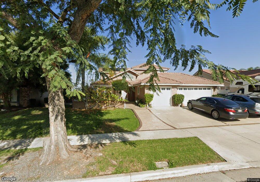
685 Walnut Cir Corona, CA 92881
South Corona NeighborhoodEstimated Value: $839,127 - $920,000
4
Beds
3
Baths
2,200
Sq Ft
$399/Sq Ft
Est. Value
About This Home
This home is located at 685 Walnut Cir, Corona, CA 92881 and is currently estimated at $877,782, approximately $398 per square foot. 685 Walnut Cir is a home located in Riverside County with nearby schools including Foothill Elementary School, Citrus Hills Intermediate School, and Santiago High School.
Ownership History
Date
Name
Owned For
Owner Type
Purchase Details
Closed on
Jun 10, 2003
Sold by
Michael Gouda and Michael Samia
Bought by
Michael Samia
Current Estimated Value
Purchase Details
Closed on
Mar 19, 2002
Sold by
Martin George M and Martin Kimaree K
Bought by
Michael Gouda and Michael Samia
Home Financials for this Owner
Home Financials are based on the most recent Mortgage that was taken out on this home.
Original Mortgage
$247,200
Outstanding Balance
$101,881
Interest Rate
6.87%
Estimated Equity
$775,901
Purchase Details
Closed on
Feb 1, 1995
Sold by
Hud
Bought by
Forrest Gloria Ann and Stansberry Thomas F
Purchase Details
Closed on
Sep 2, 1994
Sold by
Corona Homes Ltd
Bought by
Martin George M and Martin Kimaree K
Home Financials for this Owner
Home Financials are based on the most recent Mortgage that was taken out on this home.
Original Mortgage
$166,450
Interest Rate
9.25%
Create a Home Valuation Report for This Property
The Home Valuation Report is an in-depth analysis detailing your home's value as well as a comparison with similar homes in the area
Home Values in the Area
Average Home Value in this Area
Purchase History
| Date | Buyer | Sale Price | Title Company |
|---|---|---|---|
| Michael Samia | -- | Commerce Title | |
| Michael Gouda | $309,000 | Commonwealth Land Title Co | |
| Forrest Gloria Ann | $39,000 | Quality Title Company | |
| Martin George M | $187,000 | Continental Lawyers Title |
Source: Public Records
Mortgage History
| Date | Status | Borrower | Loan Amount |
|---|---|---|---|
| Open | Michael Gouda | $247,200 | |
| Previous Owner | Martin George M | $166,450 |
Source: Public Records
Tax History
| Year | Tax Paid | Tax Assessment Tax Assessment Total Assessment is a certain percentage of the fair market value that is determined by local assessors to be the total taxable value of land and additions on the property. | Land | Improvement |
|---|---|---|---|---|
| 2025 | $5,165 | $456,460 | $118,171 | $338,289 |
| 2023 | $5,165 | $438,736 | $113,583 | $325,153 |
| 2022 | $5,006 | $430,134 | $111,356 | $318,778 |
| 2021 | $4,910 | $421,701 | $109,173 | $312,528 |
| 2020 | $4,858 | $417,378 | $108,054 | $309,324 |
| 2019 | $4,749 | $409,195 | $105,936 | $303,259 |
| 2018 | $5,290 | $401,172 | $103,859 | $297,313 |
| 2017 | $5,375 | $393,307 | $101,823 | $291,484 |
| 2016 | $5,368 | $385,596 | $99,827 | $285,769 |
| 2015 | $5,285 | $379,807 | $98,329 | $281,478 |
| 2014 | $5,157 | $372,368 | $96,403 | $275,965 |
Source: Public Records
Map
Nearby Homes
- 3730 Wallowa Cir
- 3740 Coleville Cir
- 3770 Deerlodge Cir Unit 122
- 626 Viewtop Ln Unit 95
- 1041 Stanislaus Dr
- 342 Selkirk Dr
- 3185 Sonrisa Dr
- 423 Cleveland Way
- 3995 Holly Springs Dr
- 4071 Judy Cir
- 3122 Pinehurst Dr
- 4085 Strandberg St
- 4050 Lester Ave
- 1284 Longport Way
- 3100 Garretson Ave
- 3419 Redport Dr
- 3043 Garretson Ave
- 4050 Murphy Ct
- 2947 Gilbert Ave
- 1345 Sallie Jeffreys Way
- 701 Walnut Ln
- 669 Walnut Cir
- 688 Black Oak Cir
- 674 Black Oak Cir
- 702 Black Oak Cir
- 717 Walnut Ln
- 653 Walnut Cir
- 684 Walnut Cir
- 660 Black Oak Cir
- 668 Walnut Cir
- 704 Walnut Ln
- 637 Walnut Cir
- 733 Walnut Ln
- 652 Walnut Cir
- 730 Black Oak Cir
- 646 Black Oak Cir
- 720 Walnut Ln
- 621 Walnut Cir
- 636 Walnut Cir
- 687 Black Oak Cir
Your Personal Tour Guide
Ask me questions while you tour the home.