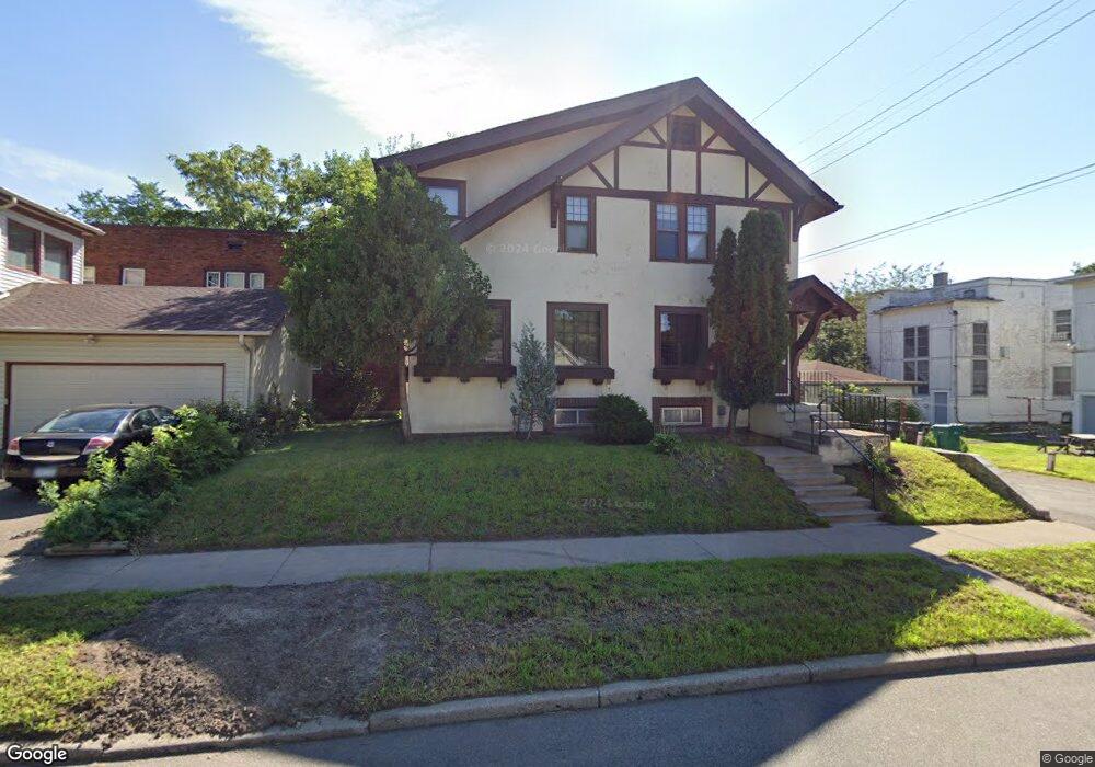
70 Fairview Ave N Saint Paul, MN 55104
Union Park NeighborhoodEstimated Value: $330,502 - $432,000
3
Beds
1
Bath
1,680
Sq Ft
$232/Sq Ft
Est. Value
About This Home
This home is located at 70 Fairview Ave N, Saint Paul, MN 55104 and is currently estimated at $390,376, approximately $232 per square foot. 70 Fairview Ave N is a home located in Ramsey County with nearby schools including Groveland Park Elementary School, Hidden River Middle School, and Central Senior High School.
Ownership History
Date
Name
Owned For
Owner Type
Purchase Details
Closed on
Nov 3, 2021
Sold by
Schneider Thomas M and Schneider Annah L
Bought by
Schneider Thomas M and Schneider Annah L
Current Estimated Value
Home Financials for this Owner
Home Financials are based on the most recent Mortgage that was taken out on this home.
Original Mortgage
$166,000
Outstanding Balance
$128,813
Interest Rate
2.28%
Mortgage Type
New Conventional
Estimated Equity
$261,563
Purchase Details
Closed on
Jul 21, 2014
Sold by
Broussard Gretchen Gretchen
Bought by
Schneider Thomas Thomas
Home Financials for this Owner
Home Financials are based on the most recent Mortgage that was taken out on this home.
Original Mortgage
$204,250
Interest Rate
4.13%
Create a Home Valuation Report for This Property
The Home Valuation Report is an in-depth analysis detailing your home's value as well as a comparison with similar homes in the area
Home Values in the Area
Average Home Value in this Area
Purchase History
| Date | Buyer | Sale Price | Title Company |
|---|---|---|---|
| Schneider Thomas M | -- | Orange Coast Lender Services | |
| Schneider Thomas Thomas | $215,000 | -- |
Source: Public Records
Mortgage History
| Date | Status | Borrower | Loan Amount |
|---|---|---|---|
| Open | Schneider Thomas M | $166,000 | |
| Closed | Schneider Thomas Thomas | $204,250 |
Source: Public Records
Tax History Compared to Growth
Tax History
| Year | Tax Paid | Tax Assessment Tax Assessment Total Assessment is a certain percentage of the fair market value that is determined by local assessors to be the total taxable value of land and additions on the property. | Land | Improvement |
|---|---|---|---|---|
| 2025 | $4,958 | $306,400 | $50,100 | $256,300 |
| 2023 | $4,958 | $325,400 | $50,100 | $275,300 |
| 2022 | $4,060 | $299,900 | $50,100 | $249,800 |
| 2021 | $3,950 | $260,800 | $50,100 | $210,700 |
| 2020 | $4,476 | $263,000 | $50,100 | $212,900 |
| 2019 | $3,630 | $275,800 | $50,100 | $225,700 |
| 2018 | $3,430 | $225,800 | $50,100 | $175,700 |
| 2017 | $3,324 | $221,000 | $50,100 | $170,900 |
| 2016 | $3,240 | $0 | $0 | $0 |
| 2015 | $3,824 | $210,300 | $50,100 | $160,200 |
| 2014 | $3,476 | $0 | $0 | $0 |
Source: Public Records
Map
Nearby Homes
- 1821 Selby Ave
- 1920 Laurel Ave
- 1917 Summit Ave Unit 2
- 1670 Ashland Ave
- 1836 Marshall Ave
- 1798 Marshall Ave
- 1796 Iglehart Ave
- 1926 Lincoln Ave
- 1826 Goodrich Ave
- 1671 Marshall Ave
- 2034 Ashland Ave
- 2009 Grand Ave
- 2023 Selby Ave
- 1935 Iglehart Ave
- 1787 Carroll Ave
- 2047 Grand Ave
- 142 Cambridge St
- 2056 Summit Ave
- 266 Fry St
- 1943 Carroll Ave
- 1810 Ashland Ave
- 1816 Ashland Ave
- 1804 Ashland Ave
- 1822 Ashland Ave
- 1809 Portland Ave
- 1809 1809 Portland Ave
- 1828 Ashland Ave
- 1805 Portland Ave
- 1805 1805 Portland Ave
- 1832 Ashland Ave
- 1799 Portland Ave
- 1794 Ashland Ave
- 1794 1794 Ashland Ave
- 1795 Portland Ave
- 1836 Ashland Ave
- 1809 Ashland Ave
- 1835 Portland Ave
- 1823 Ashland Ave
- 1791 Portland Ave
- 1838 Ashland Ave