Estimated Value: $216,340 - $246,000
2
Beds
2
Baths
1,322
Sq Ft
$175/Sq Ft
Est. Value
About This Home
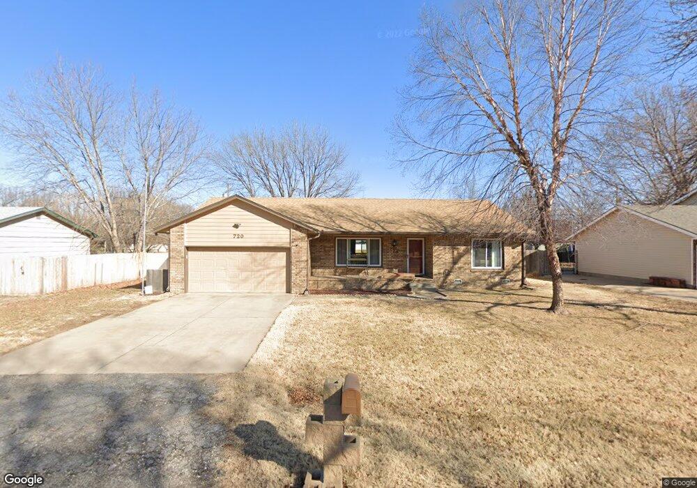
This home is located at 720 Opal St, Maize, KS 67101 and is currently estimated at $231,170, approximately $174 per square foot. 720 Opal St is a home located in Sedgwick County with nearby schools including Maize Middle School and Maize High School.
Ownership History
Date
Name
Owned For
Owner Type
Purchase Details
Closed on
Dec 3, 2020
Sold by
Smith Charles R and Smith Carol A
Bought by
Boorigie Lisa D
Current Estimated Value
Purchase Details
Closed on
May 24, 2010
Sold by
Klaver James C and James C Klaver Living Trust
Bought by
Smith Charles R and Smith Carol A
Home Financials for this Owner
Home Financials are based on the most recent Mortgage that was taken out on this home.
Original Mortgage
$109,911
Interest Rate
5%
Mortgage Type
VA
Create a Home Valuation Report for This Property
The Home Valuation Report is an in-depth analysis detailing your home's value as well as a comparison with similar homes in the area
Home Values in the Area
Average Home Value in this Area
Purchase History
| Date | Buyer | Sale Price | Title Company |
|---|---|---|---|
| Boorigie Lisa D | -- | None Available | |
| Smith Charles R | $106,500 | None Available |
Source: Public Records
Mortgage History
| Date | Status | Borrower | Loan Amount |
|---|---|---|---|
| Previous Owner | Smith Charles R | $109,911 |
Source: Public Records
Tax History
| Year | Tax Paid | Tax Assessment Tax Assessment Total Assessment is a certain percentage of the fair market value that is determined by local assessors to be the total taxable value of land and additions on the property. | Land | Improvement |
|---|---|---|---|---|
| 2025 | $2,691 | $22,080 | $5,428 | $16,652 |
| 2023 | $2,691 | $18,665 | $4,635 | $14,030 |
| 2022 | $2,562 | $17,078 | $4,370 | $12,708 |
| 2021 | $2,287 | $15,088 | $2,875 | $12,213 |
| 2020 | $2,152 | $14,237 | $2,875 | $11,362 |
| 2019 | $2,043 | $13,559 | $2,875 | $10,684 |
| 2018 | $1,932 | $12,788 | $1,771 | $11,017 |
| 2017 | $1,812 | $0 | $0 | $0 |
| 2016 | $1,810 | $0 | $0 | $0 |
| 2015 | $1,779 | $0 | $0 | $0 |
| 2014 | $1,816 | $0 | $0 | $0 |
Source: Public Records
Map
Nearby Homes
- 600 Laramie Cir
- 600 Trotter Ave
- 713 High Plains Cir
- 721 High Plains Cir
- 415 S Sweetwater Rd
- 432 S Sweetwater Rd
- 403 S Sweetwater Rd
- 319 Jonathan St
- 4560 N Atherton St
- 613 S Sweetwater Cir
- 429 S Longbranch Dr
- 10494 W Wilkinson St
- 10498 W Wilkinson St
- 10530 W Wilkinson St
- 9658 W Cedar Ln
- 10696 Sondra
- 9657 W Cedar Ln
- 9650 W Cedar Ln
- 4446 N Rutgers Ct
- 10861 W Sondra Ct
Your Personal Tour Guide
Ask me questions while you tour the home.