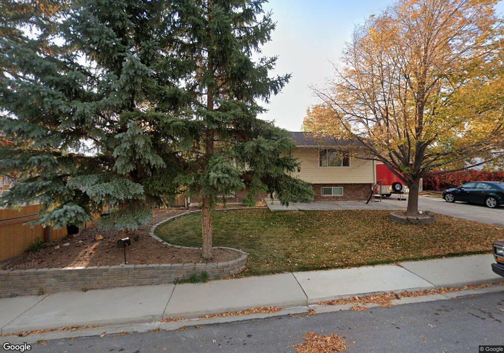
742 Tomahawk Dr Payson, UT 84651
Estimated Value: $441,000 - $542,000
4
Beds
2
Baths
2,035
Sq Ft
$237/Sq Ft
Est. Value
About This Home
This home is located at 742 Tomahawk Dr, Payson, UT 84651 and is currently estimated at $481,743, approximately $236 per square foot. 742 Tomahawk Dr is a home located in Utah County with nearby schools including Barnett Elementary School, Salem Junior High School, and Valley View Middle School.
Ownership History
Date
Name
Owned For
Owner Type
Purchase Details
Closed on
Dec 15, 2016
Sold by
Bastian Morgan B
Bought by
Magana Jose R and Magana Maria I
Current Estimated Value
Home Financials for this Owner
Home Financials are based on the most recent Mortgage that was taken out on this home.
Original Mortgage
$217,171
Outstanding Balance
$175,470
Interest Rate
3.54%
Mortgage Type
New Conventional
Estimated Equity
$306,273
Purchase Details
Closed on
Feb 3, 2014
Sold by
Davis Colby F and Davis Erika D
Bought by
Bastian Morgan B
Home Financials for this Owner
Home Financials are based on the most recent Mortgage that was taken out on this home.
Original Mortgage
$153,061
Interest Rate
4.45%
Mortgage Type
New Conventional
Purchase Details
Closed on
Sep 7, 1999
Sold by
Mabey Lee W and Mabey Marlene Dian
Bought by
Davis Colby F and Davis Erika D
Home Financials for this Owner
Home Financials are based on the most recent Mortgage that was taken out on this home.
Original Mortgage
$126,378
Interest Rate
7.84%
Mortgage Type
VA
Create a Home Valuation Report for This Property
The Home Valuation Report is an in-depth analysis detailing your home's value as well as a comparison with similar homes in the area
Home Values in the Area
Average Home Value in this Area
Purchase History
| Date | Buyer | Sale Price | Title Company |
|---|---|---|---|
| Magana Jose R | -- | Eagle Pointe Title Ins | |
| Bastian Morgan B | -- | North American Title | |
| Davis Colby F | -- | First American Title Co |
Source: Public Records
Mortgage History
| Date | Status | Borrower | Loan Amount |
|---|---|---|---|
| Open | Magana Jose R | $217,171 | |
| Previous Owner | Bastian Morgan B | $153,061 | |
| Previous Owner | Davis Colby F | $126,378 |
Source: Public Records
Tax History
| Year | Tax Paid | Tax Assessment Tax Assessment Total Assessment is a certain percentage of the fair market value that is determined by local assessors to be the total taxable value of land and additions on the property. | Land | Improvement |
|---|---|---|---|---|
| 2025 | $2,007 | $244,475 | -- | -- |
| 2024 | $2,007 | $204,270 | $0 | $0 |
| 2023 | $2,006 | $204,765 | $0 | $0 |
| 2022 | $2,123 | $213,070 | $0 | $0 |
| 2021 | $1,805 | $290,600 | $89,400 | $201,200 |
| 2020 | $1,712 | $269,700 | $81,300 | $188,400 |
| 2019 | $1,481 | $239,200 | $73,100 | $166,100 |
| 2018 | $1,369 | $213,100 | $65,300 | $147,800 |
| 2017 | $1,237 | $103,565 | $0 | $0 |
| 2016 | $1,138 | $94,600 | $0 | $0 |
| 2015 | $1,064 | $87,835 | $0 | $0 |
| 2014 | $947 | $78,760 | $0 | $0 |
Source: Public Records
Map
Nearby Homes
- 682 N 500 E
- 574 N 450 E
- 339 N 500 E Unit 3
- 327 N 500 E Unit 2
- 331 N 500 E Unit 2
- 446 N 460 E Unit 9
- 443 E 450 N
- 433 E 450 N
- 332 N 500 E
- 1289 N Bamberger Rd
- 873 E 200 N
- 603 900 N
- 1058 E 100 N
- 1287 N 1390 E Unit 25-96
- 420 N 150 W
- 283 E 1250 N
- 283 E 1250 N Unit 64
- 1299 E 1670 N Unit 812
- 1299 E 1670 N
- 1298 1670 N
- 726 Tomahawk Dr
- 803 Black Hawk
- 803 N Blackhawk St
- 775 Arrowhead Trail
- 759 Arrowhead Trail
- 767 Arrowhead Trail
- 743 Tomahawk Dr
- 727 Tomahawk Dr
- 708 Tomahawk Dr
- 743 Arrowhead Trail
- 757 Tomahawk Dr
- 709 Tomahawk Dr
- 804 N Blackhawk St
- 760 Wasatch
- 804 Black Hawk
- 798 Black Hawk
- 751 N 750 E
- 820 Wasatch
- 818 Black Hawk
- 725 Arrowhead Trail
Your Personal Tour Guide
Ask me questions while you tour the home.