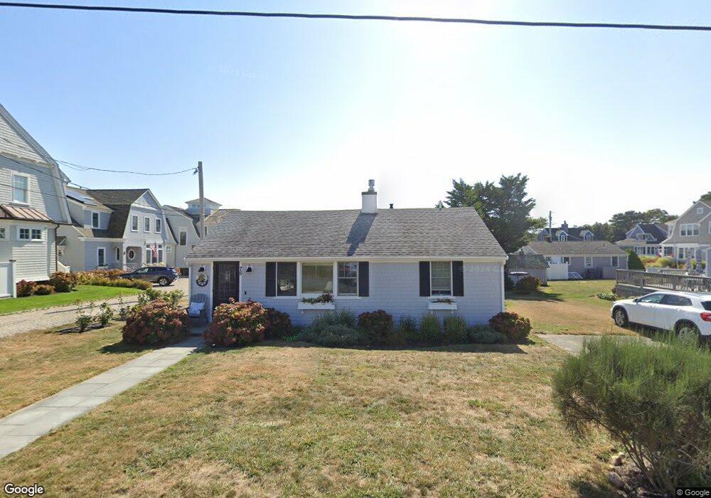
75 Nick Trail Mashpee, MA 02649
Popponesset NeighborhoodEstimated Value: $1,164,000 - $2,201,653
3
Beds
1
Bath
1,064
Sq Ft
$1,650/Sq Ft
Est. Value
About This Home
This home is located at 75 Nick Trail, Mashpee, MA 02649 and is currently estimated at $1,755,163, approximately $1,649 per square foot. 75 Nick Trail is a home located in Barnstable County with nearby schools including Kenneth C. Coombs School, Quashnet School, and Mashpee Middle School.
Create a Home Valuation Report for This Property
The Home Valuation Report is an in-depth analysis detailing your home's value as well as a comparison with similar homes in the area
Home Values in the Area
Average Home Value in this Area
Tax History
| Year | Tax Paid | Tax Assessment Tax Assessment Total Assessment is a certain percentage of the fair market value that is determined by local assessors to be the total taxable value of land and additions on the property. | Land | Improvement |
|---|---|---|---|---|
| 2025 | $13,317 | $2,011,700 | $1,677,700 | $334,000 |
| 2024 | $11,876 | $1,847,000 | $1,525,400 | $321,600 |
| 2023 | $12,025 | $1,715,400 | $1,452,400 | $263,000 |
| 2022 | $11,420 | $1,397,800 | $1,180,900 | $216,900 |
| 2021 | $11,284 | $1,244,100 | $1,063,700 | $180,400 |
| 2020 | $10,493 | $1,154,400 | $979,000 | $175,400 |
| 2019 | $10,346 | $1,143,200 | $979,000 | $164,200 |
| 2018 | $9,989 | $1,119,800 | $979,000 | $140,800 |
| 2017 | $9,650 | $1,050,100 | $979,000 | $71,100 |
| 2016 | $9,648 | $1,044,200 | $979,000 | $65,200 |
| 2015 | $9,480 | $1,040,600 | $979,000 | $61,600 |
| 2014 | $10,205 | $1,086,800 | $1,026,100 | $60,700 |
Source: Public Records
Map
Nearby Homes
- 42 Kim Path
- 71 Shore Dr
- 251 Shore Dr Unit D2
- 251 Shore Dr Unit C2
- 251 Shore Dr Unit C2
- 251 Shore Dr Unit D2
- 37 The Hunt Cir
- 16 Bosun's Ln
- 16 Bosuns Ln
- 30 Bright Coves Way
- 101 Greensward Rd
- 15 Halyard Cir
- 160 Waterway
- 109 Waterway
- 3 Hyannis Point Rd Unit 790
- 3 Hyannis Point Rd
- 6 Hammock Pond Rd
- 6 Hammock Pond Rd Unit 6
- 21 Saltwater Cir
- 15 Brant Rock Rd Unit 765
Your Personal Tour Guide
Ask me questions while you tour the home.