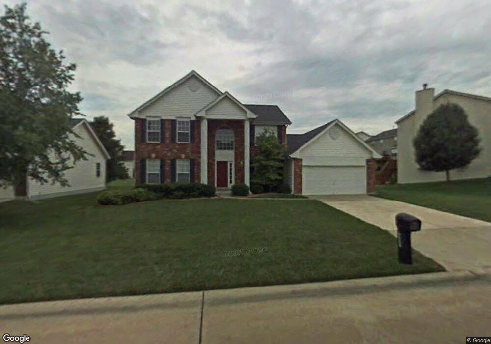
7517 Pierside Dr O Fallon, MO 63368
Estimated Value: $394,000 - $445,000
4
Beds
3
Baths
2,175
Sq Ft
$189/Sq Ft
Est. Value
About This Home
This home is located at 7517 Pierside Dr, O Fallon, MO 63368 and is currently estimated at $410,808, approximately $188 per square foot. 7517 Pierside Dr is a home located in St. Charles County with nearby schools including Crossroads Elementary School, Frontier Middle School, and Liberty High School.
Ownership History
Date
Name
Owned For
Owner Type
Purchase Details
Closed on
Sep 30, 2002
Sold by
Johnson Eric C
Bought by
Higgins King April
Current Estimated Value
Home Financials for this Owner
Home Financials are based on the most recent Mortgage that was taken out on this home.
Original Mortgage
$159,920
Outstanding Balance
$67,241
Interest Rate
6.2%
Estimated Equity
$343,567
Purchase Details
Closed on
Dec 27, 1998
Sold by
Price Kevin S and Price Yvonne W
Bought by
Johnson Eric C
Home Financials for this Owner
Home Financials are based on the most recent Mortgage that was taken out on this home.
Original Mortgage
$140,250
Interest Rate
8.5%
Create a Home Valuation Report for This Property
The Home Valuation Report is an in-depth analysis detailing your home's value as well as a comparison with similar homes in the area
Home Values in the Area
Average Home Value in this Area
Purchase History
| Date | Buyer | Sale Price | Title Company |
|---|---|---|---|
| Higgins King April | $199,900 | -- | |
| Johnson Eric C | -- | -- |
Source: Public Records
Mortgage History
| Date | Status | Borrower | Loan Amount |
|---|---|---|---|
| Open | Higgins King April | $159,920 | |
| Previous Owner | Johnson Eric C | $140,250 |
Source: Public Records
Tax History Compared to Growth
Tax History
| Year | Tax Paid | Tax Assessment Tax Assessment Total Assessment is a certain percentage of the fair market value that is determined by local assessors to be the total taxable value of land and additions on the property. | Land | Improvement |
|---|---|---|---|---|
| 2025 | $3,720 | $57,492 | -- | -- |
| 2023 | $3,720 | $57,472 | $0 | $0 |
| 2022 | $3,523 | $50,735 | $0 | $0 |
| 2021 | $3,527 | $50,735 | $0 | $0 |
| 2020 | $2,850 | $39,244 | $0 | $0 |
| 2019 | $2,650 | $39,244 | $0 | $0 |
| 2018 | $2,985 | $42,180 | $0 | $0 |
| 2017 | $2,984 | $42,180 | $0 | $0 |
| 2016 | $2,706 | $36,603 | $0 | $0 |
| 2015 | $2,643 | $36,603 | $0 | $0 |
| 2014 | $2,916 | $43,253 | $0 | $0 |
Source: Public Records
Map
Nearby Homes
- 7767 Boatside Dr
- 7797 Boatside Dr
- 6998 Route N
- 10 Pine Cone Ct
- 733 Thayer Ct
- 702 Balcarra Dr
- 701 Balcarra Dr
- 3 Jura Ct
- 242 Kerry Downs Dr
- 1306 Feise Rd
- 1723 Monet Dr
- 7253 Highway N
- 325 Kingsbarns Ct
- 276 Greenshire Ln
- 321 Kingsbarns Ct
- Avery Plan at Inverness - Designer Collection
- Winston Plan at Inverness - Designer Collection
- Ivy Plan at Inverness - Designer Collection
- Blair Plan at Inverness - Designer Collection
- Emmett Plan at Inverness - Designer Collection
- 7507 Pierside Dr
- 7527 Pierside Dr
- 7497 Pierside Dr
- 111 Boatside Ct
- 7442 Pierside Dr
- 109 Boatside Ct
- 7547 Pierside Dr
- 7432 Pierside Dr
- 7452 Pierside Dr
- 7487 Pierside Dr
- 7422 Pierside Dr
- 7462 Pierside Dr
- 110 Boatside Ct
- 2277 Harborside Dr
- 7412 Pierside Dr
- 7492 Pierside Dr
- 0 Highway N Unit 80069642
- 107 Boatside Ct
- 7502 Pierside Dr
- 7482 Pierside Dr